


About
Referred to as dev bhoomi or "Land of God", Himachal Pradesh is bordered by Jammu and Kashmir on the north, Punjab on the west, Uttar Pradesh on the south and Uttaranchal on the east. The word "Himachal" means the abode of snow. Shimla is the capital of Himachal Pradesh and the total area of the state is 55,673 square km. The state is covered with immense natural beauty and is, undoubtedly, one of the most popular tourist destinations in the world. A majority of the area is mountainous with lofty ranges, deep valleys, swaying waterfalls and lush greenery. The climate varies extremely from one place to the other, providing heavy rainfalls to some area and no rainfall to others. Being high in altitude, snowfall is a common sight in most parts of the state. There are 12 districts in the state which are further subdivided into blocks and towns and villages for administrative convenience. Himachal Pradesh is known to be the second least corrupt state in the country. Owing to the huge production of apples, Himachal Pradesh is also known as the 'State of Apples'.
| Facts on Himachal Pradesh | |
|---|---|
| Official Website | www.himachal.gov.in |
| Date of Formation | Jan 25, 1971 |
| Area | 55,673 sq km |
| Density | 123/Km2 |
| Population (2011) | 6,864,602 |
| Males Population (2011) | 3,481,873 |
| Females Population (2011) | 3,382,729 |
| No. of District | 12 |
| Capital | Shimla |
| Rivers | Ravi, Beas, Chenab, Sutlej, Yumana |
| Forests & National Park | Pin Valley NP, Greater Himalaya NP, Renuka WS, Chail WS, Kalatope Khajjiar WS, Simbalbara WS |
| Languages | Hindi, English, Punjabi, Kinnauri, Pahari, Kangri and Dogri |
| Neighbours State | Jammu and Kashmir, Punjab, Haryana, Uttar Pradesh, Uttrakhand |
| State Animal | Snow Leopard |
| State Bird | Western Tragopan |
| State Tree | Deodar |
| State Flower | Pink Rhododendron |
| Net State Domestic Product (2011) | 65535 |
| Literacy Rate (2011) | 68.74% |
| Females per 1000 males | 974 |
| Assembly constituency | 68 |
| Parliamentary constituency | 4 |
History
Himachal Pradesh has a rich history because it has been inhabited by several clans of people at different ages from the beginning of civilization. The earliest of all were the people from the Indus Valley civilization, during the second and third millennium BC, and they came here from Gangetic plains only to live life more peacefully. Soon, the Mongolians occupied the region and they were followed by the Aryans. According to the Indian epics, Himachal Pradesh was a conglomeration of several small republics or Janpadas, each constituting a state as well as a cultural unit. Then came the Mughals and kings like Mahmud Ghaznavi, Sikandar Lodi, Timur, etc had conquered many places of the state to establish their supremacy.
After their kingdom started declining, the Gorkhas captured the land but ended up losing the territory to the British in the Anglo-Gorkha war. The British were completely smitten by the sheer beauty of the area and continued with their supremacy over the place from 1858 to 1914. Post-Independence, 30 princely states of the area were brought together to form Himachal Pradesh in 1948. When Punjab got geographically reorganised, some parts were included in the latter. In 1971, Himachal Pradesh emerged as the 18th state of the Indian Union.
Geography
Being situated at the foothills of the Western Himalayas, Himachal Pradesh is located at the higher altitudes around 6500 meters above the sea level. The elevation is from west to the east and from the north to the south. Geographically, the area may be divided into three broad categories: the outer Himalayas (Shivaliks), the inner Himalayas (central zone), and the Greater Himalayas (alpine zone). Wide Valleys, snow clad mountains, exotic lakes and rivers and gushing out streams are the few features that Himachal Pradesh is known for. Around 64 percent of the area is covered by forests that consist of Moist Deodar Forest, Ban Oak Forest, Moist Temperate Deciduous Forest, Coniferous Forest, Alpine Pastures and the Rhododendron Scrub Forests. The climate varies from semi arctic to semi tropical.
Summers stay from April-June with a comfortable climate whereas winters are chilly due to heavy snowfalls. Rainy season enhances the beauty of the place and continues from July to September. Rivers and streams get refilled and a lustrous beauty of the green vegetation is visible all throughout. Major rivers of the area are the Chandra Bhaga, the Beas, the Chenab, the Sutlej and the Ravi. These rivers flow all throughout the year and are mainly fed by the glaciers of the mountains. Bara Shigri, Bhaga, Chandra are the few glaciers of Himachal Pradesh. More Detail...
Government and Politics
The state is divided into 12 districts, 75 tehsils, 52 subdivisions, 75 blocks and almost more than 20000 villages and 57 towns. Being a post-Independence creation, the legislative assembly of Himachal Pradesh doesn't have any pre-constitution. However, the unicameral legislature of the state has 68 seats with almost 14 house committee at the assembly. It has 4 Lok Sabha constituencies and for Rajya Sabha, there are 3 constituencies. Among political parties, only the Indian National Congress (INC) and Bharatiya Janata Party (BJP) have alternately been able to establish their respective governments in Himachal Pradesh. Like all other Indian states, the Chief Minister has the ultimate powers in the state, and controls all the major operations of the government.
Education
Himachal Pradesh was the summer capital of British India and hence the standard of elementary as well as higher education here is up to the mark than the rest of the country. Literacy rates of the state are one of the highest among all the Indian states especially Hamirpur, which is one of the districts with a top ranking literacy rate. There are thousands of schools which offer primary as well as secondary education to kids, being affiliated to the CBSE and the ICSE. The government is working hard to make the state the new "educational hub" of the country. In fact, Himachal Pradesh is the first state in the country that has made elementary education possible as well as accessible for every child.
There are several universities, engineering colleges, and medical colleges that offer professional courses for aspiring candidates. Apart from that, there are some general degree colleges that help the students to pursue their basic higher education from the state itself. Other than that, there are few NGO-operated educational institutions running successfully in the state.
Economy
Himachal Pradesh is one state that has transformed itself from being the most backward state to one of the most advanced states in the country.
Shimla
 Christ Church
 The Ridge
 Jakhu Temple
 Lakkar Bazar
Manali
 Rohtang Pass
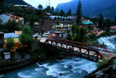 Old Manali
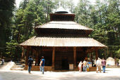 Hidimba Devi Temple
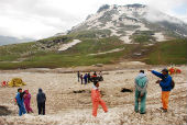
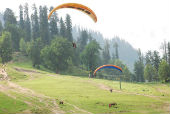 Adventure Sports at Solang Nal
Cities to Visit Himachal Pradesh
|
Chamba Kangra Rohtang Pass |
Kangra Shimla Kullu |
Manali Dalhousie Solan |
Himachal Pradesh is a multilingual and a multicultural state of India. Since many races have come and settled here from earlier times, the culture of the state is diverse, colourful and rich in heritage. It is exhibited in colourful clothes, musical melodies, festive celebrations, rhythmic dances and a simple yet rich lifestyle. Arts and handicrafts form an integral part of the culture. The state specialises in preparing pashmina shawl which is exported to foreign countries on a regular basis. Other than that, wooden potteries, metal jewellery, utensils, vessels and many more are prepared by the locals. Music and dance are an integral and essential part of life for the Himachalis. Folk songs are mainly sung to invoke the deities. Special types of songs known as samskara songs, based on Indian Ragas, are popular among the people. Some exclusive dance forms of the state are Shona, Gee, Burah, Losar, Naati etc. Festivals are celebrated with great zeal and grandeur. The international Himalayan Festival is celebrated annually at Dharamshala. Local festivals like Cheeshu and Lahaul for the Lahaulis, and Haryali at the Kangra district are celebrated with pomp and vividness. National festivals like Diwali, Lohri, Baisakhi and Christmas too mean a lot for the people of Himachal Pradesh.
Food
Like every other culture, Himachal also has its own rich flavours and tastes. The cuisine here is complete and wholesome. Some of the popular dishes of Himachal Pradesh are Madra, Dhaam, Tudkiya Bhath, Bhey or Spicy Lotus Stems, Chha Gosht, Siddu, Babru, Aktori, Kullu Trout Fish etc.
Language
Being a state located in the northern part of the country, Hindi is widely spoken and understood among all the inhabitants of Himachal Pradesh. Other than that, Pahari or "the hilly language", known to be derived from Sanskrit and Prakrit, is the second most widely spoken language among the people. There are three different forms of the language, northern Pahari, western Pahari and the eastern Pahari. Out of these, the second form is adopted by the people of Himachal Pradesh and they speak it in different dialects. Few of the dialects of Pahari used in Himachal are Churahi, Himachali, Mandeali, Kuluhi, etc. Punjabi is another popular language which people speak, due to the state's proximity to Punjab. English is the medium of instruction in most of the central board affiliated schools and fairly used among the elites. Other than these, Kangri, Dogri, Kinnauri are also used by the natives of the regions. The Tibetans who have migrated from their place prefer to speak in Tibetan languages. Other than that, people from other state of India, who have settled there, like Marwaris, Gujaratis, Biharis, Bengalis, etc, speak in their own languages among their small communities.More Detail...
Transport
Most of the part of Himachal Pradesh being mountainous, development of proper transport facilities was difficult. However, the government has made notable progress in connecting the roads to the state and today Himachal Pradesh is known to have the highest density of roads among all major hill stations of the country. There are 8 national highways that connect the state with the rest of the country. Inside the state, all the tourist spots are connected through roads for the benefits of travellers. Within the city, people prefer private vehicles and buses to communicate from one part to the other. Two railway stations connect the state with the other part of the country, the Kalka Shimla railways and the Pathankot-Jogindernagar railways. Few more tracks have been proposed by the government for better connectivity. With three airports in the state - Shimla airport near the capital, the Gaggal airport near the Kangra District, and the Bhuntar airport just near to the Kullu District - Himachal Pradesh can be reached through airways as well. However, due to improper weather conditions, most of these flights either get delayed or cancelled in most of the days, causing much inconvenience to the passengers.
GP WBST180914
WBST240914
Last Updated on : July 19, 2019


