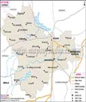
Koppal District Map


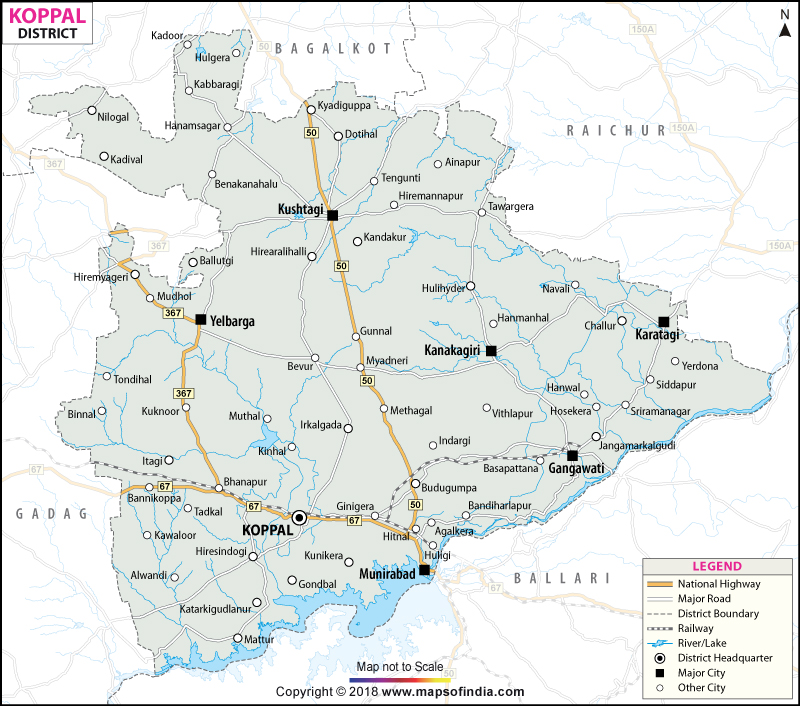
District Map of Koppal

separator Click here for Customized Maps arrow custom map
District Map of Koppal Bagalkot Raichur Bellary Gadag
Print Email Save Buy Now 
*District Map of Koppal highlights national highway, major roads, railways, rivers, etc. Disclaimer


  Major Districts of Karnataka  
Bangalore District Map Belgaum District Map Gulbarga District Map Shimoga District Map
Bangalore District MapBelgaum District MapGulbarga District MapShimoga District Map
    
Tumkur District Map Bijapur District Map Dakshin Kannad District Map Mysore District Map
Tumkur District MapBijapur District MapDakshin Kannad District MapMysore District Map
  other districts of Karnataka  >>

The district of Koppal has come into existence as recently as 1998. It is located between 15.09' 00"-16. 03' 30" North Latitude and 75. 47' 30" to 76. 48' 10" East Longitude.

The total geographical area of the district is 552495 hectares. The total population of Koppal district is 11.93 lakhs as per 2001 census. The population density is 216 per sq. km. The literacy rate of Koppal is 62.39.

Agriculture and industries of this district comprises the economy of Koppal.

The important tourist spots are
  • Anegundi
  • Itagi
  • Kinnal
  • Kanakagiri
  • Koppal Fort
  • Kukanoor


Last Updated on : May 17, 2018


-->