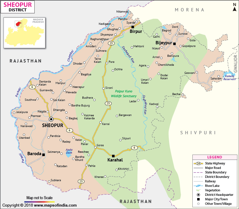
With wheat, mustard and bazra as the most grown crops, Sheopur has an agrarian economy. The district is also known for its wood curved handicrafts.
The Kuno wildlife sanctuary of Sheopur can be a memorable visit for the tourists and travelers.
| Facts of Sheopur District | |
|---|---|
| State | Madhya Pradesh |
| District | Sheopur |
| District HQ | Sheopur |
| Population (2011) | 1726050 |
| Growth | 22.76% |
| Sex Ratio | 877 |
| Literacy | 62.55 |
| Area (km2) | 6585 |
| Density (/km2) | 104 |
| Tehsils | Sheopur, Baroda, Vijaypur, Veerpur, Karahal |
| Lok Sabha Constituencies | Morena |
| Assembly Constituencies | Sheopur, Vijaypur |
| Languages | Hindi |
| Rivers | Chambal, Parbati, Kuno |
| Lat-Long | 25.770214,76.924667 |
| Travel Destinations | Sheopur Fort, Rani Mahal, Darbar Hall, Saharia Museum, Ram-Janki Temple, Doob Kund, Sangam Of Rameshwar, Vijaipur Durg, Devari Hanuman Mandir, Dhruv Kund, Dargah Nimoda Shareef, Jinn Ki Masjid, Temple Of Khhetrapal Jaini, Qazi Ji Bawri, Bivi Ji Ki Bawri etc. |
| Government Colleges/Universities | Govt PG College, Govt College (Vijaypur), Govt Law College, Rajiv Ghandhi Memorial College (Baroda) etc. |
Last Updated on : February 19, 2026
