


Nagaland has a road network of 9860 kms. As many as 900 villages in the state are connected by roads. In the absence of a well developed railway and air network, Nagaland relies heavily on its road network. Dimapur is the only city in the state of Nagaland to have a railway station and an airport.
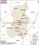
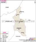
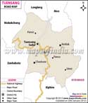
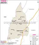
The state of Nagaland is divided into 11 districts. MapsofIndia brings you the road map of 8 districts of Nagaland. These include:
- Dimapur Road Map
- Kohima Road Map
- Mokokchung Road Map
- Phek Road Map
- Mon Road Map
- Tuensang Road Map
- Workha Road Map
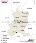
- Zunheboto Road Map
Last Updated on January 19, 2023