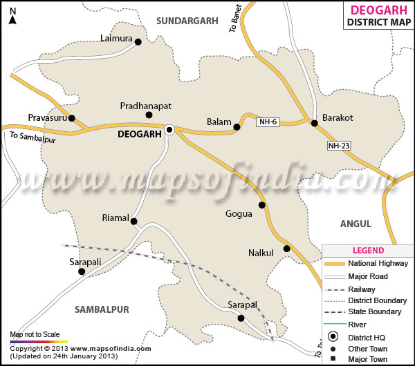
The district of Deogarh was carved out of the Sambalpur District of
Odisha in the year 1994. The district encompasses a total area of 2781.66 sq. kilometers stretching across the geographical coordinates of 84 degree 30 minutes North latitude and 21 degree 35 East longitude. The administrative headquarters of the district is at Deogarh town.
The district is divided into a number of administrative units. It comprises of the Riamal, Teleibani and Barakot blocks which are further subdivided into 774 villages. The district comprises of a single tehsil. The total population of the district according to the 2001 census stands at 2,74,095 with 1,38,913 males and 1,35,182 females. The majority of the populace is comprises of the tribal people who inhabit the district. The district maintains a marginal difference in the sex ratio which stands at 998 females per thousand males.
The primary occupation of the people of the Deogarh district is agriculture. 66,800 hectares of the total land area is under cultivation of which paddy is cultivated in 38,000 hectares of land. 1560.22 square kilometers of land area of the district is covered with forests. The forest area of Deogarh covers 2.67 percent of the total state area.
The district of Deogarh was a part of the princely state of Bamara. The region was once the prosperous capital of the Ganga Dynasty. The princely state became a part of the Union of India on 1st January, 1948. It remained a part of the district of Sambalpur till 1994 after which it acquired the status of the separate district.
Last Updated on : February 19, 2026
