Thiruvallur Tehsil Map


Tehsil Map of Thiruvallur

separator Click here for Customized Maps arrow custom map
Tehsil Map of Thiruvallur Tiruvannamalai Vellore Tiruvannamalai Chennai Kancheepuram ANDHRA PRADESH
Print Email Save Buy Now 
*Thiruvallur Tehsil Map highlights the name and location of all the mandals in Thiruvallur district, Tamil Nadu. Disclaimer


  Major Tehsils of Tamil Nadu  
Villupuram Tehsil Map Tirunelveli Tehsil Map Vellore Tehsil Map Coimbatore Tehsil Map
Villupuram Tehsil MapTirunelveli Tehsil MapVellore Tehsil MapCoimbatore Tehsil Map
    
Thanjavur Tehsil Map Madurai Tehsil Map Kancheepuram Tehsil Map Namakkal Tehsil Map
Thanjavur Tehsil MapMadurai Tehsil MapKancheepuram Tehsil MapNamakkal Tehsil Map
  other tehsils of Tamilnadu  >>

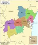
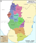
List of Taluks in Thiruvallur District

Taluk/Block NameTotal : Rural+Urban Population (2001) in NumberPin Code
Ambattur1,006,898600053
Gummidipoondi159,598601201
MathavaramN.A600060
Pallipattu183,36163120
Ponneri331,406601204
Poonamallee431,758600056
Thiruvallur325,034602001
Tiruttani185,782631209
Uthukkottai130,919602026


Last Updated on : February 26, 2020