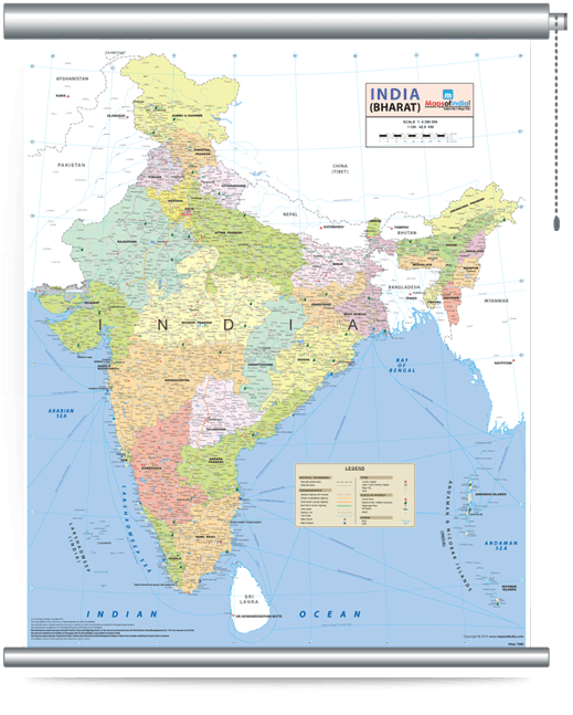
INDIA WALL MAP
A product of
Dimensions
27.5 X 33 inches

Some special features of the map:
- It accurately represents 29 states and the seven union territories. These include the newly created state of Telangana.
- It depicts the recently rechristened 12 cities of Karnataka - Bengaluru, Mangaluru, Mysuru, Tumakuru, Hubballi, Vijapura, Belagavi, Kalaburagi, Shivamogga, Chikkamagaluru, Ballari, and Hosapete.
- It also includes the railway networks recently added in Jammu and Kashmir and Rewari- Rohtak.
- It represents the states in vibrant colours along with their administrative boundaries.
- It covers islands and the river network of India and the neighbouring countries in great detail.
- It shows the tourist places including World Heritage Sites in India and places of pilgrimage. Airports, Seaports, Beaches, National Park and Wildlife Sanctuaries also figure prominently in the map. All these are shown with separate symbols.
- It has gone a step further to include the capitals and city names of the neighbouring countries.
- It depicts all the major cities, tier-II cities, towns, and district headquarters.
- It covers the Golden Quadrilateral, North-South Corridor, and East-West Corridor.
