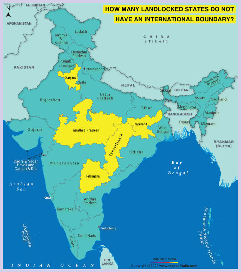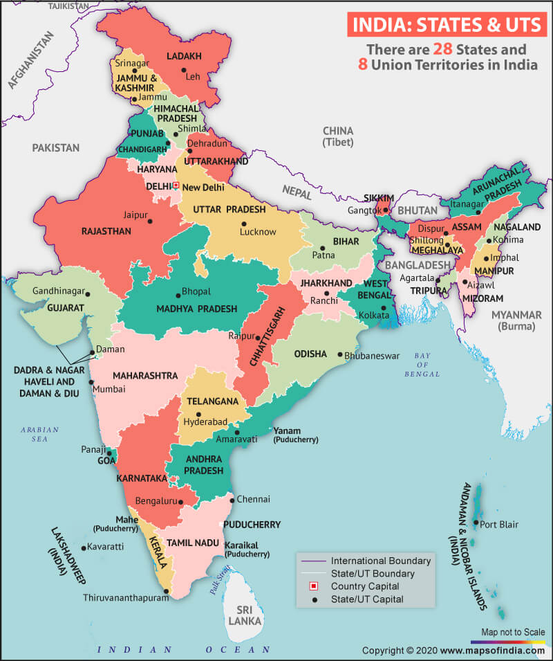

In India, there are 20 landlocked states. Of these, five do not have an international boundary.
A landlocked state is a state entirely enclosed by land or whose coastlines lie on closed seas. Access to water bodies accords benefits which is not the case of landlocked states. According to a famous saying, “If you are coastal, you serve the world; if you are landlocked, you serve your neighbours.” Five landlocked states which do not have an international boundary are Chhattisgarh, Haryana, Jharkhand, Madhya Pradesh, and Telangana.
1. Chhattisgarh
The 10th largest state of India, Chhattisgarh is one of the fastest developing states in India. Chhattisgarh shares its boundaries with the states of Madhya Pradesh in the northwest, Maharashtra in the southwest, Telangana and Andhra Pradesh in the south, Odisha in the southeast, Jharkhand in the northeast, and Uttar Pradesh in the north.
2. Haryana
Haryana is the 18th most populous state in India. Haryana shares its borders with Punjab and Himachal Pradesh to the north, Rajasthan to the southwest, and touches Uttar Pradesh towards the east which is defined by the Yamuna river. Delhi, the capital city of India, is surrounded by Haryana on the northern, western, and southern borders.
3. Jharkhand
Approximately 40% of the mineral resources of the country come from Jharkhand. Jharkhand is one of the landlocked states of India and shares its borders with Bihar on the north, West Bengal to the east, Chhattisgarh and Uttar Pradesh to the northwest, and Odisha to the south. Interestingly, all the districts of Jharkhand, except Lohardaga and Khunti, share a border with a neighbouring state.
4. Madhya Pradesh
Madhya Pradesh is the heart of India. Being located centrally, it shares its border with the states of Uttar Pradesh to the northeast, Chhatisgarh to the southeast, Maharashtra to the south, Gujrat to the west, and Rajasthan to the northwest. The name of this state itself suggests it to be the Central Province.
5. Telangana
It is the youngest state of the nation, officially formed on 2 June 2014. Telangana shares its borders with Maharashtra to the northwest, Chhattisgarh to the north, Karnataka to the west, and Andhra Pradesh to the southeast.
Related Link:


