
Where is Puducherry?
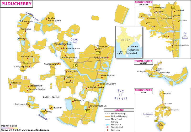
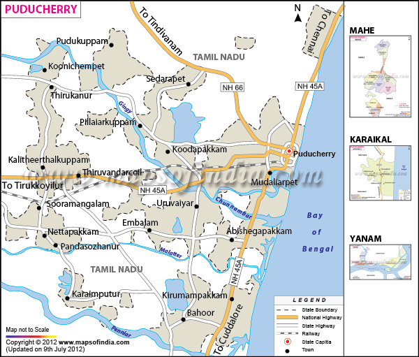
Puducherry, formerly known as Pondicherry, is one of the eight Union Territories of India, which was formed out of four provinces of former French India, namely Pondicherry (now Puducherry), Karaikal (Karaikal), Mahe and Yanaon (Yanam). Its official name was changed from Pondicherry to Puducherry on September 20, 2006. This territory is the 29th most populous and the third most densely populated amongst the States and Union Territories of India. Its capital city is the city of Puducherry in the Puducherry sector, just north of Cuddalore.
Puducherry spreads over an area of 492 sq. km (190 sq. miles) with a population of 1,244,464 as per the 2011 census. The majority of the population belongs to Hinduism, which holds 87.3% of the population. Other religions include Christianity (6.2%) and Islam (6%). The major languages spoken here are Tamil, Malayalam, Telugu. Other significant languages are Urdu, French, Kannada, Gujarati, English, and Marathi.
What is the Geography of Puducherry?
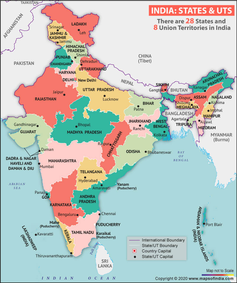
Puducherry consists of four small unconnected districts such as Puducherry (293 sq. km), Karaikal (161 sq. km) and Yanam (20 sq. km) on the Bay of Bengal and Mahe (9 sq. km) on the Laccadive Sea, covering a total area of 483 sq. km. Puducherry and Karaikal district are adjoined by Tamil Nadu, Yanam and Mahe are enclosed by the states of Andhra Pradesh and Kerala respectively. Further, both Puducherry and Karaikal have the largest areas and population and are both territorial dominions of Tamil Nadu, while Yanam and Mahe are dominions of Andhra Pradesh and Kerala. The entire city is divided into two parts; canal and main streets which run collateral to each other.
What is the Climate of Puducherry?
As per Koppen climate classification, the climate of Puducherry is tropical wet and dry, which is similar to Coastal Tamil Nadu. In this part, summers last from April to early June when the maximum temperature rises to 41 ° C and the average maximum temperature is 36 ° C, and the minimum temperature rests between 28 – 32 ° C. The residents of this city witness high humidity and occasional thundershowers from June till September. Puducherry also receives annual rainfall during the period from October to December. The yearly average rainfall is 1,240 mm. The lowest winter temperature is 18 – 20 ° C, and the maximum touches 30 ° C.
What is the Economy of Puducherry?
Puducherry’s gross domestic product (GDP) rose from 1,840 in 1980 to 258,190 in 2014, as estimated by the Ministry of Statistics and Programme Implementation. There are many industries on which the economy depends. Fisheries is one of them as four regions of this Union Territory have a coastline of 45 km with 675 of inshore waters; inland water is 1,347 hectares (3.33 acres).
Further, Puducherry has 27 marine fishing villages, and 23 inland fishing villages host a fishermen population of 65,000 out of which 13,000 are actively engaged in fishing. Another most substantial business is tourism. Food processing is another primary industry. Some of the chief crops are sugarcane, cotton, peanuts, rice, to name a few. Paddy is the predominant crop with 65% produce, followed by pulses. Other notable industries are textiles, paper, timber, and electrical appliances.
What is the Transportation System of Puducherry?
Puducherry is a well-connected union territory. It has a railway branch line from the five-way junction at Villupuram and Chennai. It also has well – built metalled roads connecting the territory. It has a road length of 2,552 km, which is the highest in the country. Puducherry can be reached from Calicut Airport, which is 70 km from Mahe. Yanam is also situated in the adjoined East Godavari district of Andhra Pradesh, which is about 200 km from Visakhapatnam airport.
What are the Popular Tourist Places/Attractions in Puducherry?
Some of the popular tourist places in Puducherry are Paradise Beach, Aurobindo Ashram, Auroville, Seaside Promenade, Promenade Beach, Serenity Beach, Arikamedu. Auroville Beach, Chunnambar Boat House, Basilica of the Sacred Heart of Jesus. Botanical Garden, Pondicherry Lighthouse, Jawahar Toy Museum, Raj Niwas, French War Memorial, Sri Manakula Vinayagar Temple, Veerapatti Beach, Gokilambal Thirukameswar, Chidambaram, Bharathi Park, Immaculate Conception Cathedral, Varadaraja Perumal Temple, Church of Our Lady of Angels, The Statue of Dupleix, Aayi Mandapam, Meeran Mosque, Ananda Ranga Pillai Mansion, Ganesh Garden, ISKCON Pondicherry, Sri Karneshwar Nataraj temple, Yanam Beach, to name a few.
Related Maps:


![]()


