
Where is Telangana?
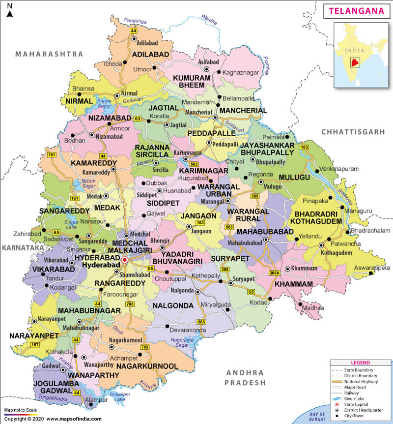
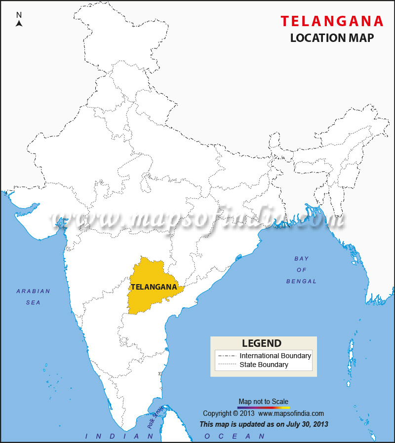
Telangana is on the south-central stretch of the Indian peninsula on the high Deccan Plateau. It is also known as ‘Telengana’ or ‘Telingana’ amongst the locals. After the bifurcation of the erstwhile state of Andhra Pradesh, the north-central and northeastern portions formed the state of Telangana. However, both Andhra Pradesh and Telangana share Hyderabad as a joint capital, located in the west-central Telangana.
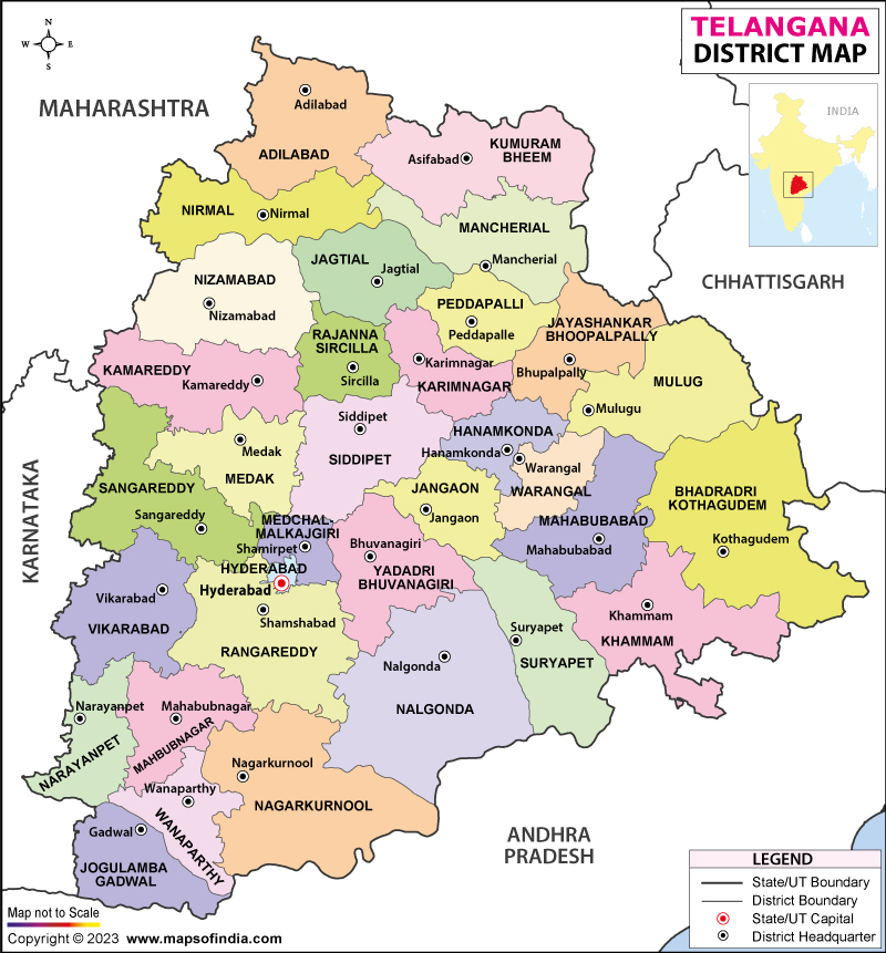
The state is the twelfth largest state and the twelfth most populated state in India. It spreads over an area of 112,077 sq. km (43,273 sq. mi) with a population of 35,193,978 as per the 2011 census. Telangana further divides into 33 districts. Festivals celebrated here are Bonalu, Bathukamma, Sammakka, Saralamma Jathara, which is also the second-largest festival in India after the Kumbh Mela.
What is the Geography of Telangana?
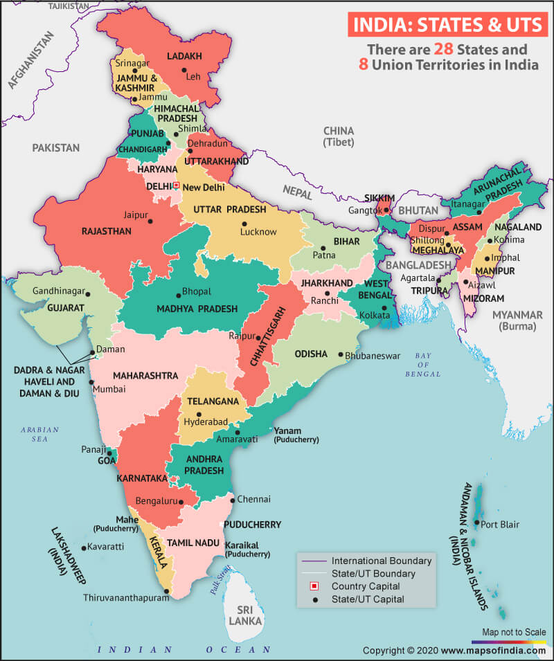
Mainly situated in an upland region of the Deccan (Peninsular India), Maharashtra adjoins the state to the north, Chhattisgarh, and Odisha to the northeast, Andhra Pradesh to the southeast and south, and Karnataka to the west. Telangana’s geography divides into – Telangana Plateau to the north and the Golconda Plateau to the south.
The average elevation here is 1,600 feet (500 meters). Black soil is present in certain parts of the state. Two major rivers of the state are Godavari River with 79% catchment area and Krishna River with 69% of the catchment area. However, most of the land is arid, and several minor rivers such as Bhima, Maner, Manjira, and Munsi pass through Telangana.
What is the Climate of Telangana?
Three significant seasons dominate the weather of Telangana – summers (lasts from March to June), tropical rains (occurs from July to September), and winters (from October to February). The state receives annual rainfall between 900 and 1500 mm in northern Telangana and 700 to 900 mm in southern Telangana.
Various soil types in this state are red sandy loams (Chalaka), red loamy sands (Dubba), lateritic soils, salt-affected soils, alluvial soils, shallow to medium black soil and very deep black cotton soil. The average minimum temperature of Hyderabad (capital of Telangana), reaches about 15 °C during January-February and usually reads in the low about 10 ° to 12 ° C at a higher elevation. The plateau area here is covered with thorny vegetation, while dense woodland covers the northeastern side near the Godavari river.
Forest covers one-fourth of the land, which consists of both moist deciduous and dry savanna vegetation such as – rosewood, teak, wild fruit, and bamboo trees. Some other trees in the region are banyan, mango, pipal, to name a few. Animals found in the hills and forest areas are hyenas, sloth bears, blackbucks, tigers, gaurs, chital, and birds found in the state are flamingos, pelicans, etc.
What is the Economy of Telangana?
Telangana’s economy largely depends on agriculture. The vital crop of this state is rice. The dry and interior regions use Godavari and Krishna river for irrigation. However, many areas still depend on rainfall. Apart from rice, other major crops are corn (maize) and cotton. Local rice is also used for products like rice flour, rice bran oil, paints and varnishes, soaps and detergents, cardboard and other packaging materials.
Other critical agricultural commodities are sorghum, pulses, beans, peanuts (groundnut), chili peppers, castor beans, and tropical fruits. Telangana’s principal minerals are coal, limestone, quartz, granite, feldspar, dolomite, and barite. Telangana’s energy is produced by thermal generators from the public sector, with hydroelectric power stations that provide a significant secondary source of energy.
What is the Transportation System of Telangana?
Telangana is well-connected with other states by road, rail, and airways. Major public transport corporation in the state is Telangana State Road Transport Corporation (T.S.R.T.C.). One of Asia’s largest bus stands is Mahatma Gandhi Bus Station (M.G.B.S.) in Hyderabad. The state is home to a total of 16 national highways. Rajiv Gandhi International Airport at Shamshabad is an international airport serving the city of Hyderabad.
What are the Popular Tourist Places/Attractions in Telangana?
Some of the famous tourist places in the state are Hyderabad, Papikondalu, Nagarjunsagar, Warangal, Bhadrachalam, Adilabad, Nalgonda, Nizamabad, Khammam, Secunderabad, Karimnagar, Chilkur Balaji Temple, Nelakondapalli, Kinnersani Wildlife Sanctuary, Laknavaram Lake, Kanakai waterfalls, Bogatha Falls, Gayatri Waterfalls, Medaram, Mallela Theertham, Mrugavani National Park, K.B.R. National Park, Vemulawada, Mahbubnagar to name a few.
Related Maps:


