
Where is Uttar Pradesh?
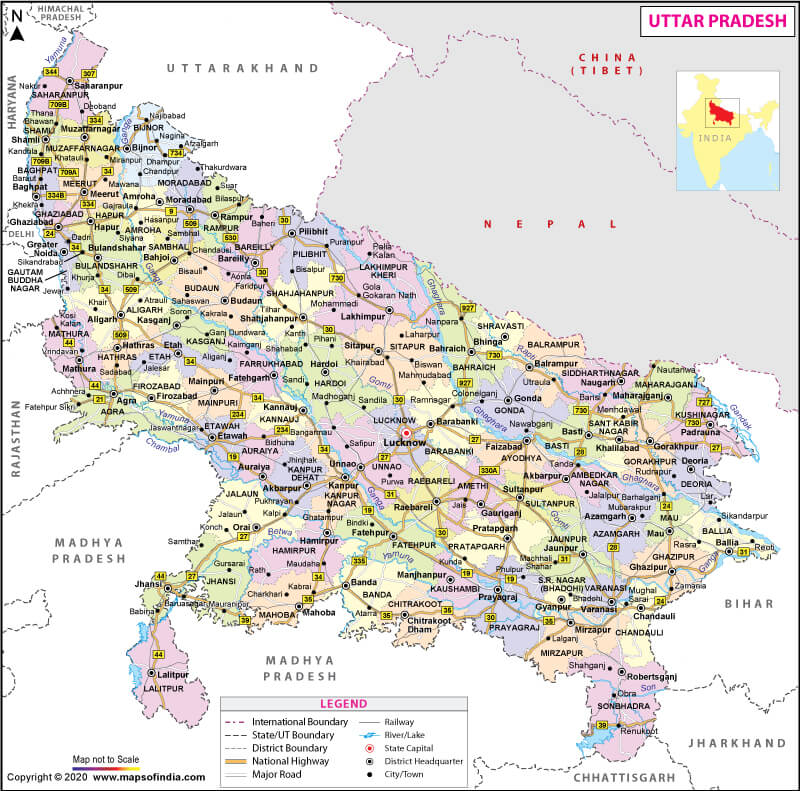
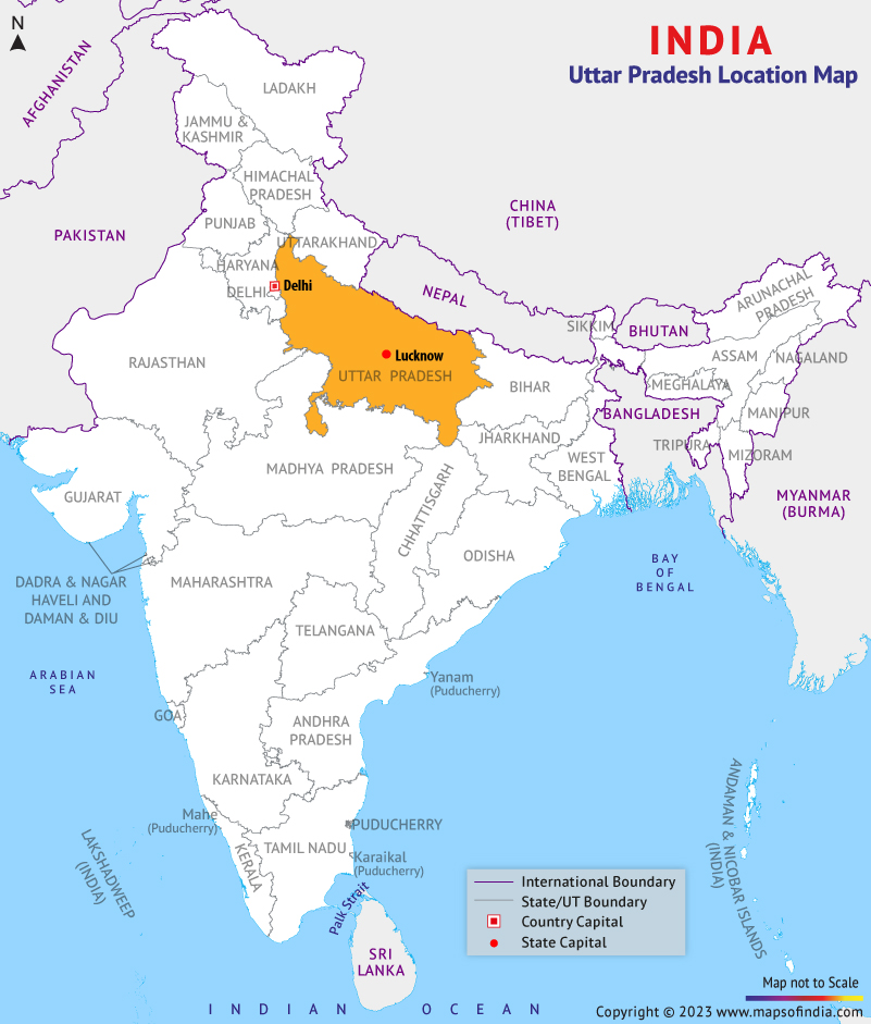
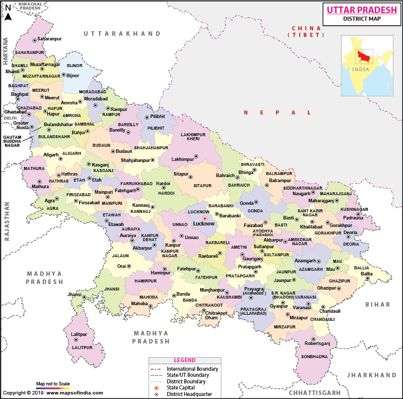
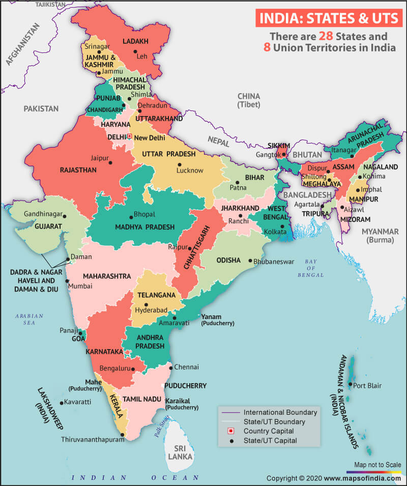
Situated in the northern region of India, Uttar Pradesh is one of the most populous states in India, as well as the most populous country subdivision in the world, with roughly 200 million natives. It is also the fourth-largest Indian state with an area of 240,928 km2 (93,023 sq. mi), which is equal to 7.34% of the total area of India.
Lucknow is the state capital, and some other major cities are Kanpur, Agra, Varanasi, Meerut, and Prayagraj.
What is the Geography of Uttar Pradesh?
Uttar Pradesh lies between 23°52’N and 30°24’N latitudes and 77°05’E and 84°38’E longitudes. Adjoined by Rajasthan to the west, Haryana, Himachal Pradesh, and Delhi to the northwest, Uttarakhand and an international border with Nepal to the north, Bihar to the east, Madhya Pradesh to the south and Jharkhand and Chhattisgarh to the southeast. Uttar Pradesh shares the longest border with Madhya Pradesh whereas, the smallest with Himachal Pradesh.
The state of Uttar Pradesh can be divided into three physiographic regions: The Sub-mountainous or the Terai-Bhabhar region in the north is a transitional belt. This region consists of foothills of the Shivalik range covered by forests. Terai region (Bhabar) extending from Saharanpur in the northwest to Kushinagar in the east is dampish. Due to excessive rainfalls, swamp fields are found here; The second physiographic division is the Gangetic plain region, which covers the maximum area of the state of Uttar Pradesh. It stretches from northwest to southeast and is the most fertile region in the state, due to the presence of alluvial soil. The Gangetic plain is further divided into Ganga-Yamuna Doab, Trans-Ghaghra plain and the Rohilkhand region; Plateau and the Vindhya Hills of the south is the third physiographic division. In this division, Bundelkhand and Baghelkhand regions are included, and it is characterised by hard terrain, hills, valleys, and plateau. The area receives very little rainfall and is not very fertile.
Uttar Pradesh is home to 32 large and small rivers, like the Ganges, Yamuna, Saraswati, Sarayu, Betwa, and Ghaghara.
What is the Climate of Uttar Pradesh?
For the most part, Uttar Pradesh’s climate is a Tropical monsoon type. Yet the weather remains warm all year round due to the elevation of different places from the sea level. Primarily, there are three seasons – Winter, Summer and Monsoon.
Winter season is from November to February, and January is the chilliest month of this season. During winters, the temperatures drop to 3°-4°C and sometimes to sub-zero.
Summer stays here from mid-March to mid-June. The average high temperature in summer is 36°C to 39°C, and the average low is between 21°C to 23°C. Heatwaves during summers are usual, and the temperatures reach as high as 50°C in regions like Bundelkhand, Gonda, Banda and Jhansi.
The Monsoon starts here in June and continues till September. The average annual rainfall in the state ranges from 600 mm in the southwest, to 1,000 mm or above in the east and southeast. Occasional failure of monsoon results in drought conditions.
What is the Economy of Uttar Pradesh?
Agriculture contributes majorly to the state’s economy. Major crops are rice, wheat, and sugarcane. With high-yielding types of seeds, increased irrigation, availability of fertilisers, UP is also the primary producer of food grains in the country. However, farmers often suffer from significant constraints like small landholdings and inadequate resources. Major manufacturing industries being textiles and sugar refining, which employs a notable proportion of the state’s total factory labour. Other resource-based industries are cement, jute, and vegetable oil. Fertilisers, electronic equipment, steel, aircraft, and telephone are some of the factories established by the government. The state also exports products such as footwear, leather goods, and sporting gear. Further, tourism is also a significant contributor to the economy.
What is the Transportation System of Uttar Pradesh?
Uttar Pradesh has the largest railway network in the country, with 8,546 km (5,310 mi) rail in the state as of 2011. Prayagraj is the headquarters of the North Central Railway and Gorakhpur of the North Eastern railway. It also has the largest road network, which is well-connected with nine neighbouring states/UTs and almost all other parts of India through the national highways (NH). The state has 42 national highways with a total length of 4,942 km (9.6% of India’s entire NH length).
What are the Popular Tourist Attractions of Uttar Pradesh?
Some of the popular tourist attractions of Uttar Pradesh are Agra, Varanasi, Vrindavan, Lucknow, Prayagraj, Sarnath, Mathura, Fatehpur Sikri, Vindhyachal, Chitrakoot, Ayodhya, Dudhwa National Park, National Chambal Wildlife Sanctuary to name a few.
Related Maps:


![]()


