
Where is West Bengal?
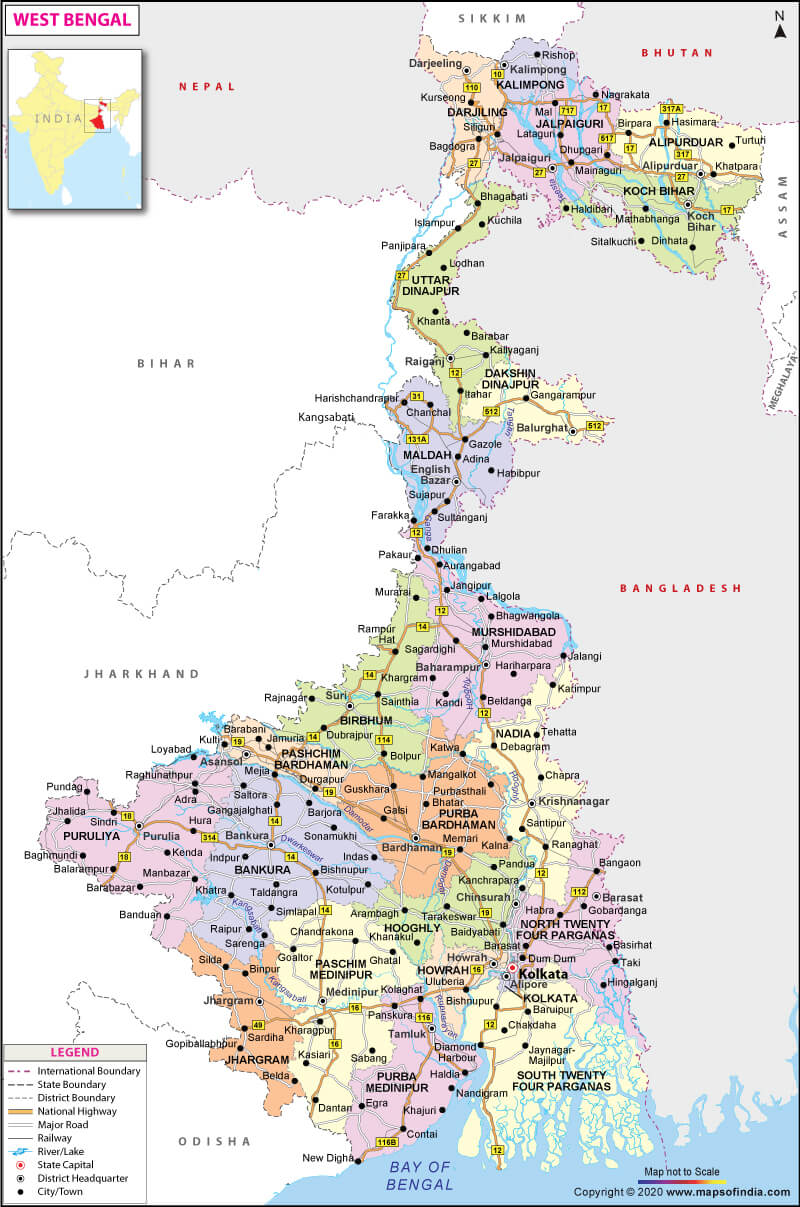
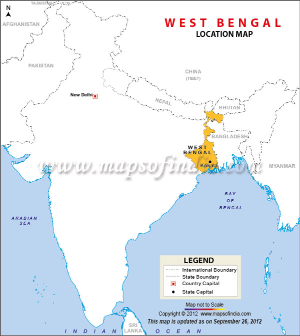
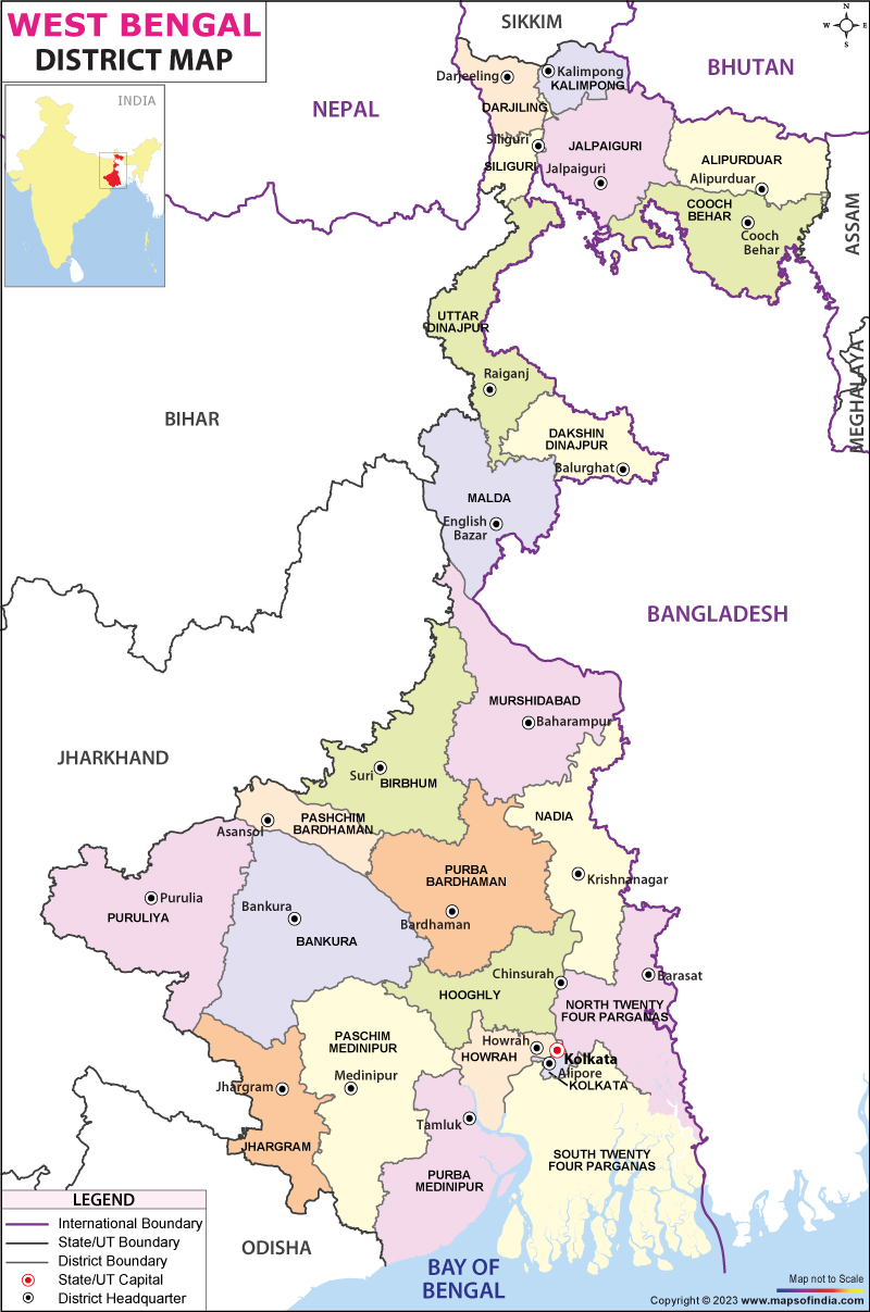
Situated in the eastern region of India along the Bay of Bengal, West Bengal is India’s fourth most populous state, with 91,347,736 population according to census 2011. It is also the thirteenth-largest state with an area of 88,752 sq. km. Adjoined with Bangladesh in the east, Nepal, and Bhutan in the north, it is part of the ethnolinguistic region of the Indian subcontinent. The state capital of West Bengal is Kolkata, which is on the banks of the Hooghly river in the southern portion. The demographic majority in this state are Bengalis.
What is the Geography of West Bengal?
West Bengal is situated in the eastern part of the country and spreads over 88,752 sq. km (34,267 sq. mi). It is bounded to the north by Sikkim and the country of Bhutan. Assam borders it to the northeast, Bangladesh to the east, the Bay of Bengal to the south, Odisha to the southwest, Jharkhand and Bihar to the west, and Nepal to the northwest.
The geography of the state is very diverse. There are the Himalayas in the north, and just to its south lies the Terai region. It is a stretch of marshy swamps and grasslands at the foothills of the Himalayas, which segregates the hills from the North Ganga plains. The river Ganges divides the plains of West Bengal into North Bengal plains and the south Bengal plains. To the west of the state lies the plateau region and the high lands, which includes eastern edges of the Chota Nagpur plateau. The Ganges delta lies to the south which is characterised by the magnificent Sundarbans mangrove forests. Between the Ganges delta to the east and the western plateau and high land to the west, lies the Rarh region which is composed mainly of laterite soil. West Bengal, also happens to be the only state in India where the mighty Himalayas are in the north and, the sea (Bay of Bengal) is also there in the south. West Bengal also comprises of a coastal region, which boasts of beautiful beaches such as Digha and Mandarmani.
Himalayan tract, also known to be the “West Bengal Duars” is part of the Tarai lowland belt in the middle of the Himalayas and the plain. Some of the best tea plantations take place there. The view of Mount Kanchenjunga dominates the landscape here. On clear days, Mount Everest is also visible.
The most important river of West Bengal is the Ganges. Upon entering West Bengal the Ganges branches into two, near Farakkha. The southern branch enters West Bengal as Bhagirathi-Hooghly, while the main branch enters Bangladesh, where it is known as the Padma. Other significant rivers of West Bengal are Teesta, Torsa, Mahananda and Jaldhaka rivers in hilly regions of north; Damodar, Kangsabati and Ajay in the plateau region of the west; and numerous distributaries in the Ganges delta region.
What is the Climate of West Bengal?
The state has a transitional climate. The Tropic of Cancer cuts across the state from the centre and divides it into two parts. To the north of the Tropic of Cancer, the climate is generally humid subtropical, while to the south it is tropical savanna. However, there is a seasonal disparity in rainfall throughout the year, but the sub-Himalayan region witnesses considerably higher rainfall.
Besides, there are three significant seasons – hot and dry which stays in March to early June; the warm and wet season or the rain-bearing monsoon between mid-June to September; and the cold season which comes in between October and February.
The average temperature of West Bengal ranges from about 27°C (80°F) in December and January to nearly 38°C (100°F) in April and May. West Bengal also witnesses thunderstorms locally known as “Kal-Baisakhi”, during the early summer months, which brings about relief from the scorching heat.
What is the Economy of West Bengal?
The Sixth-largest state economy in India, West Bengal, is primarily dependent on agriculture and medium-sized industry. However, like many other states, services, and industries also play a significant role in the state’s economy.
The portion of agricultural land in West Bengal is one of the highest of all the Indian states, which also dominates the economic landscape of the state. Rice is the leading crop here alongside sugarcane and oilseed. Jute is also prominent but more so in the border with Bangladesh and south of the Ganges River. The southern and central portion is known for producing mangoes, jackfruit, and bananas. Wheat and potato are the winter crops in the south. The northern region produces high-quality tea, such as Darjeeling and Jalpaiguri.
The state’s economy also relies on its industry. Some significant industrial regions in the state are the sites located along the Damodar River, the corridor along the Hooghly River, the steel plants at Durgapur and Burnpur, locomotive plants at Chittaranjan, to name a few.
The service sector is another sector that contributes to the economy; some of the essential industries being trade, finance, insurance, and tourism.
What is the Transportation System of West Bengal?
Railway system flagged off in West Bengal in the year 1854, and Kolkata is the headquarter of three zones of the Indian Railways – Eastern Railway and South Eastern Railway and the Kolkata Metro. Kolkata was the first Indian city to open an underground metro rail system.
The state’s largest airport, Netaji Subhas Chandra Bose International Airport is located in Kolkata. Other airports are Bagdogra Airport, Kazi Nazrul Islam Airport.
What are the Popular Tourist Attractions in West Bengal?
Some of the popular tourist spots are Victoria Memorial, Darjeeling Himalayan Railway, Sunderbans National Park, Howrah Bridge, Mirik, Gorumara National Park, Buxa Tiger Reserve, to name a few.
Related Maps:


