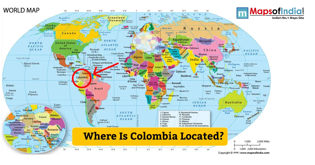
Where Is Colombia Located?
Colombia is in the north of South America, in the northwest. It is surrounded by the Caribbean Sea in the north and the Pacific Ocean in the west. Colombia is bordered by five countries: Panama, Venezuela, Brazil, Peru, and Ecuador. It is situated between the northern part of South America and Central America.
The area of Colombia is about 1.14 million square kilometres. Geographically, the nation can be seen stretching from nearly 12° North to 4° South latitude and from 67° West to 79° West longitude. The Equator runs through the south of this Nation, so Colombia is in both the Northern and Southern Hemispheres, although its territory is mostly to the north of the Equator.
Colombia on the South America Map
To view the map of South America, Colombia is located in the northwest corner of the continent. To the northwest of Panama is Colombia, which is geographically linked to Central America. To the east is Venezuela, and to the south-east is Brazil. Ecuador and Peru lie on the southern edge of Colombia.
The country of Colombia is the only country in South America with two coasts: the Caribbean Sea and the Pacific Ocean. The north of the country has a coastline along the Caribbean, and the west has a coastline along the Pacific. Colombia also has a number of islands and island groups in the Caribbean Sea and Pacific Ocean.
Colombia’s Neighboring Countries
Colombia has 5 international neighbour countries. It is bordered by Panama to the Northwest and Venezuela to the East. Brazil is situated on the southeastern border of Colombia. South Colombia borders Peru and Ecuador. These countries border most of Colombia, and the Caribbean and Pacific Ocean provide the country’s major maritime boundaries.
Geographic Coordinates of Colombia
The general geographic location of Colombia is between 12° N and 4° S latitude and 67° W and 79° W longitude. The northernmost parts of the country are in the Caribbean and the southernmost towards the Amazon Basin.
The geographical setting of Colombia also spans a large geographical area from lowland coastal regions to mountain areas, which are high in altitude. But it is also known for its general location in the northwest of South America.
Location of Bogotá
Bogotá, Colombia’s capital, is located in the central-eastern region of the country. It’s nestled in the Savanna of Bogotá in the high plateau of the Eastern Cordillera of the Andes Mountains. The city is situated away from the Caribbean and Pacific coasts.
Other important Colombian cities are scattered throughout the country. Medellín is in the northwest part of the Andes, Cali in the southwest, and Cartagena and Barranquilla in the Caribbean.
Physical Location of Colombia
The physical geography of Colombia is very linked to the fact that it is located in the northern part of South America, in the Northwestern area of the South American continent. The Andes Mountains enter Colombia from the southwest and are split into three great mountain ranges, the Western Cordillera, Central Cordillera and Eastern Cordillera. These are the mountain ranges of the western and Central parts of the nation.
The wide Llanos plains lie eastward of the Andes, and the southern and south-eastern regions of Colombia belong to the Amazon Basin. The northern part contains the Caribbean lowlands and the Guajira Peninsula, extending into the Caribbean Sea.
In general, Colombia is situated in the northwestern part of South America, bordering the Caribbean Sea to the north, the Pacific Ocean to the west, Panama to the north-west, Venezuela to the east, Brazil to the south-east, Ecuador to the south and Peru to the south. It can be easily located on a world map or a South America map, as it lies between Central America and the rest of the South American continent.