
Where is Haryana?
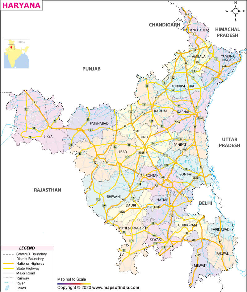
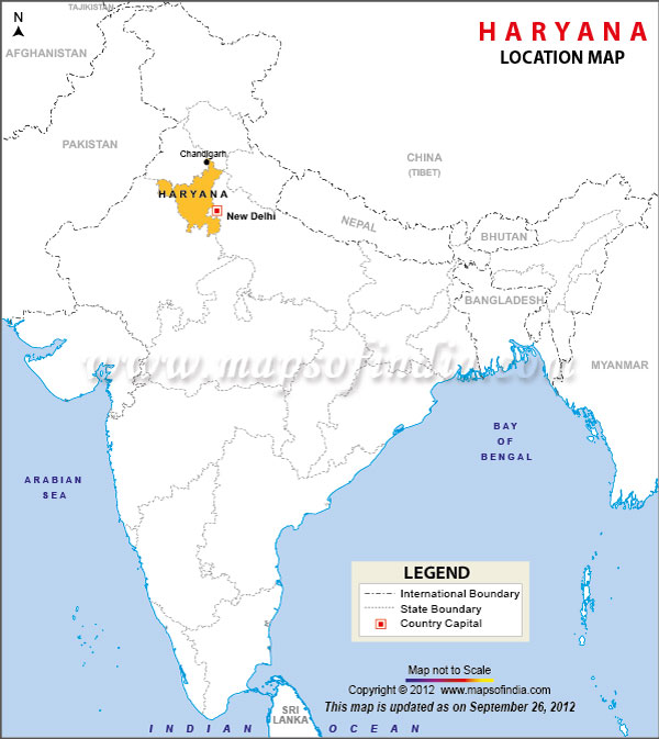
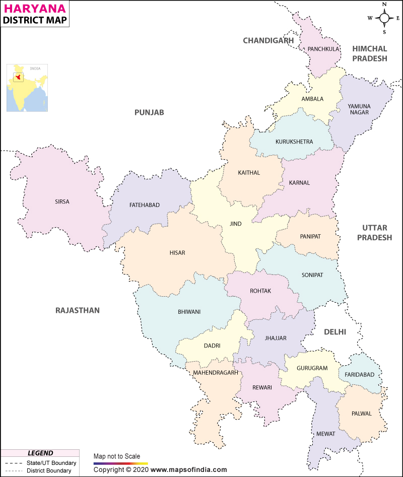
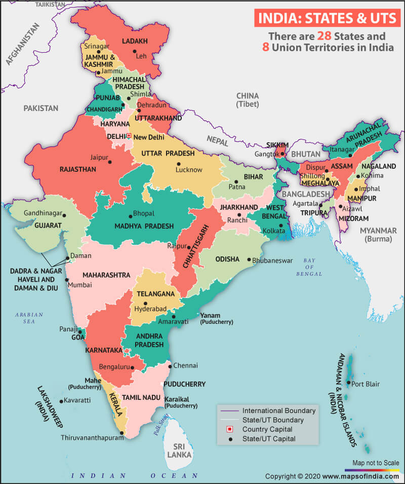
Haryana is in the northern part of India. It came into existence as a new state on November 1, 1966, on a linguistic basis. Haryana shares its borders with Punjab and union territory Chandigarh in the northwest, Himachal Pradesh in the north, Uttarakhand to the northeast. It is also bounded on the east by Uttar Pradesh and national capital Delhi, Rajasthan in the south and south-west. Chandigarh is the capital of Haryana, while Faridabad is the largest city in the state.
What is the Geography of Haryana?
The state spreads across a total area of 44,212 sq. km (17,070 sq. mi). The division of rural and urban areas of the state- 42,235.92 sq. km comes under the rural area, and 1,976.08 sq. km falls under the urban area. According to the 2011 census, the population of Haryana was 25,353,081, and the density of the population is 573 per sq. km.
The state lies between 27°39′ to 30°35′ N latitude and between 74°28′ and 77°36′ E longitude. The state is divided into four geographical features -Hills, Plains, Aravali Range, and Semi-Arid area. The plain regions are fertile because it is by the doabs (Persian word, Do-mean two, and Ab means water) of some rivers. The well-known plains of the state are Yamuna–Ghaggar plain (Delhi doab) consists of Sutlej–Ghaggar doab, Ghaggar–Hakra doab, and Hakra–Yamuna Doab.
Shivalik hills cover the northern part of Haryana, which is characterized by deciduous forest. Morni Hills is the highest point in Haryana, which falls in the Panchkula district.
The government of the state formed the Haryana Biodiversity Board in 2018 to save forest, flora, fauna, and biodiversity of the state. Emphasis has been given to protect forests in Haryana.
Several vital rivers pass from Haryana, such as Ghaggar, which is the largest river of the state, its length is 250km. Kaushalya, Markanda, and Tangri /Dangri (a tributary of Ghaggar river) are some other rivers that pass through the state.
Blackbuck is the state animal, while black francolin is the symbol of the state bird. Apart from this lotus is the state flower while peepal marks as the state tree.
The soils in the state are deep and fertile, but most of the land of the state is arable. Alluvial soil is found in the doab regions, while the southern areas of the state are replete with red soil. Wheat and rice are the principal crops of the state. Sugarcane, cotton, oilseeds, pulses, maize, and so on are also cultivated. In food production, Haryana is self-sufficient.
Along the highways and in the wasteland areas of the state a large number of eucalyptus trees are planted. The government is also promoting the plantation of shisham along the roads and canals.
The state is home to several animals like leopards, jackals, wild boars, and various kinds of deer. These are found in hilly areas. Colourful birds such as parakeets, buntings, sunbirds, bulbuls, and kingfishers are also spotted in Haryana.
What is the Climate of Haryana?
The climate of Haryana is hot and muggy in the summer. Maximum temperature falls in May and June, which may reach up to 45°C. December and January are the coldest months. The climate of the state is arid to semi-arid, and the average rainfall in Haryana is 450mm.
The state has developed canal irrigation, and tube wells are being used in large numbers for irrigation. The rainfall in Haryana is unevenly distributed. Therefore, arid and semi-arid zones are drought-prone regions. Hence artificial irrigation is necessary for the cultivation of such areas.
What is the Economy of Haryana?
The economy of Haryana depends on industry and agriculture. The state is the hub of automobile manufacturing. It is an estimation that two-thirds of passenger cars, 50 percent tractors, and 60 percent of motorcycles are manufactured in Haryana.
The state alone contributed nearly 3.63 percent in the country’s GDP in 2018-19. The state government is adamant about creating a progressive business environment. However, the state had seven Special Economic Zones (SEZs) in 2019.
The state has been doing well in merchandise exports. It reached US$ 13.83 billion in December 2019. The state government has enticed Foreign Direct Investment (FDI) equity inflows worth US$ 91.81 billion during the period April 2000 to September 2019., as per the data of the Department for Promotion of Industry and Internal Trade (DPIIT).
What is the Transportation System of Haryana?
Haryana is well connected with the entire country by road, rail, and air. Haryana Roadways are providing critical services to the passengers. the state has at least 32 National Highways and 11 expressways. Currently, there are five Civil Airstrips in the state. The state has five rail divisions under three rail zones.
What are the Popular Tourist Attractions in Haryana?
Haryana is an excellent destination for tourists. Some of the places are worth seeing like- Krishna Museum, Sheikh Chehli ka Makbara and many more. Apart from these, some historical sites like Panipat, Kurukshetra, etc. are also good tourist spots. In Chandigarh, tourists can enjoy Rock Garden, Rose Garden, and many more.
Related Maps:


![]()


