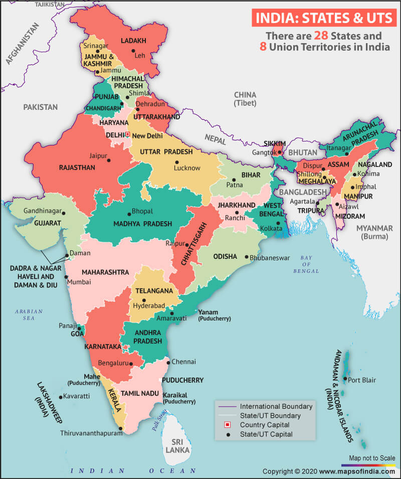

Where is Maharashtra?
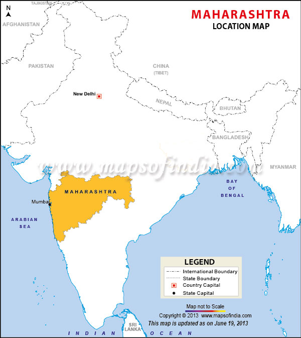
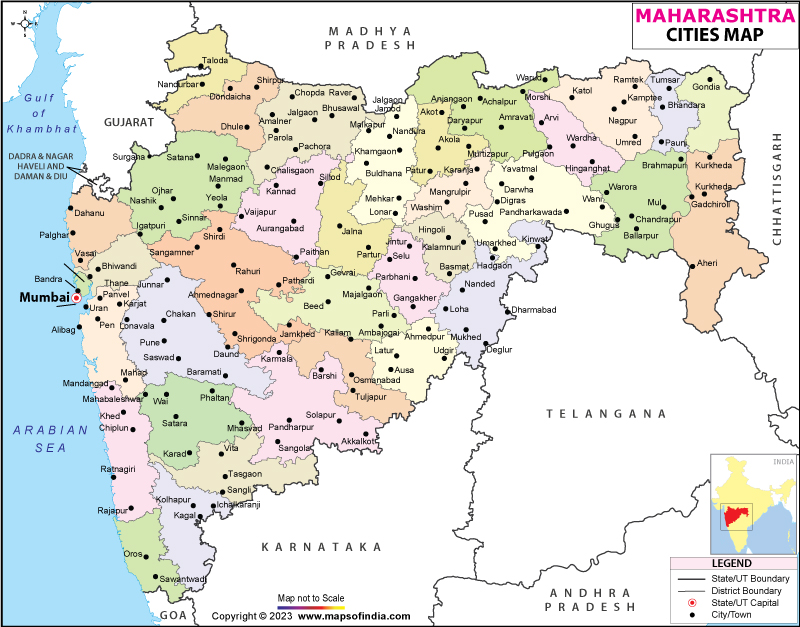
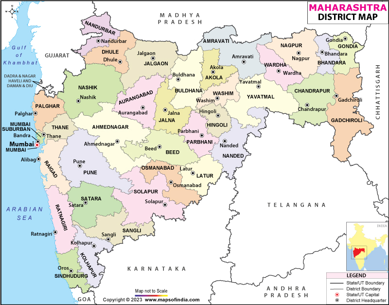
Maharashtra lies in the western peninsular occupying a sizable part of the Deccan Plateau. The Arabian Sea surrounds it to the west, Karnataka to the south, Goa to the southwest, Telangana to the southeast, Chhattisgarh to the east, Gujarat, and Madhya Pradesh to the north. It also shares its border with Union Territory of Dadra and Nagar Haveli and Daman and Diu to the northwest. The formation of Maharashtra as a state took place on May 1, 1960.
What is the Geography of Maharashtra?
Maharashtra spreads across a total area of 307,713 sq. km (118,809 sq. mi). It ranks 3rd in terms of total area amongst the states and union territories in India. Its population recorded 112,374,333 (as per the 2011census). The population density of the state was 370/ sq. km (950/sq. mi) (as per the 2011census). Maharashtra ranks 2nd in terms of population in the country.
There is no shortage of rivers in Maharashtra. Several incredible rivers pass through the state like Godavari, Krishna, Tapt, Bhima, and many more. Godavari is the longest river. Its length is 1,465 km draining in five states- Maharashtra, Telangana, Andhra Pradesh, Chattisgarh, and Odisha before discharging into the Bay of Bengal.
The state is also packed with several picturesque lakes as well, such as Ambazari Lake, Futala Lake, Lonar Lake, and Masunda Lake.
Maharashtra is home to an extensive mountain range, which is geographically part of the Sahyadris or the Western Ghats. Some of the major mountains of the state are Kalsubai, Salher, Ghanchakkar, Dhodap. Kalsubai peak is the highest mountain peak in the state. Its altitude is 1,646 meters.
The state has many dams and water reservoirs. Some of the prominent dams in the state are Koyna Dam, Bordharan Dam, Nilwande Dam, Gangapur Dam, Upper Vaitarna Dam, Mula Dam, and Dhom Dam.
As per the Indian State of Forest Report (ISFR)-2019, Maharashtra’s forest cover was 50,777.56 sq km, which is 16.50% of the state’s geographical area.
The state has an impressive flora and fauna. The state has various wildlife sanctuaries and national parks. Some of the major sanctuaries of the state include Tadoba National Park, Bhamragarh Sanctuary, Bor Wildlife Sanctuary, Sanjay Gandhi National Park, and Bhigwan Bird Sanctuary.
It is home to a large number of animals, including the tiger, crocodile, bison, gawa, wild deer, sambar, Indian wild dog, and Indian bison. Various kinds of birds are also spotted in Maharashtra, such as bulbul, shama, cuckoo, parakeet, drongoes, and Wagtails Flycatchers. The Salim Ali Bird Sanctuary and Karnala Bird Sanctuary are the perfect places for ornithologists in the state.
The state tree of Maharashtra is Mangifera indica, while the pride of India is the state’s flower. Besides this, the state has declared Indian giant squirrel as the official state animal, and Yellow-footed green pigeon is the state bird of Maharashtra.
What is the Climate of Maharashtra?
Maharashtra has a tropical climate that has been prevailing all over the state. Dew, frost, and hail take place sometimes in the state, depending on the seasonal weather.
March, April, and May are the summer season of Maharashtra while temperature during this period in the state remains in the range of 22°C (72°F) to 39°C (102°F). The winter season in the state prevails from November to February. The temperature during this period in the state remains between 12°C (53.6°F) to 34°C (93.2°F).
The state receives an average annual rainfall of around 900 mm. January and May are the coldest and hottest months, respectively, in the state.
What is the Economy of Maharashtra?
The economy of Maharashtra depends on the manufacturing industry, IT, banking sector, and agriculture. The state economy is the largest in India. Mumbai is known as the nation’s financial capital. Maharashtra is one of the most urbanized states in India.
Agriculture is the lifeline for the rural people of the state. It produces several crops such as rice, jawar, bajra, wheat, tur, mung, urad, gram, and other pulses. Apart from this, it is a major producer of groundnut, sunflower, soybean and other oilseed crops, while cotton, sugarcane, turmeric, and vegetables are the prominent cash crops of the state.
The state has a prominent place in floriculture production. Several traditional flowers are grown in abundance in Maharashtra, such as rose, chrysanthemum, marigold, jasmine, and tuberose. While some non-traditional flowers like- aster, zinnia, Stacie, lilies, and gerberas also grow in Maharashtra. It is the leading state in India in terms of production, export, and consumption of flowers in the country.
The state is famous for several industries such as pharmaceuticals, biotechnology, IT and ITeS, electronics, engineering, auto and auto components, oil and gas, gems and jewellery, banking, financial services, and textiles, etc.
Several special economic zones were existing in the state until February 2020. Maharashtra has 12 special economic zones (SEZs) with valid in-principle approvals, 48 SEZs with formal approvals, and 31 exporting SEZs and 42 SEZs with notified approvals
Maharashtra’s GDP was around ₹29.79 lakh crore (US$420 billion) in 2019-20.
What is the Transportation System of Maharashtra?
Maharashtra has three means of transportation, such as Roads, Railways, and Civil aviation. The state’s road network is extensive and largest in the country.
Maharashtra State Road Transport Corporation is a state-owned road transport corporation. It has been providing an excellent interstate and across the state bus services. In the state capital Mumbai, Bombay Electric Supply and Transportation, better known as BEST and local trains, are the primary source of public transport. Mumbai Metro is also in operation in the city.
Some prominent national highways pass through the state are NH-8, NH-50, NH-3, NH-561A, and so on. Some of the famous state highways are MH MSH 1, MH MSH 3, MH MSH 6, MH MSH 9, MH MSH 10, etc.
Railway network in the state is highly developed. The headquarters of two railway zones of India, the Central Railway and the Western Railway zones lie in Mumbai’s Chhatrapati Shivaji Terminus and Churchgate station, respectively.
The state is replete with airports. It has both international and domestic airports. Some of the major airports of the state are- Chhatrapati Shivaji International Airport, Pune International Airport, Dr. Babasaheb Ambedkar International Airport, Shri Guru Gobind Singh Ji Airport, and many more.
There are several ports in Maharashtra, two major ports of the state are Jawaharlal Nehru Port and Mumbai Port.
What are the Popular Tourist Attractions in Maharashtra?
Maharashtra is a beautiful place for tourists. The visitors can enjoy the historical heritage, hill stations, beaches, temples, monuments, wildlife sanctuaries, and so on.
The state has several remarkable tourist attractions such as Ajanta and Ellora Caves, Konkan Coast, Tadoba National Park, Mahabaleshwar, and so on. Maharashtra is a state where tourists can enjoy and relax every bit of their time.
Related Maps:
![]()

