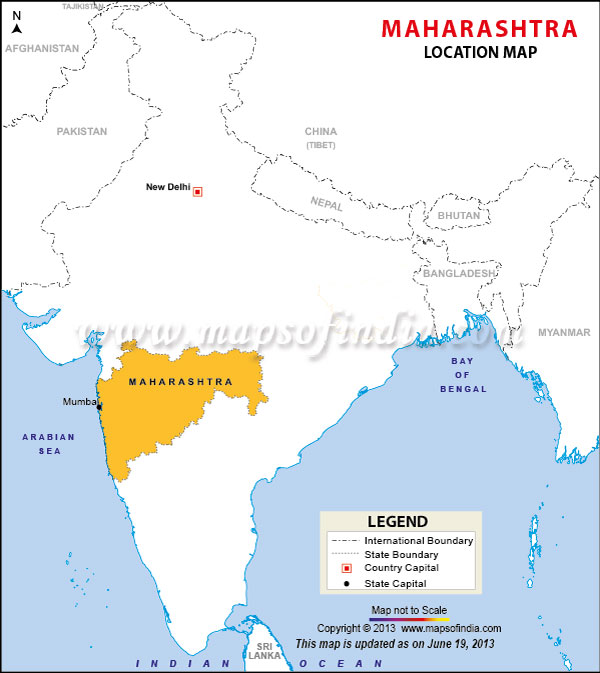
Maharashtra is located in the Deccan region of India. The Arabian Sea covers the entire western coast of the state. Mumbai is the capital city of the state; also, it is both the financial and the cinematic centre of the country. The very famous Bollywood, or the Indian Film Industry, is located in the city. Apart from this the state enjoys a year round tourist attention because of its diverse geographical features. The connectivity to the state, both within the country as well as from other countries makes it the most well connected state of the country.
The state of Maharashtra is well connected by air, road and rail routes and travelling within the state can be done with ease. In Mumbai there is one international airport, Chhatrapati Shivaji International Airport,formerly known as Sahar International Airport. There are domestic airports in all major cities like Mumbai, Pune, Nashik, Solapur, Nagpur and Aurangabad. There are flights at regular intervals with flight schedules designed to suit the visitors.
Maharashtra has the best connectivity by road too. The capital city is well connected with all the important cities of the state with regular bus services. The bus services are provided by the Maharashtra Tourism Development Corporation or the MTDC. Apart from this there is an intra - city bus service provided by the Bombay Electric Supply and Transportation Undertaking or BEST.
Last Updated on : January 14, 2026
| Cities |
| Districts |
|
|
