
Where is Manipur?
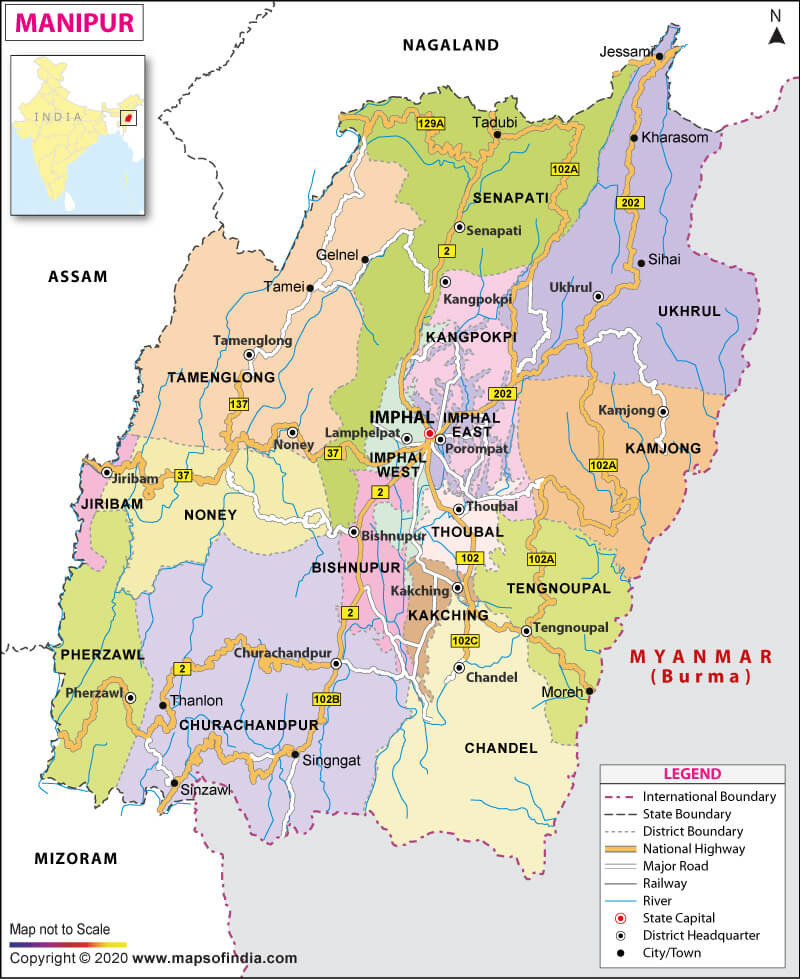
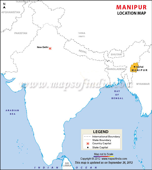
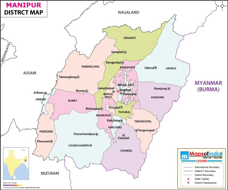
Manipur lies in the northeastern part of India. It is bounded by Nagaland to the north, Assam to the west, and Mizoram to the southwest. The state also touches an international border with Myanmar (Burma), which lies to its south and east. The formation of Manipur as a state took place on January 21, 1972.
What is the Geography of Manipur?
Manipur spreads across a total area of 22,327 sq. km (8,621 sq. mi). The state ranks 23rd in terms of total area amongst the states and union territories of the country. Its population recorded 2,855,794 (as per the 2011 census). The population density of the state was 130/sq. km (330/sq. mi), as per the 2011 census. The state ranks 23rd in terms of population in the country.
The dazzling rivers of the tiny state Manipur play a significant role in the topography of the state. It is a land of several rivers, and the breathtaking streams of the river adorn Manipur even more. Some of the prominent rivers of the state are Barak River, Imphal River, and Iril River.
Physiographically, Manipur divides into two distinct physical regions: an outer area of rugged hills and narrow valleys, and the inner area comprises the flat plain topography with related landforms.
Manipur has many forests and has a remarkable variety of flora and fauna. Forest covers around 67 percent area of the state. There are mainly three kinds of forests in the state, like- Tropical Semi-evergreen, Subtropical Pine, and Montane Wet Temperate Forests.
It is home to the endangered species of Sangai, also known as Brow Antlered Deer. It is a major wildlife attraction in the state. Apart from this, the state is also home to rare primates like Slow Loris, the Stump-Tailed Macaque, the Pig-Tailed Macaque, the Hoolock Gibbon, Clouded Leopard, and the Golden Cat. Several kinds of birds are also spotted in Manipur, such as Khunu-Khrang, Langmeidong, Urengkonthou, and many more.
The state tree of Manipur is Phoebe Hainesiana, while Lilium Mackliniae is the state’s flower. Besides this, the state has declared Sangai as the official state animal, and Mrs. Hume’s Pheasant is the state bird of Manipur.
What is the Climate of Manipur?
The climate of the state is variable. The climate of the western region of the state is tropical, while the rest of the state experiences a subtropical climate. Manipur undergoes three major seasons – summer, winter, and rainy seasons.
The average summer temperature in Manipur remains in the range of 29°C (84°F) and 21.2°C (70.2°F). While in winter, the state experiences the temperature around 8°C (46°F) to 23°C (73°F).
It gets an average annual rainfall of 1,467.5 mm. January and July are the coldest and hottest months, respectively, in the state.
What is the Economy of Manipur?
The economy of Manipur mainly depends on agriculture, industries, and the tourism sector. The climate and soil conditions of the state are ideal for horticultural crops.
The state is also known for the growth of exotic medicinal and aromatic plants. Some of the horticulture products of Manipur are famous in terms of generating revenue which are orange, lemon papaya, passion fruit, peach, plum, and so on. Cashew and walnut are also grown in the state.
Bamboo forest covers a large part of the state, which makes it a hub of the bamboo industry. The bamboo processing industry is in three places in the state – Tamenglong, Churachandpur, and Imphal.
Tourism is another source of earning for the state. The natural beauty of Manipur entices local and overseas tourists to visit that place. The peak period for tourism is from October to February. Visitors enjoy the state’s martial arts, dance, and sculpture, along with greenery as well.
The state has been making good progress in silk production and handlooms. Raw silk production in the state during 2019 was 235 metric tonnes. The handlooms industry is the primary cottage industry in the state.
The Gross State Domestic Product (GSDP) of the state was Rs 231.67 billion (US$ 3.59 billion) in 2017-18, while Manipur’s merchandise exports touched US$ 2.65 million in 2018-19.
What is the Transportation System of Manipur?
Roads are the lifeline and regarded as the arteries and veins for the people of Manipur. Roads and highways are the key infrastructures for the economic development of the state. Therefore, the state government also gives lots of emphasis on the construction of better roads.
Some major highways which pass through the state are NH 39, NH 53, NH 137A, and many more.
Railway network is not well-developed in the state. Currently, the state has two railway stations, while the Imphal railway station is under construction. The 111 km long, Jiribam- Imphal railway line, is set to be completed by March 2022.
Imphal Airport, also known as Bir Tikendrajit Airport, is a domestic upgraded new international airport situated in Imphal.
What are the Popular Tourist Attractions in Manipur?
Manipur is a gem of the north-east and is a fantastic destination for domestic as well as foreign tourists. The state has many hills, rugged streams, waterfalls, and many more tourist places.
Some of the prominent tourist destinations of the state are Senapati, Andro, Imphal, Khongjom, and many more. It is needless to add that Manipur is a state where tourists will get everything for enjoyment.
Related Maps:


