A few words on storms:
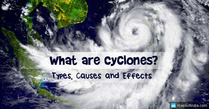
The Indian Meteorological Department (IMD) has categorized the tropical storms into six divisions, depending on the intensity, wind speed and the damages incurred. These are namely,
- DEEP DEPRESSION, characterized by wind speeds of 52 to 61 kilometers/hour
- CYCLONIC STORM, characterized by wind speeds of 62 to 87 kilometers/hour
- SEVERE CYCLONIC STORM, characterized by wind speeds of 88 to 117 kilometers/hour
- VERY SEVERE CYCLONIC STORM, which has two categories – namely, Very Severe Cyclonic Storm, characterized by wind speeds of 118 to 167 kilometers/hour and Very Severe Cyclonic Storm, characterized by wind speeds of 168 to 221 kilometers/hour. An example of this second category of the Very Severe Cyclonic Storm is the Cyclone Phailin that had ravaged the eastern coast of India, on October 13th, 2013.
- SUPER CYCLONE, characterized by wind speeds of above 222 kilometers/hour
A few facts about the Severe Cyclonic Storm Helen:
The Severe Cyclonic Storm Helen was in fact a residue of the tropical storm Podul, originally formed in the Bay of Bengal. At its nascent stage, Helen was a weak tropical storm that had already been identified as a ‘Deep Depression BOB 06’ by the Indian Meteorological Department (IMD), on November 19th. During its slow traverse in a northwesterly direction, the storm gained strength and by November 20th, it was transformed into a Cyclonic Storm, causing medium rainfall in regions of Eastern India. By November 21st, it had acquired enough strength to be categorized as a Severe Cyclonic Storm, packing a wind speed of 88 to 117 kilometers per hour (55 to73 mph), and was residing on the West Central part of the Bay of Bengal.
Predictions of the Indian Meteorological Department (IMD):
As of 21st November, the predictions of the IMD were that, Helen would hit the coastal areas of Odisha causing torrential rainfall accompanied by strong wind gusts. The storm, by this time, had shifted in a north westerly direction further, and was centralized on the Bay of Bengal, about 410 kilometers south west of the coastal city of Gopalpur, Odisha. The Meteorological reports confirmed that the storm will cause torrential rainfall over a majority of the areas of Odisha, accompanied by thunder and heavy rainfall in some places of the state, in the next 48 hours. The ports of Paradeep and Gopalpur were already posted with ‘Distant Warning Signal Number Two (DW – II)’. The IMD reports had further predicted strong North Westerly surface winds packing a speed of 45 to 55 kmph, which might even go up to 65 kmph, will ravage the southern coast of Odisha. while similar wind gusts were expected to hit the Northern coast of Odisha, packing a speed of 40 to 45 kmph, which might even accelerate to 55kmph. Sea fishing was declared unadvisable in the south coast under such conditions, while the north coast fishermen were advised to adhere to extreme caution, while venturing for sea fishing.
After searing through Odisha, the Meteorological reports confirmed that the storm would hit the Andhra Pradesh coast by 22nd November, causing very heavy rainfall. The path of the storm, as traced by the IMD, would be an initial west – northwestward, followed by a west – southwestward trajectory, crossing the south coast of Andhra Pradesh, in between the coastal cities of Nellore and Machillipatnam, in close proximity of Ongole, by midday of November 22nd. IMD had predicted heavy to very heavy thundershowers in places of the Andhra Pradesh coastal areas and isolated thunderstorms, ranging between heavy to very heavy, in Rayalaseema and adjacent areas of North Tamilnadu. As quoted in the Meteorological reports, “Gale wind speeds reaching 100 to 110 kmph gusting to 120 kmph would prevail along and off south Andhra Pradesh and north Tamilnadu coasts”. Sea conditions were predicted to be stormy and rough along the south coast of Andhra Pradesh, while extremely rough and stormy sea conditions were to be expected in the coasts of north Tamilnadu and Puducherry.
The fury of the Severe Cyclonic Storm Helen and its consequences:
Severe Cyclonic Storm Helen wreaked havoc in the coastal areas of Odisha, with the destruction of thousands of homes, crops and agricultural land, amounting to more than 5 lakh hectares and claiming nearly thirty lives. Power supply was disrupted in most of the coastal areas, as the storm had also destroyed the supply lines.
In Andhra Pradesh, the arrival of the storm was marked by heavy rainfall in the Rajamundry and other areas of the East Godavari district. The sea became so violent that the waves broke through the sea wall in Uppada village, inundating the beach road and disrupting traffic. 8000 people had been shifted to higher lands. 3000 people have been evacuated from the West Godavari district to safe zones, and are being supplied with essential relief. Two deaths were reported, as the trees uprooted by the gale fell on the victims. Thirty two fishermen, who had embarked on a sea fishing venture a couple of days before the storm hit the coasts, are still missing. Efforts are being taken to clear the roads that had been blocked by trees, uprooted in the storm.
Like in Odisha, there was a massive destruction of crops, and electric posts and coconut trees were felled indiscriminately by the storm in three districts. The district of East Godavari was affected the most, since it was right in the eye of the storm. While life had come to a halt in East Godavari, the storm caused serious destruction in eight, out of the sixteen mandals, under the Amalapuram Revenue Division. Electrical supply to the area has been completely disrupted, as a result of the storm uprooting 67 electrical posts and twenty transformers burnt to cinders, shorted by bolts of lightning.
The Severe Cyclonic Storm Helen hit the landfall near the coastal town of Machilipatnam. Ensuing the landfall, cyclonic conditions were apprehended for another six hours, while the storm gradually spent itself, and transformed into a ‘Deep Depression’ in the next six hours, as it traversed westward, across the coastal areas of Andhra Pradesh and Telengana. However, there is little reprieve, as the next forty eight hours will be marked by torrential rainfall, in isolated areas of Telengana. Wind gusts, packing a speed of 50 to 60 kmph are expected in the subsequent twelve hours, which may even culminate to 100 kmph in areas around the eye of the storm.
Conclusion:
The main affected areas are the East and West districts of Godavari Krishna, Guntur and parts of the adjacent district of Prakasham, Andhra Pradesh. The Chief Minister of Andhra Pradesh, N Kiran Kumar Reddy, held a meeting with the collectors of the coastal districts and the Chief Secretary to reassess the situation, posing before them as a result of the Severe Cyclone. The susceptible districts of the coastal areas have been declared as high alert zones, with the standing instructions of the Chief Minister to the officials, to be ready for any emergency. Reddy has also sought the cooperation of the National Disaster Response Force (NDRF), as well as the police department, fire department, emergency medical services department and also the agriculture department. The officials have been instructed by Reddy, to seek the help of the Army, Navy and the Air – force, in case the situation demands further helping hands.


