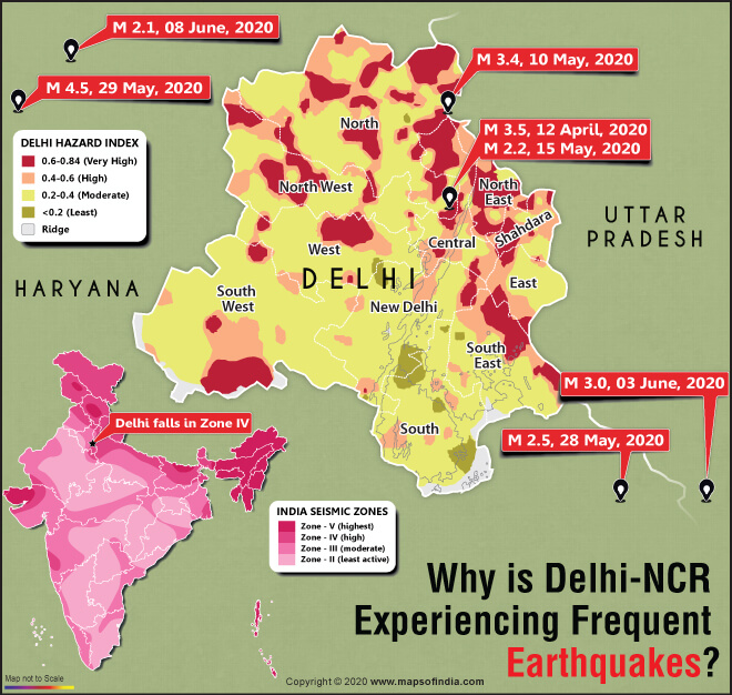

An earthquake of low magnitude 2.1 struck near Delhi on Monday as mild tremors hit the national capital. The frequent occurrence of earthquakes is an alarming bell. Monday’s earthquake is the 13th minor tremor recorded in Delhi and its nearby areas in the last two and a half months.
Frequent earthquakes in Delhi
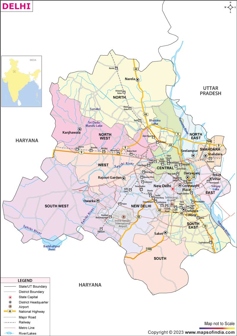
The tremors were felt in Delhi, Noida and adjoining areas for a few seconds which was detected at 1 PM at a depth of 18 km. According to India’s National Center for Seismology, the epicentre of the earthquake was in Gurgaon (Haryana). Geologists believe that Delhi, which lies close to a fault line, is susceptible to low-intensity earthquakes.
Fear in the mind of people
The recent frequent tremors have raised the alarm in the mind of the people on the possibility of increased seismicity in Delhi and its nearby places. People are frightened that big earthquake disasters may occur sometime shortly. But scientists have assured that no unusual seismic activity has been taking place near Delhi since April 2020.
Small earthquakes, a sign of a bigger one?
Experts say that an earthquake of magnitude four or below is not dangerous as it hardly causes any damage to life and property. Such earthquakes are recorded around the world regularly. The important point is that it is not the warning signal of any big earthquake. Therefore, it is unscientific that small earthquakes are the precursors to the big earthquake.
Signal behind frequent earthquakes
Scientists have been busy in research for years to identify the “precursors” to an earthquake, but they are not able to break the jinx. Experts can only somewhat predict earthquakes, which take place due to volcanic activity; otherwise, it is not possible even for experts to predict an earthquake and its magnitude.
Professor Durgesh C Rai, the convener of the National Information Center of Earthquake Engineering, IIT Kanpur, said that just because the local fault cess is jolting the national capital, it does not mean that Delhi-NCR will witness a major earthquake. He said that earthquakes intensifying in the Himalayan belt could affect Delhi-NCR, and if this happens continuously, then there will be a situation to worry.
Seismic hazard microzonation can reduce earthquake
The Ministry of Earth Sciences (MoES) said that the impact of a high-intensity earthquake can be reduced with the help of seismic hazard microzonation of vulnerable areas and putting in place adequate mitigation measures.
Four seismic zones in India
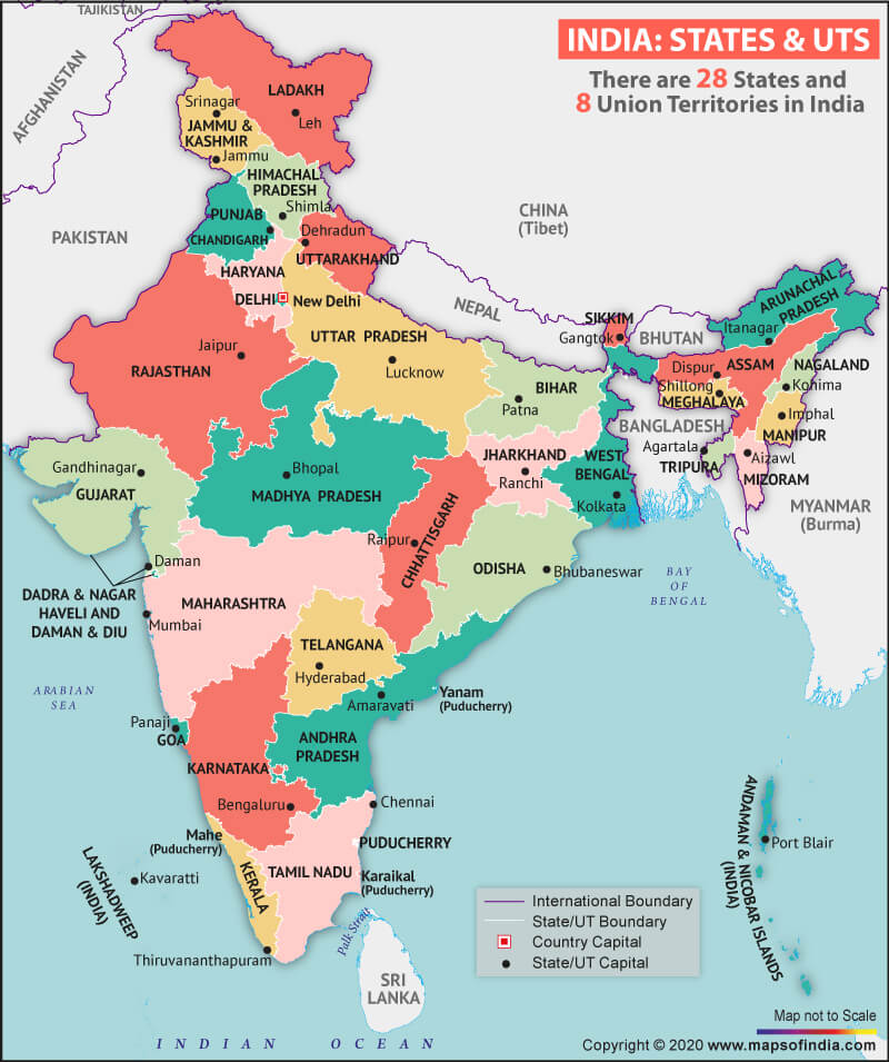
The Bureau of Indian Standards has classified India into four seismic zones based on their past seismic activity. These zones are known as II, III, IV and V. Zone V is the most sensitive and active region. At the same time, zone II is the least active area. As per the Modified Mercalli scale, the seismic zone intensity is classified as zone II (low-intensity zone), zone III (moderate intensity zone), zone IV (severe intensity zone), and zone V (very severe intensity zone). High-seismic Zones IV and V are always at risk to earthquakes. Some of the areas come in this list such as- all north-eastern states, Delhi, the Kutch region in Gujarat, and Andaman and Nicobar Islands.
Govt completes mapping of eight cities
The Ministry has been planning for phased seismic hazard microzonation of important cities with a population of at least half a million. The government has so far completed the micro-seismic mapping of Sikkim and eight cities Bengaluru, Delhi, Kolkata, Guwahati, Jabalpur, Ahmedabad, DehraDun, and Gandhidham.
What is seismic microzonation?
Seismic microzonation is the process of the division of a potential seismic or earthquake-prone area into zones concerning some geological and geophysical characteristics of the regions like- ground shaking, liquefaction susceptibility, landslide and rockfall hazard, earthquake-related flooding so that seismic hazards of different areas can be accurately identified.
Delhi comes under danger zone
The national capital Delhi has experienced several earthquakes in recent time and it is at risk for earthquake-related disasters in the future. There are nearby diffuse seismic sources known for their irregular activity. Apart from this, the warning has been highlighted by the proximity of the active Himalayan plate boundary region. A national disaster risk index mapping hazard has categorised Delhi as a risky city for a natural disaster.
The Ministry of Earth Sciences has categorised the entire country into four zones. Delhi-NCR falls into zone-IV, which means the national capital and its nearby areas come under the severe intensity zone. It means there is no denial of a big earthquake in Delhi in the near future. Hence people should know what to do if a big earthquake of high magnitude takes place. They must be ready and follow the prescribed drills.
Related Links:
Top 10 Earthquakes That Happened in India
Major Earthquakes, Tsunamis, and Floods Happened in India in the 21st Century
Related Map:


