 |
 |
|
|
| Location of Imphal |
|
|
|
|
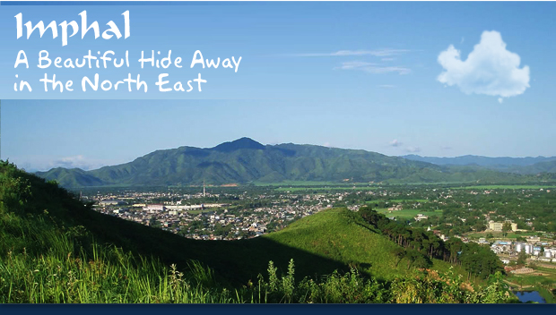
| Imphal is the capital of the state of Manipur and is located in the North East of India. The city is located at an elevation of 786 meters and has a humid sub tropical climate. Imphal is known for its natural beauty and unique culture.
|
|
| |
 |
|
|
|
|
| Tourist Attractions in Imphal |
|
| Known for its natural beauty and cultural heritage, there are many tourist attractions in Imphal. Here are a few of them : |
|
|
|
|
|
| Hotels and Accommodation |
|
 |
|
| There are many hotels and guest houses in Imphal that visitors can choose from. The choice ranges from budget hotels to guest houses to budget to top end hotels. These hotels provide a comfortable stay and warm hospitality. |
|
| |
|
|
|
|
|
|
| How to Reach Imphal |
|
| Here is how you can reach Imphal: |
|
 |
|
| Rail |
| The nearest railway station to Imphal is at Jiribam, but there are no convenient road transport options to the city from there. The other best options to get to Imphal are through Guwahati, Silchar or Dimapur. These cities are well connected by regular train services. |
|
|
 |
|
| Road |
| Imphal is well connected by road is connected NH 39 and 53 to cities like Silchar, Guwahati, Aizwal, Itanagar and Shillong among others. There are regular state run buses which operate on frequent intervals. |
|
|
 |
|
| Air |
| The Imphal airport is located at a distance of 8km south of Imphal and is connected by regular flights to the rest of the country. |
|
|
|
|
|
|
 |
|
|
|
|
|
|
|
|
A Business venture of Mapping Digiworld Pvt Ltd (An ISO 9001:2000 Certified Company)
C-62, Community Centre, Janakpuri, New Delhi - 58 (India) |
|
|
|
|
|