


It is densely covered with 30% forest reserve with a population of tigers in reserves such as Kanha, Bandhavgarh, and Pench as the main wildlife attraction places. It is further beautified by rivers such as Narmada and Chambal which fertilize the low plains suitable in growing wheat, soy, and pulses.
History and Culture
The history of Madhya Pradesh is epic tapestry woven from ancient whispers, the medieval splendor and the contemporary strengths. It starts in the rock shelters of Bhimbetka, 30,000-year-old cave paintings which represent the life of a hunter-gatherer; dancers, animals and day hunting are painted in rich red ochre. These UNESCO relics contain the earliest impressions of humanity in the area, a thousand years before the existence of civilizations.
Ancient times left enduring marks on the Mauryan Empire under the reign of Ashoka. The Sanchi Stupa which is a gigantic dome topped with very well carved gateways is a Buddhist beacon of the 3rd century BCE. Its toranas -gateways abound with images of the life of Buddha: elephants trumpeting Jataka stories, devotees bringing lotuses. Close at hand, Udayagiri Caves feature pre-modern Hindu sculptures, Jain sages in comfortable contemplation that suggested even back then a spiritual pluralism.
The medieval world began with the popularity of the local dynasties. The tall fortress of Gwalior occupied by the Gurjara-Pratihars was an immense citadel of sandstones gripping nearly the entire Tigmala Hill. It is surrounded by its walls that guard Man Mandir Palace and there are acoustic chambers to this day echoing with Rajput bravery, and here are Saas-Bahu temples with eternal dancers carved in stone. Farther to the South, under Chandelas ruling between 950-1150 CE, Khajuraho was the symphony of spires to the sky sculpted by Chandelas. Nagara-type shikharas have an upward twist and the walls boast of erotic sculptures: couples embracing in 64 arts, ranging in activities such as lovemaking to archery. It is not just titillation and it is a representation of joys in life under the tantric philosophy attracting both pilgrims and scholars.
The Bundela Rajputs of Orchha gave a light touch of poetry. It was established in 1501 by Raja Rudra Pratap, but the Jahangir Mahal of Bir Singh Deo, their 21 story wonder in the fusion of Islamic and Hindu arches, is the one that draws the attention. Stepped pyramids of kings that line the River Betwa, with their domes silhouetted on monsoon sunsets. The strength of Bundelkhandi was revealed in the Mughal skirmish, when the forts had been used for safety.
The state first appeared to be integrated after the coalescence of Central Provinces in 1956 and the states of the princes were absorbed into the democratic fold.
Culture runs with festivals which hold communities. Diwali fills the towns with diyas, Lakshmi Puja and fireworks following the night: houses light up, streets full of sweets such as ladoos. Holi bursts into colored powders; Holika Dahan pyre symbolizes the good conquering the evil and then wild gulaal throwing in the streets with dhol drums. The nine days of Navratri are in praise of Durga: Garba rings its circles in mirror-worked lehengas, as Raas dances and claps fill mandaps in the moonlight. Eid also introduces iftar feasts sewaiyan and biryani which are common to all faiths. Tansen Samaroh in Gwalior which recreates the dhrupads of the maestro whose voice sings in the Akashvani amphitheaters.
The gond and Bhil embroiderers produce both cowrie-patterned jewels and the bamboo flutes. Cuisine includes poha-jalebi, snacks such as bhutte ka kis, and roasted bafla soaked in ghee.
Economy
Government Sector
Public administration provides stability, employing lakhs in state civil services, police, and education. Revenue from mining leases and farm subsidies keeps the economy turning.
Public Sector
The Sasan Ultra Mega Power Plant by NTPC powers the grid, UltraTech and Prism cement plants grind Satpura limestone and SAIL’s steel in Bhilai (linked region) to enable auto ancillaries. Oil India drilling Morena, offers simple blue-collar employment, as well as infrastructure support.
Services Sector
Services, which constituted 50 percent or more of GSDP, was headed by the wholesale/retail commerce in fluttering mandis, such as Sarafa in Indore. To the NH-44/46 corridors and the Raja Bhoj Airport of Bhopal, transport is thriving and academics are employed in education hubs of IIM/IIT. Smart cities have real estate booms, Kanha safaris success, and fintech grows in Bhopal start-up ecosystem.
Key employment includes agriculture for 65% rural folk, factories for semi-skilled youth, services for graduates. Dependence on monsoons pushes the diversification towards food processing (maida mills), and handicrafts (bell metal in Bastar).
Tourism
The Khajuraho Temples create erotic poetry in stone, the erotic nagaras spires twisting skyward, the walls teeming with 85+ sculptures of lovers in 64 arts, kama sutra poses to musicians in mid raga. Dawn light dances on Lakshmana Temple's Vishnu shrine, drawing romantics and architects to this UNESCO icon.
The 3rd century BCE Sanchi Stupa, dedicated to Buddhism by Emperor Ashoka, is a huge hemispherical dome and four toranas or gateways. Hike up to panoramic views; within one mile distance Udayagiri Caves feature some Jain tirthankaras carved into volcanic rock.
The Bhimbetka Rock Shelters put out the pre-historic--30000 years old paintings of bison hunts, dancing tribes, and pregnant women. Explore 700+ stops of stones-laden vine-lined canyons, a place of worship and marvels of UNESCO.
Wild life sings at Kanha National Park, home to Jungle book by Rudyard Kipling. Bandhavgarh Tiger Reserve is the densest with 33+ tigers in 448 sq km of area. 32 caves intermingle with Tala Zone establishing core safaris, with cubs tumbling trailside.
Pench N.P. echoes once more of Kipling and his teak jungles concealing leopards, gaur, Pench River mirrors pink skies. Spot otters fishing, vultures wheeling.
Gwalior Fort grips a cliff of 35 stories--the 15th century palace of Man Singh echoes with ragas in interior dark chambers; Saas-Bahu temples are shiny with their cosmic friezes. The tomb of Tansen is playing with music festivals nearby.
Pachmarhi is the only hill station of Satpura that covers Dhoopgarh mountain, fairy pools and pre-historic paintings. Tribal huts are shaped as beehives on slopes.
Demographics
The population is approximately about 90 million according to the latest estimations, and it is the fifth most populated state in India with the population density of 303 people per sq km. The literacy rates stand at 69.32 percent as of the census in 2011 in which males are at 78.73 percent, and females at 59.24. Cities such as Indore and Bhopal are above 80% fuelled by IIT and IIM programs, whereas tribal belts are between 50% and 60% from access barriers. The recent impetuses have pushed the total figures in the direction of 75% estimates in 2026.The most popular as the native language is Hindi, which is spoken by more than 86 percent. There are regional tastes - Bundeli in the north hills, Bagheli in the east, Malvi over Malwa plateau and Nimadi towards Gujarat. The tribal communities bring another taste by the use of Gondi (Gonds), Bhili (Bhil tribes), Korku and Halbi usually intertwined with Hindi in day to day conversations. The old city of Bhopal speaks Urdu, Marathi and Sindhi exist as a result of migrations. English was spoken in the professional areas.
Scheduled Tribes make up 21% of total population (second highest after northeastern states) mainly Bhils, Gonds, and Kols. SCs contribute to another 16% with Bundelkhand being the centre. Our youth bulge (more than 30% below 15) offers a demographic dividend, but the migration to Maharashtra and Gujarat to work puts a strain on the villages. Development of urbanization is 28% with Bhopal and Indore having crossed a figure of 2 and 3 million respectively. The essence of this mosaic is a state between the custom and a transformation.
Administration
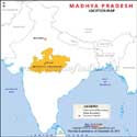
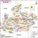
The state of Madhya Pradesh is a well run machine with 55 districts comprising 10 divisions, which include: Bhopal, Chambal, Gwalior, Indore, Jabalpur, Narmadapuram, Rewa, Sagar, Shahdol and Ujjain divisions to carry out effective management. The Chief Secretary in Bhopal coordinates with the Divisional Commissioners, and the day-to-day activities are run by District Collectors (IAS officers): revenue, law-order and schemes, such as PM Awas Yojana.There are also approximately 428 tehsils which are revenue centers where Naib Tehsildars resolve land disputes, collect taxes and provide caste certificates. Every tehsil has 100-150 villages under its control, and patwaris (village accountants) go around on bikes to update crop records in the wheat fields. This is replicated in blocks (panchayat samitis) at 313, which promotes rural development- MNREGA works, anganwadi nutrition, and solar pumps.
| Madhya Pradesh State Information | |
|---|---|
| Capital | Bhopal |
| Date of formation | 01/11/56 |
| Governor | Mangubhai C. Patel |
| Chief Minister | Mohan Yadav |
| Tourist attractions | Sanchi Stupa, Gwalior Fort, Orchha Fort, Khajuraho, Ujjain |
| Festivals | Gana-Gour, Ganga, Dashami, Hareli |
| Major dance and music forms | Gaur Dance, Muria Dance, Relo Songs |
| Arts and crafts | Wall paintings or bhitti chitras; Chippa bagh or hand-block printers; battubai dolls. |
| Languages | Hindi |
| Size | 308,252 km2 (119,017 sq mi) |
| Population (Census 2011) | 72626809 |
| Rivers | Narmada, Tapti, Betwa, Son, Chambal |
| Forests and wildlife sanctuaries | Bandhavgarh NP, Kanha NP, Pench NP, Indrawati Tiger Reserve, and others |
| State animal | Swamp Deer |
| State bird | Paradise flycatcher |
| Major crops | Rice, wheat soybeans, spices |
| Factoids | One half of Bhawani Mandi station on the Mumbai- Delhi railway line lies in Madhya Pradesh and the other half lies in Rajasthan. |
| Pench and Kanha forests in the Satpura ranges, and Bandhavgarh in the Vindhyas, are all tiger reserves. | |
| No. of District | 55 |
Blogs about Madhya Pradesh
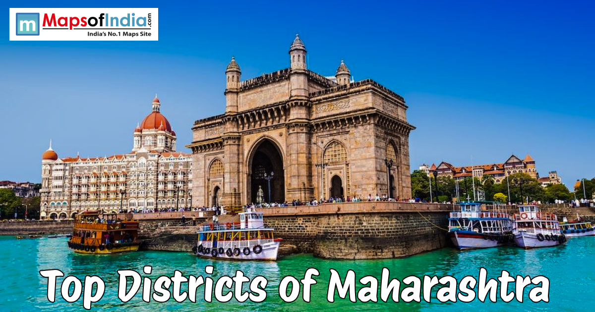
Top Districts of Madhya Pradesh : Madhya Pradesh is not just another dot on the map but the heart that beats at the centre of India's story. Where old stone temples with their towering spires are near silent lakes, and dusty roads are under the watchful eyes of palaces. Instead of fitting into the background, certain places draw attention simply by their presence. Gwalior, almost like a museum of majestic kings' past, is still a testament to the rulers of vast…

Inside Indore’s Sarafa Bazaar: India’s Night Food Paradise : When daylight fades, Sarafa Bazaar stirs. As the sun dips, jewel stores shutter their fronts. Flickering bulbs spark to life. Metal trays clang nearby. Grease hums in hot pans. A flood of faces moves through. This is Indore’s legendary evening eat-street waking up. Daytime gold gives way to nighttime feasts under naked lightbulbs. Midnight finds two hundred vendors packed tight along the slim street. Smells twist together sugar, heat, tang, and richness, all jumbled in…

India to celebrate Diwali without ‘Made in China’ stigma? : On 8th October, 2016, a village court at Obra panchayat in Aurangabad, Bihar banned all Chinese goods from being bought or sold in the region in the wake of China's support of Pakistan on the recent Uri attack. The gram kachahri has also branded China an enemy for its stance on Pakistan (and Kashmir) and passed a consensus-based provision that will see people punished in case they are found violating this order. Read: Impact of…

Positive News During Lockdown: UP CM Interacts with US Investors, Stranded Workers Ready to Move and Many More : The number of COVID-19 cases in India has touched 35,043 (as per the health ministry’s report as on May 1, 2020). Despite the rise of novel coronavirus patients across the country, the recovery rate has also increased. The Centre on Thursday claimed India’s recovery rate of COVID-19 mounted from 13.06 per cent a fortnight ago to 25.19 per cent. Here are some of the positive news that has come around during this lockdown due to…

What is the National Security Act? Which States are Using it to Protect Health Workers? : The National Security Act (NSA) was the brainchild of the former Prime Minister of the country Indira Gandhi in 1980. Under this act, the government has the power to detain anyone if the authorities believe that the detainees are a threat to national security. The NSA also has the power to prevent anyone from damaging public order. According to a journal published by The Anatomy of an Institutionalized Emergency: Preventive Detention and Personal Liberty in…
Maps in Other Regional Languages
FAQs
Q1: How many villages are here?
54,903 villages.
Q2: What is the population of the state?
Approximately 89 million.
Q3: What is this state famous for?
UNESCO sites (Khajuraho, Sanchi, Bhimbetka), wildlife sanctuaries, and tribal culture.
Last Updated on: June 29, 2026
Travel to Madhya Pradesh
Places to visit in Madhya-pradesh