Location Map of Army Personnel Killed in Militant Attack in Manipur


Location map of army personnel killed in militant attack, Manipur

Location map of army personnel killed in militant attack, Manipur

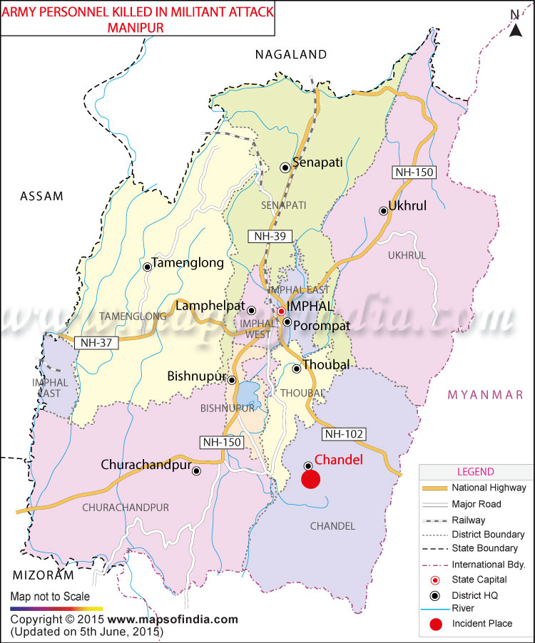
Around 20 Army Personnel Killed in Militant Attack in Manipur


At least 20 soldiers were killed and 11 other injured when militants ambushed army’s convoy in Chandel district in Manipur on Thursday. As per media reports, the ambush happened when the convoy reached between the villages of Charong and Paralong around 8.30 a.m. According to reports, around 50 militants attacked the convoy and used Rocket Proplled Grenade and other firearms. As per sources, the Home Minister has ordered to take a strongest action against those involved in the attacks. Reportedly, these attacks on army are seen as the worst since past decade.

WBST050615


Which States Share Boundary with China?India, in total, shares land borders with 6 sovereign countries. China is one of those. Below are the Indian states which share borders with the country. 1. Jammu and Kashmir This northern state of India is mostly located in the Himalayan mountains. It shares a… Read More...
Which States Share Boundaries with Pakistan? There are four states that share a border with Pakistan, namely, Jammu and Kashmir, Punjab, Rajasthan, and Gujarat. The India Pakistan Border is quite intriguing. Since India has installed 1,50,000 flood lights on… Read More...
Which Places in India Still Largely Speak Sanskrit?Sanskrit is considered as Dev Bhasha, the language of Gods. It has a history of around 3500 years. It used to be a primary language of ancient India. Its earliest form Vedic Sanskrit, was prevalent from 1500 500 BCE. However, it is fading… Read More...


EU GDPR Update:
MapsofIndia has updated its Terms and Privacy Policy to give Users more transparency into the data this Website collects, how it is processed and the controls Users have on their personal data. Users are requested to review the revised Privacy Policy before using the website services, as any further use of the website will be considered as User's consent to MapsofIndia Privacy Policy and Terms.

We follow editorialcalls.org for border and boundary demarcations