


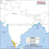
Kerala Location Map

Kerala Map

Kerala Travel Map
Kerala is a state tucked away in the southwest corner of India. The state is often referred as "God's Own Country". Kerala has a total area of 38,863 sq km and has a population of 33,406,061 inhabitants.
The state is bordered by the states of Karnataka and Tamil Nadu along with the Laccadive Sea. Thiruvananthapuram (also known as Trivandrum) is the capital of Kerala, which is famous for the Kovalam beach, one of the top beaches in the world. The state of Kerala is divided into fourteen districts. Each of them has a distinct character.
Kerala has a history dating back to the Christian era, although the modern Kerala was created on 1st November 1956 when all the states were reorganized along linguistic lines. Kerala is different from the rest of the India in many ways. History was created in 1957 when Kerala became the first state in the world to democratically elect a Marxist government. The state has a strong presence of left ideology. It has the highest literacy rate in the country, lowest infant mortality rate and the highest female to male population ratio. These facts speak volume of the state which is often compared to the society of the developed western countries.
| Facts on Kerala | |
|---|---|
| Official Website | www.kerala.gov.in |
| Date of Formation | Nov 1, 1956 |
| Area | 38,863 sq km |
| Density | 859/Km2 |
| Population (2011) | 33,406,061 |
| Males Population (2011) | 16,027,412 |
| Females Population (2011) | 17,378,649 |
| No. of District | 14 |
| Chief Minister | Pinarayi Vijayan |
| Governor | P Sathasivam |
| Capital | Thiruvananthapuram |
| Rivers | Periyar, Bharathapuzha, Pamba, Chalakudy, Kallada |
| Forests & National Park | Periyar National Park, Wayanad Wildlife Sanctuary, Silent Valley National Park |
| Languages | Malayalam, English |
| Neighbours State | Tamil Nadu, Karnataka, Lakshadweep |
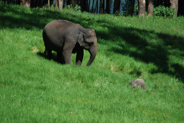
| State Animal | Elephant |
| State Bird | Great Hornbill |
| State Tree | Coconut |
| State Flower | (Kanikonna) Golden Shower Tree Flower |
| Net State Domestic Product (2011) | 71434 |
| Literacy Rate (2011) | 94.00% |
| Females per 1000 males | 1084 |
| Assembly constituency | 140 |
| Parliamentary constituency | 20 |
History of Kerala
The modern day culture of Kerala is due to the influence of several cultures and dynasties that came from different corners of the world and settled down in the state. The Muslims of Kerala are the descendents of the Arab traders who came to Kerala and married locally and finally settled down here. The Arabs, who landed here after the Jewish men, brought the first wave of Muslims settlers. They were the first peoples to build the first Mosque in this sub-continent at Kodungallur. They concentrated in the Malabar area and up to the 18th century they were mostly agricultural laborers, petty traders and soldiers in the Zamorin army. Read More ...
Geography and Climate
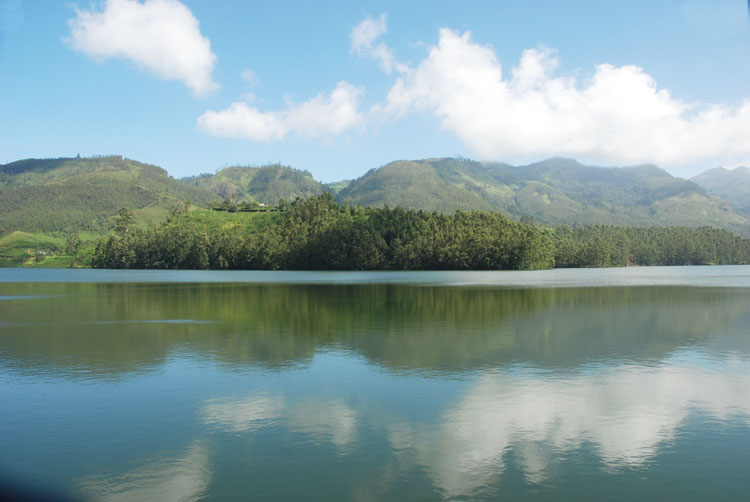
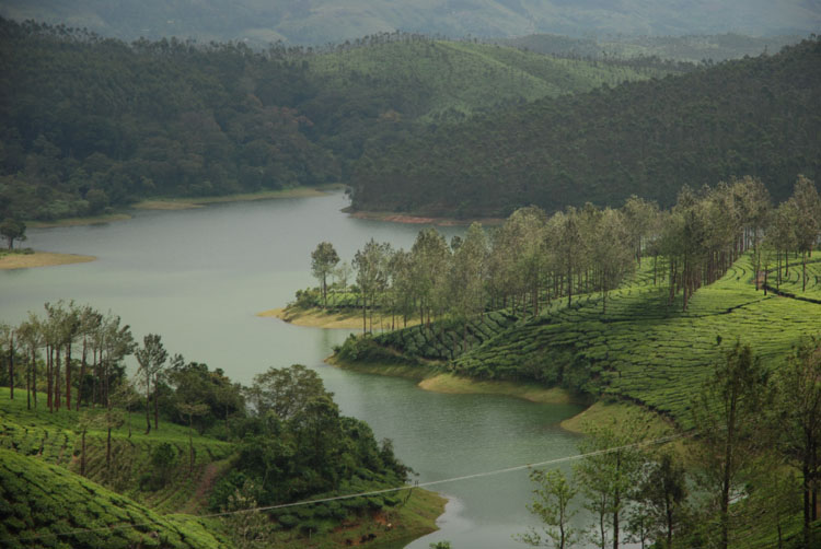
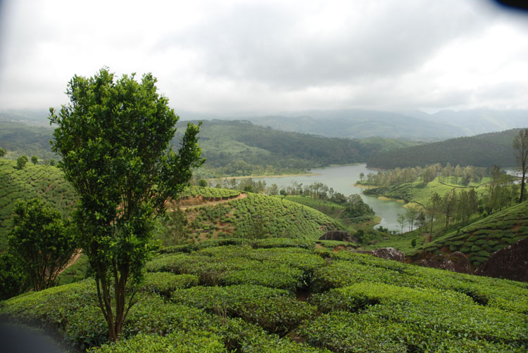
Kerala is lodged between the Western Ghats and the Lakshadweep Sea. The state has a total coastline of 590 km. The state can be divided into three distinct regions; they are the eastern highlands, the central midlands and the western lowlands. The eastern region of the state comprises of high mountains, gorges and valleys which are immediately west of the Western Ghats' rain shadow area. Forty one west flowing rivers and three east flowing rivers originate from this region. The Western Ghats have an average height of 4920 ft (1,500 m) above sea level, with highest peaks that reach around 8200 ft (2,500 m). The coastal belt is comparatively flat and is crisscrossed by an interconnected network of canals, estuaries, lakes and rivers which are collectively known as the Kerala Backwaters. Read More ...
Districts of Kerala
Kerala is divided into 14 districts. which are Alappuzha, Ernakulam, Idukki, Kannur, Kasaragod, Kollam, Kottayam, Kozhikode, Malappuram, Palakkad, Pathanamthitta, Thiruvananthapuram, Thrissur and Wayanad. The districts are further subdivided into 75 taluks, which are further divided into 1453 revenue villages. Local self-government constitutes 14 District Panchayats, 152 Block Panchayats, 978 Gram Panchayats along with 60 Municipalities, 5 Corporations and 1 Township.Read More ...
Economy
| Click to View large Map |
 |
| Kerala Industrial Map |
Agriculture contributes most to the state's income in the primary sector. Nearly half of the population of the state is dependent on agriculture for income. Rice is the most important cereal crop and staple food in Kerala. Other key crops are coconut, tea, coffee, rubber, cashews, pepper, vanilla, cardamom, cinnamon and nutmeg. Major sources of exports are and traditional like coir and cashew as well as marine products and manpower. In spices, pepper is the single most important product, with Kerala being the largest producer and exporter of black pepper. Cardamom and ginger are also exported. Fishing is another major industry in the state.Read More ...
Infrastructure
Kerala is well connected to the rest of the country by air road and rail. Kerala has a very well established infrastructure with a total network of motorable roads of about 145,704 km. The total length of its National Highways is around 1524 km. Most of Kerala is accessible through National Highways 47 and 17, and various other state highways. The Southern Railway line of the Indian Railways runs through the state connecting major cities and towns except for those in the districts of Idukki and Wayanad. The railway network in the state is controlled by the Thiruvananthapuram Railway division and the Palakkad Railway Division.
Society and Culture
Kerala is India's most advanced society in terms of education, literacy and health. In fact, Kerala has the highest physical Quality of Life Index too. The age old wanderlust of the people of Kerala has taken them to virtually every nation on the face of this earth. The culture of Malayalis has a flavor of its own, though it is a part of the Indian and Dravidian culture. This has been the product of the peculiar geographical feature of Kerala. Bounded on the east by the Western Ghats and the west by the Arabian Sea, it had long periods of insular existence. This has resulted in the distinctiveness of their language, dress, culture and institutions.Read More ...
Art and Festivals in Kerala
Kathakali is the most refined, most scientific and elaborately defined dance form of Kerala. It is a very exciting art form demanding not only complete control of practically every fiber of the artiste body, but also intense sensitivity of emotion. It had its origin in the courts of the Kings of Kerala. It is considered to be a synthetic art form combining in itself the rudiments of its earlier forms like Krishnanattam and Ramanattam with a highly scientific dance drama form. It is not folk, but highly classical.
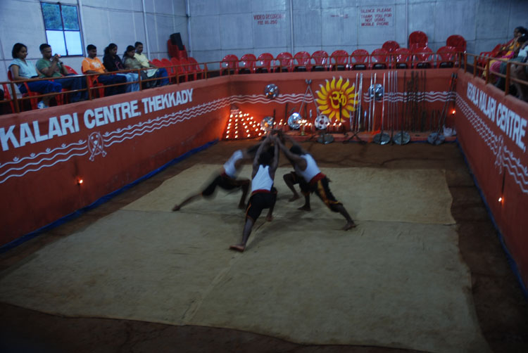
Kalaripayattu is the traditional 11th century martial art form of Kerala. It is said to be the forerunner of oriental martial arts like kung-fu and karate. It follows a system as specialized and as intricate as the Ju-jitsu of the Japanese.Read More ...
Food
Kerala offers a plethora of dishes which has Malabari, French and Arabian touch. It is a combination of both vegetarian and non-vegetarian food. The most common ingredient in all of Kerala's food is coconut. And to enhance the flavours several other spices used are chillies, curry leaves, mustard seeds, turmeric, tamarind, clove, cardamom, black pepper, cinnamon, asafoetids, ginger. Some of the popular Keralian food are Idiyappam, Puttu and Kadala Curry, Erissery, Appam with Ishtu, Ela Sadya, Dosa, Idli Sambar, Kerala style prawn curry, Karimeen Pollichathu to name a few.
Language
Kerala is one first Indian state with a 100 per cent literacy rate. Both Malayalam and English are widely taught Language in the state. Malayalam is, however, the regional and official Language of the state whereas Malayalam is also one of the official Language of India. It is essentially a Dravidian Language but historical events have influenced the growth and vocabulary of Malayalam.Read More ...
Demographics
Kerala has a population of 33,406,061 with a population density of 860 persons per sq km. The population growth rate of the state is 4.91%. The sex ratio of Kerala is the most impressive at 1084 females per 1000 males. The State's indigenous tribal people constitute of 1.10% of the population. As per last census which was taken in 2001, around 56.2% of Kerala's inhabitants are Hindus, next are Muslims with 24.7%, followed by Christians at 19% and the remaining religions are at 1.1%. The Literacy rate as per the 2011 census is 94.00 %.
Education
The importance of education in the state of Kerala is clearly underscored by its ranking amongst the most literate state in the country. The Catholic missionaries are responsible for bringing the modern school education system in the state. Many institutes and organizations led to the development of mass education in Kerala. In 1991, Kerala was the first Indian state to be renowned as a completely literate state, although literacy rate during that time was 90% only. Kerala has primary schools, middle schools and higher secondary school. Majority of schools are affiliated with the Kerala State Education Board with familiar boards like ICSE, CBSE and NIOS. The language of instruction is English. There are many universities in Kerala some of the famous ones are University of Calicut, University of Kerala, Kerala Agricultural University, Cochin University of Science and Technology, amongst others. Other premiere educational institutions are Indian Institute of Management Kozhikode, Indian Institute of Science Education and Research Thiruvananthapuram, National Institute of Technology Calicut (NITC) and the Indian Institute of Space Science and Technology (IIST).Read More ...
Government and Politics
Kerala has two major political coalitions, the United Democratic Front (UDF) which is led by the Indian National Congress (INC) and the Left Democratic Front (LDF) which is led by the Communist Party of India (Marxist) (CPIM). Kerala has 140 assembly constituencies; it elects 20 members in the Lok Sabha and 9 members in the Rajya Sabha. The judiciary comprise of the Kerala High Court with a system of lower courts. The High Court is located at Kochi and the Kerala Legislative Assembly building along with the Kerala Secretariat building is located in Thiruvananthapuram. The local governing bodies consist of Panchayats, Municipalities and Corporations.Read More ...
Tourism of Kerala
| Click to View large Map |
 | Kerala Travel Map |
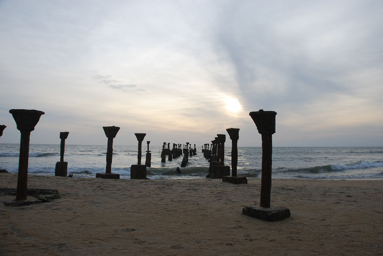
- Thiruvananthapuram, the capital city is an abode of temples, mosques and churches. Kovalam beach resort, Veli, Neyyar Dam and Ponmudi are some of the places of prime interest.
- Periyar wildlife Sanctuary at Thekkadi in Idukki district is another attraction.
- Sabarimala, abode of lord Ayyappan is a famous pilgrim center in Pathanamthitta District.
- Kochi, the major port of Kerala, is known as the queen of the Arabian Sea.
- The beautiful Willingdon Island with the adjoining port is a great attraction.
- Kalady is the birthplace of Shri Sankaracharya.
- Guruvayur has the famous Lord Krishna Shrine.
- Kalamandalam is the renowned Kathakali centre is in Thrissur District.Read More ...
WBST190914GP
Last Updated on : June 11, 2026
Travel to Kerala