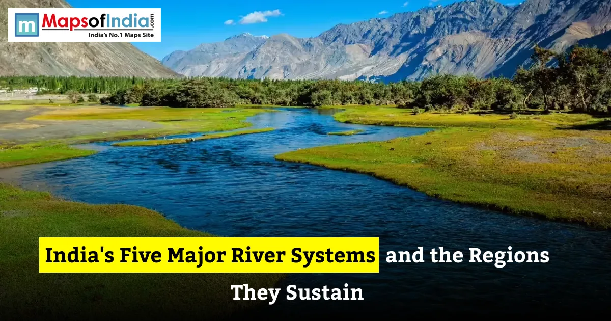
India’s river systems – the Indus, the Ganga, the Brahmaputra, the Godavari and the Krishna – provide water for farming, drinking, electricity generation, natural habitats and support millions of people. The Indus, the Ganga and the Brahmaputra belong to the Himalayan river systems, whereas the Godavari and the Krishna belong to the peninsular rivers. Together, India’s major river systems create plains, small towns, factories, wetlands and some of the country’s most cherished cultural sites. The basins of India’s river systems spread over many states, and some even cross national borders, which makes water management a shared geographical and administrative challenge. India has other important rivers, but these five river systems give a clear picture of the country’s diverse drainage patterns and regional growth. This guide tells the story of the origins, paths, tributaries, the regions that rely on each river system, and the main problems that threaten their future.
What Are India’s Major River Systems?
A river system is a river together with its tributaries, smaller streams and connected channels. A river basin is the stretch of land from which rain and other water flow into a river system. The basins of India’s river systems differ in size, weather, land type and water supply. The Central Water. ISRO’s River Basin Atlas lists many more basins than the five river systems discussed here.
India’s rivers are usually divided into two groups:
- Himalayan rivers – These rivers generally flow throughout the year and receive water from rainfall, snowmelt, and glacier melt. Their water levels vary with the seasons, and they often carry substantial amounts of sediment, particularly during the monsoon.
- Peninsular rivers – These rivers mainly flow across the Peninsular Plateau and depend largely on monsoon rainfall. Their water levels can fall considerably during the dry months, although some maintain flows through groundwater contributions and regulated releases from dams and reservoirs.
The difference is useful, but not strict. Himalayan rivers also react strongly to monsoon rain, and peninsular rivers can keep water flowing outside the season when groundwater, reservoirs, or other sources supply them.
The five river systems chosen for this guide are the Indus, the Ganga, the Brahmaputra, the Godavari and the Krishna. Some other lists might also include the Mahanadi, the Narmada and the Kaveri depending on whether the focus is on river length, basin size, water supply or local importance.
Quick Overview of the Five River Systems
- Indus River System – starts in the Tibetan Plateau, goes through Ladakh, enters Pakistan, and finally reaches the Arabian Sea. Its many tributaries collect water from the Himalayas and the Punjab area.
- Ganga River System – begins as the Bhagirathi River in Uttarakhand, turns into the Ganga at Devprayag, and travels across the northern plains to the Bay of Bengal. This river system supports one of India’s crowded farming areas.
- Brahmaputra River System – called the Yarlung Tsangpo in Tibet and the Siang or Dihang in Arunachal Pradesh, it moves through Assam and Bangladesh and ends at the Bay of Bengal.
- Godavari River System – rises near Trimbak in Maharashtra, travels east across the Deccan land to the Bay of Bengal, and nourishes central and southeastern India.
- Krishna River System – starts near Mahabaleshwar in the Western Ghats, crosses Maharashtra, Karnataka, Telangana and Andhra Pradesh and finally reaches the Bay of Bengal.
The Indus River System
Origin and Course
The Indus River starts in the Tibetan Plateau close to the Kailash range. It moves through the Himalayas, comes into India at Ladakh, and then goes into Pakistan before it reaches the Arabian Sea. Major tributaries of the Indus River are the Jhelum, the Chenab, the Ravi, the Beas, and the Sutlej. These rivers together make a linked drainage network across part of the Indian subcontinent.
The Indus River is vital for irrigation and water control in a region where rain's uneven and water supply changes a lot. Snow and glacier melt add to the river’s flow. Monsoon rain also affects the water level and seasonal variations.
Regions It Sustains in India
Within India, the Indus basin covers parts of Ladakh, Jammu and Kashmir, Himachal Pradesh, Punjab, Haryana and Rajasthan. The river and its canal system help farming, villages, and many other activities that need water.
Punjab and parts of Haryana and Rajasthan depend on irrigation networks that spread water from the rivers and reservoirs. In the area, river valleys also support local people, natural habitats, and hydropower projects.
The Indus Waters Treaty
The Indus River System is shared by India and Pakistan, which makes it important for water matters. The Indus Waters Treaty was signed in 1960. Set up rules for how the rivers’ waters are used.
Current status: As of October 2026, the Indian government still calls the treaty on hold. This is a sensitive and changing situation, so it should be reported with proper attribution instead of as an unquestioned fact.
The future management of the Ganga River System involves water availability, infrastructure, agricultural needs, and the relations between the two countries.
The Ganga River System
Origin and Major Tributaries
The Ganga River System starts as the Bhagirathi River at Gaumukh, close to the Gangotri Glacier in Uttarakhand. At Devprayag, the Bhagirathi River meets the Alaknanda River. From that point on, the river is called the Ganga River System. The Ganga River System flows through the plains, then moves into the delta region and finally reaches the Bay of Bengal.
Major tributaries of the Ganga River System include the Yamuna River, the Ghaghara River, the Gandak River, the Kosi River, and the Son River. These rivers gather water from parts of the Himalayas, the plains, and the central Indian uplands. Together they create a complex drainage network.
The Indo-Gangetic Plain and Its Farmland
The Ganga River System basin supports agriculture across northern and eastern India. The alluvial soils, the gentle terrain and the irrigation networks fed by the Ganga River System make the region suitable for crops such as rice, wheat, sugarcane and pulses.
The basin of the Ganga River System extends across Uttarakhand, Uttar Pradesh, Madhya Pradesh, Rajasthan, Haryana, Himachal Pradesh, Chhattisgarh, Jharkhand, Bihar, West Bengal and the National Capital Territory of Delhi according to the Central Water Commission’s 2024 assessment. The main course of the Ganga River System does not run through every one of these states; some states contain parts of the larger basin.
The Ganga River System basin is India’s river basin by area. According to the Central Water Commission’s 2024 assessment, the Ganga River System basin covers 838,803 square kilometres within India, which represents nearly 26% of the country’s geographical area.
Cities, Culture and Population
The Ganga River System is closely linked to the religious and economic life of India. Important cities such as Haridwar, Varanasi, Prayagraj, Patna and Kolkata are associated with the Ganga River System and its wider drainage network.
Pilgrimage, festivals, bathing rituals, tourism, fishing and riverbank commerce all contribute to the economic life around the Ganga River System. At the same time, the concentration of people and industry puts pressure on water quality. Sewage, industrial discharges, solid waste, and changes to river flow make pollution control and responsible river management essential.
The Brahmaputra River System
Course from Tibet to the Bay of Bengal
The Brahmaputra River System begins in Tibet, where the river is called the Yarlung Tsangpo. It flows eastward across Tibet, then makes a major bend around the Himalayas. When the river enters Arunachal Pradesh, it is called the Siang or Dihang. After joining tributaries, it flows through Assam as the Brahmaputra River System and continues into Bangladesh, where it is called the Jamuna. The waters of the Brahmaputra River System eventually join the Ganga–Padma system before reaching the Bay of Bengal.
Important tributaries of the Brahmaputra River System include the Subansiri River, the Dibang River, the Lohit River, and the Manas River, along with other rivers that flow down from the surrounding hills and mountains.
Regions It Sustains
The Brahmaputra River System is central to life in Arunachal Pradesh and Assam. Its floodplain supports agriculture, fisheries, wetlands, transport links and settlements. Seasonal changes in water levels shape farming cycles and the livelihoods of communities living near the Brahmaputra River System.
The wider basin of the Brahmaputra River System also extends beyond India into Tibet, Bhutan and Bangladesh. This international reach makes cooperation on river data, flood forecasting and water management important.
Floods, Fertility and Biodiversity
The Brahmaputra River System carries volumes of water and sediment. During the monsoon, heavy rainfall across its catchment and tributary basins can cause the river to rise rapidly. Flooding becomes especially severe when the main Brahmaputra River System and several tributaries reach levels at the same time. The Assam government identifies monsoon rainfall and the interaction of tributary flood waves as major contributors to flooding.
Floods can damage homes, roads, farmland, and public infrastructure. Bank erosion can gradually remove land and displace communities. Seasonal flooding also deposits fertile sediment across floodplains and sustains wetlands and ecosystems.
Majuli, a river island in Assam, is associated with the Brahmaputra River System’s shifting channels and erosion processes. Kaziranga National Park, located in the Brahmaputra floodplain, also depends on the region’s floodplain ecology, although floods can create risks for wildlife and nearby communities.
The Godavari River System
Origin and Course
The Godavari River System rises near Trimbak, close to Nashik, in Maharashtra and flows eastward across the Deccan Plateau before reaching the Bay of Bengal. At 1,465 kilometres long, it is the largest peninsular river in India by length and basin area. Its major tributaries include the Pranhita River, the Indravati River, the Manjira River, the Sabari River and the Purna River.
The basin of the Godavari River System covers parts of Maharashtra, Telangana, Andhra Pradesh, Chhattisgarh, Odisha, Madhya Pradesh and Karnataka. The amount of basin area in each state differs; the main channel of the Godavari River System does not flow through every state within the basin.
Why It Is Called the Dakshin Ganga
Godavari is often called the Dakshin Ganga, meaning Ganga of the South. Godavari is large and important to peninsular India. The Godavari's name reflects the Godavari's drainage network and the Godavari's central role in supporting agriculture, settlements, and cultural traditions.
Godavari provides water for irrigation, domestic use, and industry. Dams, reservoirs, and canal networks help store and distribute water. They also require management to balance upstream and downstream needs.
Regions It Sustains
Godavari basin supports agricultural areas. This is especially true in Maharashtra, Telangana, and Andhra Pradesh. Irrigation helps cultivate crops such as rice, cotton, sugarcane, and pulses depending on soil and climate.
Godavari widens into a delta in Andhra Pradesh before flowing into the Bay of Bengal. This delta supports farming, fisheries and wetland habitats. However, water demand, pollution, changes in sediment flow, and competing requirements between states make sustainable basin management increasingly important.
The Krishna River System
Origin and Course
Krishna rises near Mahabaleshwar in the Western Ghats of Maharashtra. Krishna flows east for 1,400 kilometres before entering the Bay of Bengal downstream of Vijayawada. Krishna's principal tributaries include the Bhima, Tungabhadra, Ghataprabha, Malaprabha and Musi.
Krishna basin extends across Maharashtra, Karnataka, Telangana and Andhra Pradesh. Krishna water resources are strongly influenced by monsoon rainfall. Reservoirs and irrigation systems are important for managing variation.
Regions It Sustains
Krishna supports farming, towns and industries across the Deccan Plateau. Irrigation helps sustain crops such as rice, sugarcane, cotton and other important crops. Major reservoirs also support drinking-water supplies, hydropower and other uses.
Krishna is particularly important to districts in Maharashtra, northern Karnataka, Telangana and Andhra Pradesh. The balance between water availability and demand can be challenging during drought years when monsoon rainfall is below normal.
Irrigation, Dams and Inter-State Sharing
Dams and reservoirs across the Krishna basin regulate flows and supply water to irrigation networks, cities and industries. These projects can improve water security. Their operation must consider downstream requirements, environmental flows and seasonal rainfall.
Krishna Basin is shared by four states. Allocation of Krishna waters has been the subject of inter-state negotiations and tribunal proceedings. The issues involve how available water should be distributed, how projects are assessed, and how changing state needs should be addressed. A balanced explanation should describe the process without treating the claims of any one state as automatically correct.
Himalayan vs Peninsular Rivers: Key Differences
Peninsular rivers differ in their sources, seasonal behaviour, valley shapes and the landscapes they create. These differences affect how communities use their water and how they manage floods and droughts.
Water source and flow: Himalayan rivers such as the Indus, Ganga and Brahmaputra receive water from rainfall as well as snow and glacier melt. Himalayan rivers are generally perennial, meaning they continue to flow throughout the year, although their discharge varies seasonally. Peninsular rivers such as the Godavari and Krishna depend heavily on monsoon rainfall. River flows can decline considerably during dry periods, although reservoirs and groundwater can help sustain water supplies.
Valleys and terrain: Himalayan rivers often cut valleys and gorges in mountainous areas before reaching the plains. Peninsular rivers cross a plateau landscape with broad valleys in some stretches and rapids or rocky sections in others.
Deltas and estuaries: The Ganga–Brahmaputra system forms a delta with Bangladesh, while the Godavari and Krishna form important deltas on India’s eastern coast. Some major peninsular rivers, including the Narmada and Tapi, flow westward through rift valleys and form estuaries rather than large eastern-style deltas.
Navigation and sediment: Navigability depends on depth, flow, seasonal variation, sediment, channel stability, and infrastructure. Some stretches of peninsular rivers are used for inland navigation, but neither group is uniformly navigable along its entire course.
In short, Himalayan rivers are more consistently supplied by multiple water sources. Peninsular rivers tend to show seasonal changes linked to the monsoon.
How These River Systems Support Agriculture, Cities and Industry
Farming and Food Security
Rivers support agriculture by supplying water and replenishing reservoirs, canals, wetlands and groundwater. The Indo-Gangetic Plain is especially important for food production. Irrigation networks in Punjab, Haryana, Maharashtra, Telangana, Karnataka and Andhra Pradesh help sustain farming in areas where rainfall alone may be insufficient or unreliable.
River water is not unlimited. Agriculture often needs water during dry times, exactly when river flow can dip lower. Efficient irrigation, smart crop selection and better water management can ease pressure on river systems.
Drinking Water and Urban Growth
Cities and villages draw water from rivers, reservoirs and groundwater that belong to river basins. The Ganga supports urban centres in northern and eastern India while the Brahmaputra, Godavari and Krishna provide water to communities and urban regions within their own basins.
Growing populations, industry and urban expansion raise demand. Water treatment, sewage management and protection of catchment areas are crucial to keep rivers available for domestic needs.
Hydropower and Energy
River systems supply hydropower through dams and reservoirs in Himalayan regions where elevation differences create opportunities for electricity generation. Projects on peninsular rivers can also help regulate flows and store water, but their environmental and social impacts must be examined carefully.
Hydropower output relies on water availability and project design. Shifts in rainfall patterns, sedimentation and competing water needs can affect how a reservoir or power station functions.
Culture, Pilgrimage and Livelihoods
Rivers are central to traditions, festivals, pilgrimage, fishing and local economies. The Ganga is especially significant in Hindu traditions, while the Brahmaputra and Godavari also carry cultural and regional identities. River‑based livelihoods consist of fishing, farming, boat transport, tourism and trade.
Protecting rivers carries economic importance. Pollution, erosion, and the loss of wetlands can harm not only ecosystems but also the cultural practices and livelihoods of communities that rely on them.
Other Important River Systems Worth Knowing
The five systems discussed above are part of India’s drainage network. Four other important river systems are:
- Kaveri (Cauvery): Rises in the Western Ghats of Karnataka and flows through Karnataka and Tamil Nadu to the Bay of Bengal. It supports irrigation, cities, and delta agriculture. It is also the focus of long‑standing inter‑state water‑sharing arrangements.
- Mahanadi: Rises in Chhattisgarh and flows through Odisha to the Bay of Bengal. Its basin supports agriculture, reservoirs, and important delta ecosystems.
- Narmada: Rises in Madhya Pradesh and flows west through a rift valley to the Arabian Sea. It is vital for irrigation, drinking water, and hydropower.
- Tapi (Tapti): Rises in Madhya Pradesh and flows west through Maharashtra and Gujarat to the Arabian Sea. Its basin supports agriculture, urban areas and industrial activity.
These rivers illustrate why there is no universal list of "India’s five major rivers." The useful selection depends on whether the aim is to compare basin sizes, examine regional economies, study Himalayan and peninsular drainage, or understand water management.
Challenges Facing India’s River Systems
India’s rivers confront interconnected pressures. Their effects vary by basin. The main challenges are pollution, excessive water extraction, climate‑related changes, floods, sedimentation and disputes over shared resources.
Pollution: Untreated sewage, industrial wastewater, agricultural runoff and solid waste can lower water quality. Pollution impacts treatment, aquatic habitats, fisheries and public health. Effective sewage treatment, enforcement and regular monitoring are essential.
Over‑extraction of water: Irrigation, cities and industry increase demands on surface water and groundwater. When withdrawals surpass the amount that can be replenished, water availability drops, and ecosystems can suffer. India’s 2025 groundwater assessment continued to identify units where extraction was classified as over‑exploited, showing the importance of managing water demand.
Climate change and glacier retreat: Changing rainfall patterns, rising temperatures, and glacier retreat can alter river flows and the timing of water availability. The consequences vary between basins. These remain a focus of scientific research. Water planning must account for uncertainty rather than assume that historical flow patterns will stay the same.
Flooding and erosion: Intense monsoon rainfall, high river levels and sediment movement can cause floods and bank erosion. The Brahmaputra basin is especially exposed to monsoon flooding while other basins also experience floods during extreme rainfall events. Floodplain planning, early‑warning systems and resilient infrastructure can reduce harm.
Dams and sedimentation: Reservoirs can offer water storage, irrigation and electricity. They also modify river flows and trap sediment. Sedimentation reduces storage capacity over time, while changes in sediment supply can affect river channels, floodplains and deltas.
Inter-state and international disputes: Rivers cross state borders and national borders. Conflicts about how much water to give, how to run dams, and when to approve projects can make planning hard. Open sharing of data, clear legal steps, and teamwork between the regions that share a river are essential for keeping rivers in good shape.
Conclusion
India has five main river systems: the Indus, Ganga, Brahmaputra, Godavari and Krishna. These rivers support connected areas for farming, drinking water, power, wildlife, towns, and culture. Rivers that come from the Himalayas usually keep flowing all year, while the big rivers on the peninsula depend more on monsoon rains and water storage.
India’s rivers shape where farmers grow crops, where cities grow, and how many people can earn a living. Managing these rivers in a sustainable way is vital for keeping water and food safe for the long run. Keeping river water clean, using water efficiently, and working together across river basins will help keep these resources alive for future people.
FAQs
1. Which are the five river systems of India?
A common list of India’s five river systems is the Indus, Ganga, Brahmaputra, Godavari and Krishna. The first three are usually called rivers, while the Godavari and Krishna are big rivers on the peninsula. Some other lists add rivers such as the Mahanadi, Narmada, or Kaveri depending on what the list looks at.
2. Which is the river system in India?
The Ganga has the largest river basin in India. In 2024, the Central Water Commission said the basin covers 838,803 square kilometres inside India, almost 26% of the country’s land area. That basin supports a lot of farming, cities, factories, and many people.
3. What is the difference between peninsular rivers?
Himalayan rivers like the Indus, Ganga, and Brahmaputra get water from rain, melting snow, and glaciers, so they usually keep flowing all year long. Peninsular rivers such as the Godavari and Krishna rely more on monsoon rains. They often change a lot with the seasons.
4. Which river system supports the people in India?
The Ganga basin holds one of the groups of people in India because it covers wide farming plains and big cities. It provides water for farms, homes, and factories in states. The large number of people also brings problems like pollution, high water use, flood danger, and protecting river life.
5. Why is the Brahmaputra prone to flooding?
The Brahmaputra floods a lot because its basin gets monsoon rain, and many small rivers can rise fast at the same time. The river carries a lot of water and dirt across a floodplain. Erosion of the banks, villages, and shifting river paths can make floods worse.
6. Which Indian river systems are shared with countries?
The Indus system is shared by India and Pakistan. The Ganga and Brahmaputra systems reach into countries such as Nepal, China, Bhutan and Bangladesh in parts of their wider basins. Because of these international links, sharing water data, predicting floods, managing rivers, and working together diplomatically are very important for all the areas involved.