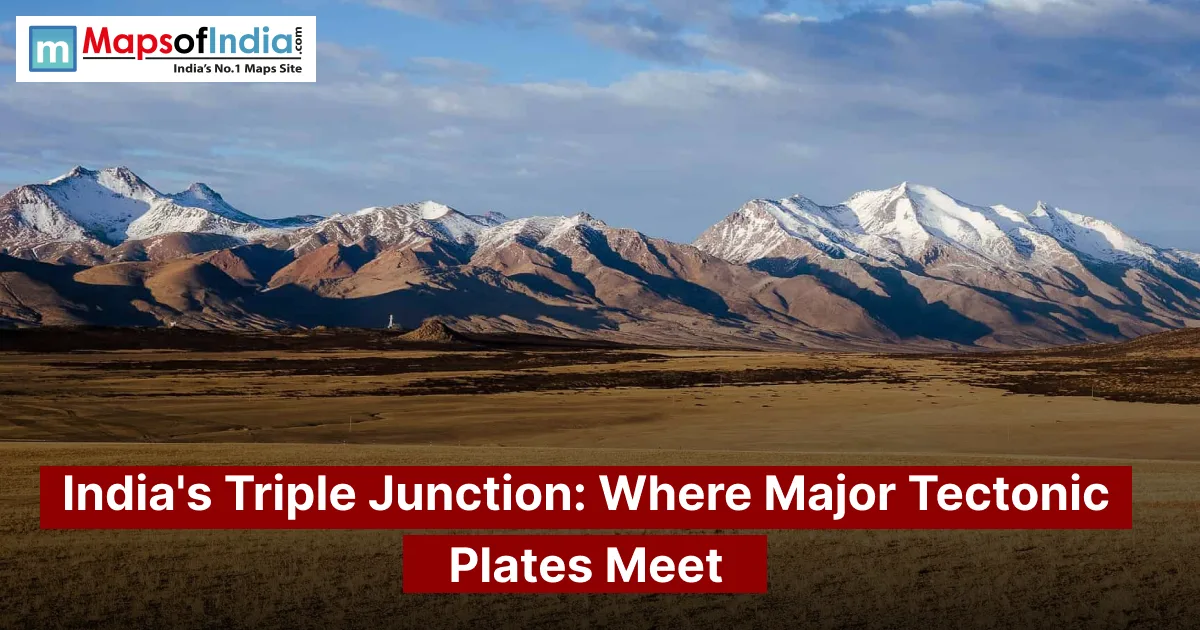
The idea of an "India junction" is often misunderstood. It does not refer to a point inside India where three plates meet. Instead, the Indian Plate interacts with other major tectonic plates across the Indian Ocean and Asia. These interactions help explain the formation of the Himalayas, the earthquakes in the Andaman region, and the broader tectonic setting of the Indian subcontinent.
The term "India junction" can be misleading. This article explains what a triple junction really is, where the main plate boundaries around India are located, why the Rodrigues and Aden-Owen-Carlsberg triple junctions matter, and how these tectonic forces influence mountain building and earthquake risk in the region.
What Is a Triple Junction in Plate Tectonics?
A triple junction is a location where three tectonic plate boundaries come together. The three boundaries can be divergent, convergent, or transform. This means that different types of movements—such as plates pulling apart, crashing into each other, or sliding past one another—can combine at a point. These junctions are key for understanding how Earth’s lithosphere forms, disappears, and rearranges over time.
The Three Types of Plate Boundaries
- Divergent boundaries: Two plates move away from each other, creating a new crust. This often happens along ocean ridges.
- Convergent boundaries: Two plates move toward each other. One plate may sink beneath the other (subduction) or two continental plates may collide.
- Transform boundaries: Two plates slide alongside each other along faults. These are often associated with earthquakes.
Triple junctions can mix these types. For example, the Rodrigues Triple Junction involves three spreading ridges and is classified as a ridge-ridge-ridge (RRR) type.
Why Triple Junctions Matter to Geologists
Triple junctions serve as laboratories for studying plate motion. Their geometry allows scientists to examine spreading rates, fault movement, earthquake patterns, and how plate-boundary systems change over time. They are not static either. Recent research on the Rodrigues Triple Junction has shown that ridges can shift and the shape of the junction can evolve due to changes in plate motion.
The Indian Plate: A Quick Overview
The Indian Plate underlies most of the subcontinent and extends into parts of the surrounding Indian Ocean. Its northern edge is shaped by the collision with the Eurasian Plate. To the west, it meets the Arabian Plate. To the south, it interacts with the Somali and Capricorn plates. To the east, its motion spreads through interactions with the Burma/Sunda plate system.
GPS measurements show that the Indian Plate continues moving in a north-northeast direction. Relative to Eurasia, the movement averages about 40 mm per year in some areas, though this rate varies depending on location and reference frame.
Which Plates Surround India?
The main tectonic plates that border the Indian Plate include:
- Eurasian Plate to the north and northeast
- Arabian Plate to the northwest
- Somali Plate to the southwest
- Capricorn Plate to the south
- Australian Plate farther southeast
- Burma/Sunda plate system along the eastern boundary
Different tectonic models may define these boundaries slightly differently. Some regions include blocks or microplates, especially in the northeastern Indian Ocean and eastern Himalaya.
How Fast Is the Indian Plate Moving?
The Indian Plate moves north-northeastward at centimetres per year. GPS data show velocities of 40 mm per year relative to stable Eurasia. The rate of convergence across the arc varies from about 35 mm per year in the west to roughly 50 mm per year in the east.
Map suggestion: Insert a labelled map showing the Indian Plate, Eurasian Plate, Arabian Plate, Burma/Sunda system, Himalayan collision zone, Andaman-Sunda subduction zone, and Rodrigues Triple Junction.
Alt text: "Map showing the Plate and major tectonic plate boundaries surrounding the Indian subcontinent.”
Is There a Triple Junction in India? Clarifying the Term
There is no widely accepted "India Triple Junction" located within the Indian mainland. Instead, the Indian Plate takes part in important plate-boundary junctions around its edges.
Two notable examples are the Rodrigues Triple Junction in the Indian Ocean and the Aden-Owen-Carlsberg Triple Junction in the northwestern Indian Ocean. The Indian Plate also connects with boundary systems involving Eurasia, Arabia, and the Burma/Sunda region.
This distinction matters because a triple junction refers specifically to a point where three plate boundaries meet. A larger area where many plates interact is not necessarily a triple junction.
The Rodrigues Triple Junction in the Indian Ocean
The Rodrigues Triple Junction (RTJ) lies in the Indian Ocean far from the mainland of India. It is one of the known triple junctions tied to the mid-ocean ridge system of the Indian Ocean.
Which Plates Meet Here?
Recent research identifies the Rodrigues Triple Junction as involving the Somali, Capricorn and Antarctic plates. It sits 1,400 km southeast of Mauritius and links three major spreading centres: the Central Indian Ridge, Southeast Indian Ridge and Southwest Indian Ridge.
Earlier descriptions sometimes grouped these areas under categories like African or Indo-Australian plates. That difference reflects how geologists now divide plate systems into smaller, more precise modern plates and blocks.
Why It Is Called a Ridge-Ridge-Ridge Junction
The Rodrigues Triple Junction is connected to three mid-ocean ridges. Each of these spreading centres forms one branch of the junction, giving it the ridge-ridge-ridge classification. At these ridges, seafloor spreading creates oceanic crust as the plates pull apart.
Recent seismic studies have shown that the junction is not fixed. Evidence suggests that the Central Indian Ridge has migrated over time and the overall geometry of the junction has changed. This shows that triple junctions are features, not permanent structures.
What It Tells Us About India's Geological Past
The Rodrigues system provides clues about the breakup of landmasses around the Indian Ocean. The opening of ridges helped separate the Indian subcontinent from other continental fragments while allowing the ocean basin to grow.
The wider Indian Ocean records the journey of India after it broke away from Gondwana. These processes eventually led to the arrangement of plates around the subcontinent.
The Arabia–India–Eurasia Junction Near the Makran Coast
The northwestern margin of the Indian Plate is particularly complex. The Owen Fracture Zone forms an active boundary between the Indian and Arabian plates in the Arabian Sea. It continues southward. Connects to the Aden-Owen-Carlsberg triple-junction system.
To the north, the boundary approaches the Makran region, where deformation zones in Pakistan play a role in the interaction between plates.
The Owen Fracture Zone and the Makran Subduction Zone
The Owen Fracture Zone is an 800-km-long strike-slip fault between the Indian and Arabian plates. Studies indicate that the system is still active, with motion of a few millimetres per year.
To the north, the Makran Subduction Zone marks the sinking of the Arabian Plate beneath Eurasia. This makes the entire region a zone of interacting plate boundaries rather than a simple three-way junction.
The India-Arabia boundary is also linked to the Murray Ridge, Dalrymple Trough, and Chaman fault system. These features help accommodate the movement between the plates.
Why This Region Matters for Western India and Pakistan
The northwestern Indian Ocean and Pakistan region combines strike-slip faulting, subduction, and continental deformation. These processes generate earthquakes. Slowly reshape the crust.
The Makran region is capable of producing earthquakes and potential tsunamis. Its tectonic setting is therefore crucial for assessing risk along the coasts of Pakistan, Iran and the broader Arabian Sea.
The Northeast and Andaman Region: Where India Meets the Burma and Sunda Plates
India's boundary is another highly active tectonic area. The Indian Plate interacts with the Burma microplate and the broader Sunda plate system with convergence spread across the Andaman and Indo-Burmese regions.
The Eastern Himalayan Syntaxis
At the end of the Himalaya, the plate boundary bends sharply around the Eastern Himalayan Syntaxis. Here the ongoing collision between India and Eurasia intersects with deformation involving the Burma plate system.
Research describes this area as having convergence, crustal shortening, and rotation. The interaction between India, Eurasia, and Burma has created a complex tectonic structure, not a simple straight line of plate boundary.
The Andaman-Nicobar Subduction Zone
Farther southeast, oceanic crust from the Indian Plate is being subducted beneath the Burma microplate. This is part of the Sunda subduction system. The boundary forms the Sunda Trench. It extends through the Andaman region.
The 2004 Sumatra–Andaman Earthquake and Its Impact on India
On December 26, 2004, a magnitude 9.1 earthquake struck the boundary between the Indian Plate and the Burma microplate. The rupture spanned a section of the subduction zone, displaced the seafloor, and triggered the devastating Indian Ocean tsunami.
This event highlighted why India’s eastern and southeastern boundaries are important, not only for geology but also for earthquake and tsunami hazards. The Andaman and Nicobar Islands lie close to this subduction system.
How These Plate Boundaries Built the Himalaya
The Himalayas are the result of the ongoing collision between the Indian Plate and the Eurasian Plate. A long time ago, India was much farther south. After the breakup of Pangaea, India began moving.
Around 40 to 50 million years ago, India collided with Eurasia, starting the phase of Himalayan mountain building.
Simple timeline:
~200 million years ago → India begins separating and moving north after the breakup of Pangaea
↓
~80 million years ago → India is thousands of kilometres south of Asia and moving rapidly north
↓
~40–50 million years ago → India collides with Eurasia
↓
After collision → Crust shortens, thickens, and rises.
↓
Today → India continues converging with Eurasia and the Himalaya remains tectonically active.
Because continental crust resists being easily subducted, the collision produces compression, crustal thickening, faulting, and uplift. USGS describes the Himalaya as the product of this continuing collision.
How Plate Tectonics Shapes Earthquake Risk in India
India's Seismic Zones Explained
India's earthquake hazard is closely related to its setting, particularly along the Himalayan and northeastern boundaries. The Government of India states that India's seismic zoning framework divides the country into Zones II, III, IV, and V, with Zone V representing the highest seismic hazard category.
The Himalayan belt is especially active because the Indian Plate continues to underthrust Eurasia. USGS research identifies the India-Eurasia collision as the tectonic cause of seismicity across much of the Himalaya.
Major Earthquakes Linked to Plate Boundaries
Earthquakes associated with India's broader tectonic setting include:
- 1897 Shillong earthquake: magnitude 8.1
- 1905 Kangra earthquake: magnitude 7.8
- 1934 Bihar-Nepal earthquake: magnitude 8.3
- 1950 Assam-Tibet earthquake: magnitude 8.5
- 2004 Sumatra-Andaman earthquake: magnitude 9.1
- 2015 Nepal earthquake: magnitude 7.8
The Government of India's Ministry of Earth Sciences identifies several of the Himalayan earthquakes as consequences of deformation associated with the Main Himalayan Thrust and continuing India-Eurasia convergence.
Can Triple Junctions Predict Earthquakes?
No. Triple junctions cannot predict the time or magnitude of an earthquake. They can, however, identify regions where several plate boundaries interact and where tectonic stress and deformation may be concentrated.
Earthquake forecasting requires more than locating a plate junction. Scientists combine records, GPS measurements, fault studies, geological evidence, and other observations to assess earthquake hazards. The National Centre for Seismology conducts seismotectonic studies to improve understanding of earthquake processes in India.
How Scientists Study Plate Boundaries Around India
Scientists use complementary techniques to understand India's moving plates and active boundaries.
GPS and GNSS measurements track horizontal and vertical movements of Earth's crust. CSIR-NGRI maintains GPS sites across the Himalaya, Andaman region, Indo-Burmese arc, and other tectonically important areas. These observations help measure plate motion and strain accumulation.
Seismology records earthquakes and their wave patterns to identify faults and understand the depth and geometry of earthquakes.
Ocean-floor magnetic anomalies preserve evidence of past seafloor spreading. Because formed oceanic crust records changes in Earth's magnetic field, these patterns can be used to reconstruct the history and direction of plate movement.
Satellite geodesy and remote sensing provide measurements of crustal deformation across large and difficult-to-access regions.
Together, these methods allow researchers to study both the movement of plates and the sudden earthquakes that occur when accumulated strain is released.
Key Facts at a Glance
- A junction is a point where three tectonic plate boundaries meet.
- There is no single universally recognised junction inside mainland India; several important junctions occur around the Indian Plate.
- The Rodrigues Triple Junction lies in the Indian Ocean and connects three major mid-ocean ridges.
- The Aden-Owen-Carlsberg Triple Junction is associated with the Arabia, Somalia and India plate system in the Indian Ocean.
- The Indian Plate moves north-northeastward at several centimetres per year, with GPS studies giving around 40 mm/yr relative to stable Eurasia in parts of the plate.
- India-Eurasia convergence began producing the major Himalayan mountain system roughly 40–50 million years ago.
- India's earthquake risk is strongly linked to active plate boundaries, especially the Himalaya and Indo-Burmese/Andaman regions.
Conclusion
India's tectonic setting is shaped by interacting plate boundaries rather than one simple "India triple junction." The Rodrigues and Aden-Owen-Carlsberg junctions, the Himalayan collision zone and the Andaman subduction system, together show how the Indian Plate has moved, collided, and continues to deform its surroundings.
As GPS, satellite, and seismological observations improve, scientists can map these boundaries with increasing precision. Better understand the earthquake hazards associated with India's continuing plate movement.
FAQs
What is a junction in geology?
A triple junction is a location where three tectonic plate boundaries meet. The boundaries may be divergent, convergent, or transform, producing types of triple junctions. Such locations are important because they reveal how several plate motions interact and can help scientists understand seafloor spreading, faulting, and long-term changes in Earth's system.
Which tectonic plates meet near India?
The Indian Plate interacts with the Arabian-Somali, Capricorn, Australian, and Burma/Sunda plate systems across different parts of its boundary. The exact configuration varies between models because some broad plates are divided into smaller blocks. The Himalaya, Arabian Sea and Andaman region therefore have different plate-boundary settings.
Does India have a junction?
India does not have one universally recognised junction located within its mainland. Instead, the Indian Plate participates in complex boundary systems. Important examples include the Rodrigues Triple Junction in the Indian Ocean and the Aden-Owen-Carlsberg Triple Junction in the northwest Indian Ocean.
Why is the Himalaya still rising?
The Himalaya remains tectonically active because the Indian Plate continues moving and converging with Eurasia. This convergence. Thickens Earth's crust, producing uplift and earthquakes. The India-Eurasia collision began 40–50 million years ago, and geological deformation continues today along the Himalayan plate boundary.
Why does India experience earthquakes?
India experiences earthquakes because several active faults and plate boundaries surround and cross the subcontinent. The Himalayas are driven by India-Eurasia convergence, while the Andaman region is associated with subduction between the Indian and Burma/Sunda systems. Earthquakes can also occur within the Indian Plate itself.
How fast is the Indian Plate moving north?
The Indian Plate moves north-northeastward at centimetres per year. A GPS-based study found a velocity of about 40 mm per year relative to stable Eurasia, while convergence along the Himalayan arc varies geographically, reaching roughly 50 mm per year toward the eastern end.
What is the Rodrigues Triple Junction?
The Rodrigues Triple Junction is a tectonic junction in the southern Indian Ocean where three mid-ocean ridges meet. Recent research describes it in terms of the Somali, Capricorn, and Antarctic plates. It is classified as a ridge-ridge-ridge junction. It is important for studying seafloor spreading. It is important for studying the changing geometry of plate boundaries.