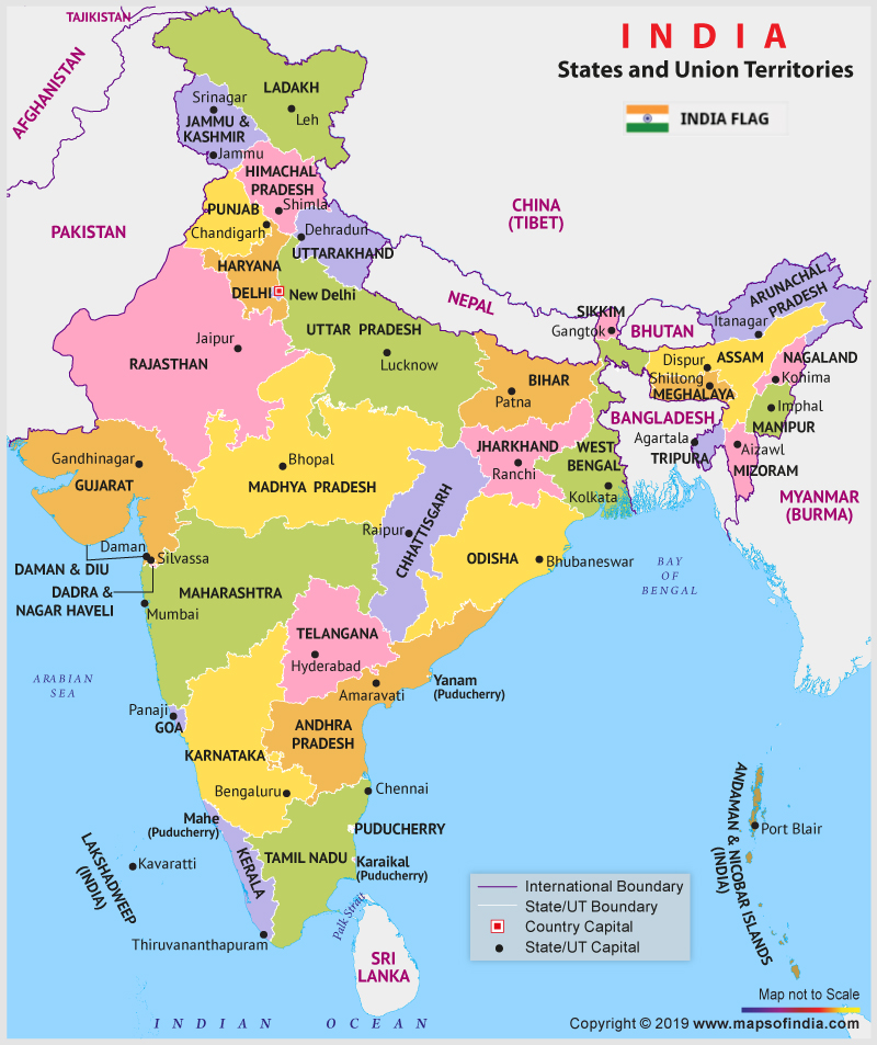
[caption id="attachment_92014" align="aligncenter" width="800"]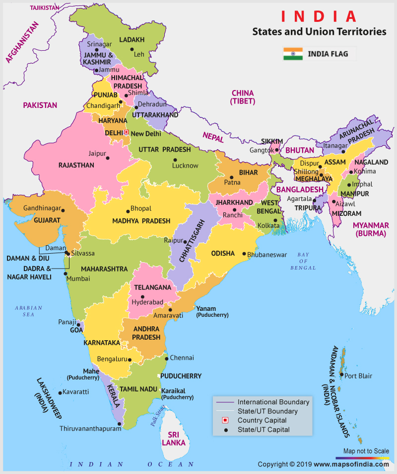 New map of India depicting 28 states and 9 union territories[/caption]
On the intervening night of October 30-31, when almost everyone in India was sleeping, Government of India took a step towards further integration or total integration of the erstwhile state of Jammu & Kashmir with rest of India. For the first time in the history of India, India witnessed, a State being delimited and two Union Territories taking its position. Here we present to you the new Political Map of India with effect from October 31, 2019.
Table List of 28 States with their capitals, formation date and their population:
| S.No. |
States |
Capital |
Founded Year |
Population (Per 2011 census number) |
| 1 |
Andhra Pradesh |
Amaravati, Hyderabad |
1. Nov. 1956 |
4,93,86,799 |
| 2 |
Arunachal Pradesh |
Itanagar |
20. Feb. 1987 |
13,83,727 |
| 3 |
Assam |
Dispur |
26. Jan. 1950 |
3,12,05,576 |
| 4 |
Bihar |
Patna |
26. Jan. 1950 |
10,40,99,452 |
| 5 |
Chhattisgarh |
Naya Raipur |
1. Nov. 2000 |
2,55,45,198 |
| 6 |
Goa |
Panaji |
30. May. 1987 |
14,58,545 |
| 7 |
Gujarat |
Gandhinagar |
1. May. 1960 |
6,04,39,692 |
| 8 |
Haryana |
Chandigarh |
1. Nov. 1966 |
2,53,51,462 |
| 9 |
Himachal Pradesh |
Shimla |
25. Jan. 1971 |
68,64,602 |
| 10 |
Jharkhand |
Ranchi |
15. Nov. 2000 |
3,29,88,134 |
| 11 |
Karnataka |
Bangalore |
1. Nov. 1956 |
6,10,95,297 |
| 12 |
Kerala |
Thiruvananthapuram |
1. Nov. 1956 |
3,34,06,061 |
| 13 |
Madhya Pradesh |
Bhopal |
1. Nov. 1956 |
7,26,26,809 |
| 14 |
Maharashtra |
Mumbai |
1. May. 1960 |
11,23,74,333 |
| 15 |
Manipur |
Imphal |
21. Jan. 1972 |
28,55,794 |
| 16 |
Meghalaya |
Shillong |
21. Jan. 1972 |
29,66,889 |
| 17 |
Mizoram |
Aizawl |
20. Feb. 1987 |
10,97,206 |
| 18 |
Nagaland |
Kohima |
1. Dec. 1963 |
19,78,502 |
| 19 |
Odisha |
Bhubaneswar |
26. Jan. 1950 |
4,19,74,218 |
| 20 |
Punjab |
Chandigarh |
1. Nov. 1956 |
2,77,43,338 |
| 21 |
Rajasthan |
Jaipur |
1. Nov. 1956 |
6,85,48,437 |
| 22 |
Sikkim |
Gangtok |
16. May. 1975 |
6,10,577 |
| 23 |
Tamil Nadu |
Chennai |
26. Jan. 1950 |
7,21,47,030 |
| 24 |
Telangana |
Hyderabad |
2. Jun. 2014 |
3,51,93,978 |
| 25 |
Tripura |
Agartala |
21. Jan. 1972 |
36,73,917 |
| 26 |
Uttar Pradesh |
Lucknow |
26. Jan. 1950 |
19,98,12,341 |
| 27 |
Uttarakhand |
Dehradun |
9. Nov. 2000 |
1,00,86,292 |
| 28 |
West Bengal |
Kolkata |
1. Nov. 1956 |
9,12,76,115 |
Table List of 9 Union Territories with their capitals, formation date and their population:
| S.No. |
Union territories |
Capital |
Founded Year |
Population (Per 2011 census number) |
| 1 |
Andaman and Nicobar Islands |
Port Blair |
1. Nov. 1956 |
3,80,581 |
| 2 |
Chandigarh |
Chandigarh |
1. Nov. 1966 |
10,55,450 |
| 3 |
Dadra and Nagar Haveli |
Silvassa |
11. Aug. 1961 |
3,43,709 |
| 4 |
Daman and Diu |
Daman |
30. May. 1987 |
2,43,247 |
| 5 |
Delhi |
New Delhi |
9. May. 1905 |
1,67,87,941 |
| 6 |
Lakshadweep |
Kavaratti |
1. Nov. 1956 |
64,473 |
| 7 |
Puducherry |
Pondicherry |
1. Nov. 1954 |
12,47,953 |
| 8 |
Jammu and Kashmir |
Srinagar (Summer), Jammu (Winter) |
31. Oct. 2019 |
1,22,67,013 |
| 9 |
Ladakh |
Leh |
31. Oct. 2019 |
2,74,289 |