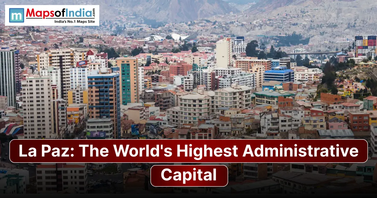
La Paz is widely known as the world's administrative capital, with the city existing at elevations of roughly 3,200–4,100 metres above sea level. Bolivia has a two-capital system: Sucre is the constitutional capital, while La Paz is the seat of government, where the executive and legislative branches are located. This is important because La Paz is often wrongly called simply Bolivia's capital.
La Paz at a Glance
| Fact | Details |
| City | Nuestra Señora de La Paz, Bolivia |
| Commonly cited elevation | ~3,640 m (~11,942 ft) |
| Elevation range | Roughly 3,200–4,100 m |
| Status | Administrative capital/seat of government |
| Constitutional capital | Sucre |
| Government functions in La Paz | Executive and Legislative |
| Distinction | World's highest administrative capital |
La Paz's elevation is not a single number because the city extends through a steep valley and up surrounding slopes. The municipal government says the altitude is 3,200–4,100 metres, while 3,640 metres is often used as a representative elevation.
How High Is La Paz?
La Paz sits at 3,640 metres (11,940 feet) above sea level, a commonly cited reference elevation. However, the city’s dramatic topography means different parts of the area sit at very different heights.
Elevation in Metres and Feet
At 3,640 metres, La Paz is 11,940 feet above sea level. The altitude is high enough to affect air pressure and oxygen availability, making acclimatisation important for visitors arriving from lower elevations.
Why La Paz Has a Range, Not a Single Altitude
The city of La Paz is not situated at a single fixed altitude since it extends over a steep canyon and the surrounding hills. The southern sections of the city lie at about 3,100 metres, and the areas in the upper parts of the city go above 4,000 metres. Although 3,640 metres (11,940 feet) is often taken as the representative elevation of La Paz, this figure does not apply to all the neighbourhoods.
La Paz vs. El Alto. The Higher Neighbour
El Alto sits on the Altiplano above La Paz. It reaches roughly 4,000 metres or more, making it higher than most of La Paz. It does not, however, change La Paz's status because El Alto is a city rather than Bolivia's administrative capital.
Why La Paz Is Administrative, Not Constitutional Capital
The distinction between La Paz and Sucre is one of the important facts about Bolivia's capital system.
Bolivia's Two-Capital System
Bolivia's Constitution says that Sucre is the capital of Bolivia. La Paz functions as the country's seat of government, where the national executive and legislature operate.
The 1899 Federal War and the Move of Government
The current arrangement has roots in the Federal War of 1898–1899. The conflict pitted forces centred in different parts of Bolivia against each other. After the liberals won, La Paz became the de facto seat of government, while Sucre kept its status.
What Each City Governs Today
Sucre keeps the constitutional-capital role. It is linked particularly with Bolivia's judicial institutions. La Paz is the country's political and administrative centre, housing the executive and legislative branches.
The World's Highest Capitals
La Paz's distinction is clearer when it is compared with high-altitude capitals.
| Capital / Government Seat | Approx. elevation |
| La Paz, Bolivia | ~3,640 m |
| Quito, Ecuador | ~2,850 m |
| Bogotá, Colombia | ~2,625 m |
| Addis Ababa, Ethiopia | ~2,355 m |
| Thimphu, Bhutan | ~2,334 m |
The comparison includes capitals or government seats. El Alto is higher than La Paz. It is a separate city, while Lhasa is also a high-altitude city but is not the capital of an independent country.
What 3,600 Metres Actually Feels Like
La Paz's altitude is more than a number. Visitors arriving from near sea level can notice the air, especially during physical activity.
Altitude Sickness and Symptoms
At elevations above about 2,450 metres, unacclimatised travellers can be at risk of altitude illness. Common symptoms of mountain sickness include headache, tiredness, reduced appetite and nausea.
Acclimatisation Timeline for Visitors
The safest way is to go up and allow time for the body to adjust. Travellers should avoid activity immediately after arriving and should pay attention to symptoms. People with conditions should talk to a doctor before going to high altitudes.
How Locals Have Adapted
People who grow up in the Andes have lived with low atmospheric oxygen for generations. Coca-based drinks are traditionally linked with high-altitude life in the Andes, although they should not be seen as a cure for altitude illness.
Why Water Boils Below 90°C
At La Paz's elevation, atmospheric pressure is much lower than at sea level. As a result, water boils at a temperature below 90°C, rather than the familiar 100°C at sea level. This can affect cooking times and methods.
The Geography That Made La Paz
The Canyon City and the Altiplano
La Paz developed within a valley and canyon system, surrounded by the high Altiplano. Its unusual geography produces neighbourhoods, winding roads, and large differences in elevation across relatively short distances.
The Surrounding Andes
The snow-covered Illimani is one of La Paz's recognisable geographical landmarks. The mountain forms a backdrop to the city and is closely connected with its identity.
The Inverted Social Geography
La Paz has an urban pattern in which many wealthier neighbourhoods are located at lower elevations in the southern part of the city, while poorer communities historically developed higher up toward the Altiplano. Geography, climate, and urban expansion all contributed to this pattern.
Mi Teleférico, the World's Highest Urban Cable Car Network
La Paz's terrain makes conventional road transport difficult, so the Mi Teleférico cable-car system has become a major part of daily transportation.
How the Cable Car Changed the Commute
Mi Teleférico connects La Paz and El Alto through a network designed to overcome terrain and reduce road congestion. The system has 10 lines and more than 30 km of cable carrying hundreds of thousands of passenger trips.
Lines, Fares and Best Views
The network includes Red, Yellow, Green, Blue, Orange, White, Light Blue, Purple, Brown and Silver lines. For visitors, the cable cars are both transport and a way to see the city from above. Current fares and operating conditions can change, so travellers should check information before travelling.
What to See in La Paz?
Plaza Murillo and the Government Quarter
Plaza Murillo lies at the heart of La Paz's political centre, surrounded by major government and religious buildings. The municipal tourism authority identifies it among the city’s attractions.
Witches Market
The Mercado de las Brujas, or Witches Market, is one of La Paz's known tourist areas. It offers crafts and products connected with Andean cultural practices. The municipality has also recognised the market as part of the city's heritage.
Valle de la Luna
Valle de la Luna is a landscape of eroded clay formations in the southern part of La Paz. Its unusual shapes and colours make it one of the city's recognisable natural attractions.
Day Trips — Tiwanaku and Lake Titicaca
La Paz also works as a base for exploring Andean attractions. Tiwanaku, an archaeological site near La Paz, has been a UNESCO World Heritage Site since 2000. Lake Titicaca is another destination in the wider Altiplano region.
Guide To Visit
Best Time to Visit
The season generally from April to October offers more stable conditions for sightseeing. The municipal tourism authority specifically recommends April–October for Valle de la Luna because of rainfall.
Flying into El Alto International Airport
Most air travellers arrive through El Alto International Airport, located on the plateau above La Paz. Because the airport itself is at high altitude, visitors should take acclimatisation seriously from the beginning of their trip.
Safety and First-Day Tips
Keep the day relatively light, stay hydrated, and avoid heavy physical exertion while adjusting to the altitude. La Paz's tourism authority similarly recommends resting and avoiding physical effort during the first days at high altitude.
FAQs
1. What is the highest capital city in the world?
La Paz is widely recognised as the world's administrative capital at roughly 3,640 metres above sea level. It is the seat of Bolivia's government, while Sucre is the constitutional capital.
2. Is La Paz or Sucre the capital of Bolivia?
Both have capital roles. Sucre is Bolivia's constitutional capital, while La Paz is the seat of government and administrative capital.
3. How high is La Paz in feet?
La Paz is commonly cited at about 3,640 metres or 11,940 feet, although the city extends across a broader elevation range.
4. Will I get sick in La Paz?
It is possible, particularly if you arrive from an elevation without acclimatising. Anyone sleeping above 2,450 metres can be at risk of altitude illness.
5. How many days do you need in La Paz?
Two to three days is a starting point for seeing major attractions in La Paz, while a longer stay allows time for acclimatisation and nearby excursions.
6. Is La Paz safe for tourists?
La Paz is a tourist destination, but normal urban travel precautions are still necessary. Visitors should also treat the altitude as a genuine health consideration rather than simply a sightseeing detail.
7. What language is spoken in La Paz?
Spanish is widely spoken, alongside languages including Aymara and Quechua.