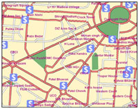
GIS is a computer based integrated database management system that stores a large volume of spatial data along with its attribute or non spatial data which are captured, stored, retrieved, processed and analyzed to provide answers to queries of a geographical nature as and when required.
| more... | ||||
|
|
||||
|
MapsofIndia has been the leading source of mapping information on India since its inception in 1998. We have qualified staff, supervised by experienced managers, working on state-of-the-art GIS. We offer to provide the following GIS and Digital Image Processing (DIP) services.
| ||||
SURVEY AND DATA COLLECTION SERVICES
We also offer Ground survey and data collection services for a wide range of vertical segments for generation of GIS database. These surveys will be tailored to your requirements with respect to the details that need to be picked up. These surveys can be specific to a telecom, municipal, forest or any such application or just creation of a base map at scales going up to 1:5000. The outputs will be delivered in a GIS ready format as per the required database design. Query... |
DATA MIGRATIONAs the GIS industry has matured, organizations are soliciting services to migrate their data from one GIS model to another. Migration may involve upgrading to a new system from the same supplier or to a completely new system. MapsOfindia offers to receive a client's current GIS data in any format, process it and deliver it back in the specified format. Query... For queries please contact Apoorv Bhardwaj +91-8929683196 or at [email protected] |
|||
SATELLITE IMAGE PROCESSINGWe offer services for processing high-resolution imagery into quality raster data products. This may involve removing distortions in the images (Georectification, Orthorectification) and ensuring that the output is of high quality in terms of clarity, resolution, and color. The processing consists of Georeferencing images, orthorectification, mosaicing, color balancing, and cutting to specified output formats. We are able to produce a seamless raster data product from multiple image tiles. Query... |
||||
|
|
||||
|
| ||||