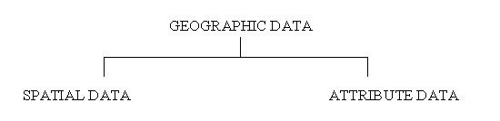
The ability of GIS to handle and process geographically referenced data, distinguish GIS from other Information systems. Geographically referenced data describe both the location and characteristics of spatial feature on earth surface. GIS therefore involves two geographic data components.
1. Spatial Data: Spatial data describes the absolute and relative location of geographic feature. It relate to the geometry of a spatial feature.
2. Attribute Data: Attribute data describes characteristics of spatial features. These characteristics can be quantitative and /or quantities in nature. Attribute data are often referred to as tabular data. It gives information about the spatial features.
|
|
|
|
Last Updated on 28 September 2012