The plateaus of the world range from the vast Tibetan Plateau in Asia to the volcanic Deccan Plateau in India and the high Altiplano of South America. A plateau is an area of land with a relatively broad, level or gently rolling surface. Plateaus form through processes such as uplift, volcanic activity, and prolonged erosion. Their distribution is closely linked to Earth's history, including plate collisions, volcanic hotspots, and erosion. This article explores what defines a plateau, the types of plateaus, major examples across different continents, their geographic distribution, and their ecological and economic importance.
What Is a Plateau?
A plateau is an area of relatively level or gently rolling land that rises distinctly above surrounding terrain. Unlike a mountain, which generally has slopes and a prominent peak, a plateau has a broad elevated surface. Plateaus can form through uplift, volcanic eruptions, lava flows, or erosion.
Plateau vs. Plain vs. Mountain
Landform | Main Characteristic | Elevation | Typical Shape |
| Plateau | Elevated, relatively level surface | Generally higher than surrounding land | Flat or gently rolling top |
| Plain | Broad, mostly level low-relief land | Usually low or moderately elevated | Flat or gently undulating |
| Mountain | High relief with steep slopes and peaks | Generally high | Peaks, ridges and steep slopes |
Elevation and structural criteria
There is no single worldwide minimum elevation that defines a plateau. Instead, geographers identify plateaus based on their elevated position relative to surrounding land and their broad, comparatively level surface. Some plateaus are thousands of metres above sea level while others occur at lower elevations.
Types of Plateaus by Formation
Tectonic (uplift) plateaus
Plateaus form when large sections of Earth's crust are uplifted by tectonic forces. The uplift can occur over areas producing high, relatively level surfaces. The Tibetan Plateau is an example associated with the collision of the Indian and Eurasian tectonic plates.
Volcanic plateaus
Volcanic plateaus develop when repeated lava flows spread across areas and later cool into thick layers of volcanic rock. The Deccan Plateau of India is an example formed largely from extensive basaltic lava flows.
Dissected plateaus
Dissected plateaus are regions that have been deeply cut by rivers and erosion. On a continuous flat surface, they contain valleys, canyons, and rugged terrain. The Colorado Plateau contains examples of this type of erosion.
Intermontane plateaus
Intermontane plateaus are areas located between or surrounded by mountain ranges. They are commonly associated with activity and high mountain systems. The Bolivian Altiplano is an example in the Andes.
Plateau Types by Formation
Plateau Type | Formation Process | Example |
| Tectonic Plateau | Uplift of Earth's crust due to tectonic forces | Tibetan Plateau |
| Volcanic Plateau | Formation from extensive layers of cooled lava | Deccan Plateau |
| Dissected Plateau | Long-term erosion by rivers and weathering cuts into an elevated surface | Colorado Plateau |
| Intermontane Plateau | Elevated plateau located between or surrounded by mountain ranges | Bolivian Altiplano |
Major Plateaus of Asia
The Tibetan Plateau — The world's highest
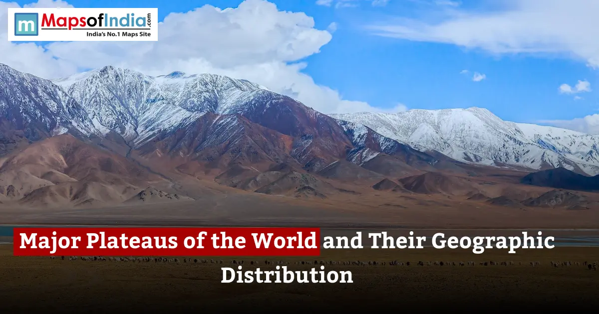
The Tibetan Plateau is the world's highest and one of its largest plateaus with an average elevation of roughly 4,500 metres. It formed largely through the collision and continuing interaction of the Eurasian tectonic plates. The plateau influences the climate and river systems of much of Asia.
The Deccan Plateau, India
The Deccan Plateau occupies much of India and is largely composed of basalt created by ancient volcanic eruptions. Its black soils, in parts of the region, support crops such as cotton. Rivers including the Godavari, Krishna, and Tungabhadra drain parts of the plateau.
The Anatolian Plateau, Turkey
The Anatolian Plateau occupies much of Turkey and lies between major mountain systems. Its dry continental climate supports agriculture and livestock, while cities such as Ankara developed within or around the plateau region.
The Iranian Plateau
The Iranian Plateau covers much of Iran. Extends into parts of Afghanistan and Pakistan. It contains mountains, basins, deserts, and elevated plains, making it a diverse plateau region.
Major Plateaus of the Americas
The Colorado Plateau, USA
The Colorado Plateau covers parts of the United States. It is famous for its eroded landscapes, including canyons, mesas, and buttes. The Grand Canyon is one of the spectacular landscapes associated with the region.
The Bolivian Plateau (Altiplano)
The Altiplano is an intermontane plateau in the central Andes mainly across Bolivia and Peru. It contains high-altitude basins and lakes, including Lake Titicaca. It is surrounded by major Andean mountain ranges.
The Columbia Plateau
The Columbia Plateau extends across parts of Washington, Oregon, and Idaho in the United States. It was formed largely by enormous basaltic lava flows that spread across the region during volcanic activity.
Major Plateaus of Africa
The Ethiopian Highlands (Plateau)
The Ethiopian Highlands form an elevated region of East Africa. Extensive volcanic rocks, deep river valleys and rugged highlands characterise the landscape. The region is sometimes called the "Roof of Africa" because of its elevation.
The East African Plateau
The East African Plateau covers elevated areas around the Great Rift Valley. Its landscape includes highlands, volcanic mountains, lakes and savannas supporting ecosystems and agricultural communities.
The Katanga Plateau
The Katanga Plateau is centred in the Democratic Republic of the Congo. Extends into neighbouring areas. It is particularly significant for its mineral resources, including deposits of copper and cobalt.
Major Plateaus of Europe and Australia
The Meseta Central, Spain
The Meseta Central is an elevated plateau occupying much of central Spain. Mountain ranges divide parts of the plateau into basins, while its inland location contributes to significant seasonal temperature differences.
The Bavarian Plateau, Germany
The Bavarian Plateau lies in Germany between the Danube and the Alps. It contains agricultural areas and slopes gradually towards the Danube basin.
The Western Plateau, Australia
The Western Plateau covers a portion of Australia's interior and western region. It is a relatively stable geological area dominated by dry landscapes, deserts, and extensive mineral resources.
Geographic Distribution Patterns
Tectonic Plate boundaries and collision zones
Many of the world's highest plateaus occur near areas of tectonic activity. Continental collisions can uplift Earth's crust over enormous areas. The Tibetan Plateau is an example resulting from the ongoing collision between India and Eurasia.
Volcanic activity hotspots
Volcanic activity can create plateaus when huge quantities of lava spread across regions. Repeated eruptions can build layers of basalt as seen in the Deccan and Columbia plateaus.
Erosion and weathering over geological time
Erosion can reshape plateaus after they form. Rivers gradually cut into surfaces, creating valleys, gorges, mesas, and other landforms. Over millions of years, this process can transform a level plateau into a deeply dissected landscape.
Importance of Plateaus
Mineral and resource wealth
Many plateau regions contain valuable mineral resources. The Deccan region has basaltic formations, while the Katanga Plateau is internationally important for copper and cobalt resources. Mineral deposits contribute significantly to economies and industries.
Agriculture on plateau regions
Plateau agriculture varies according to climate, soil and elevation. The Deccan Plateau supports crops such as cotton, pulses and oilseeds, while other plateaus support cereals, grazing and livestock farming. Elevation and rainfall strongly influence what can be cultivated.
Water sources — Plateaus as river origins
Several major rivers originate in or around plateau regions. The Tibetan Plateau is particularly important because rivers including the Yangtze, Yellow River, Mekong, Salween and Brahmaputra have headwaters in the Tibetan Plateau region. These rivers provide water for agriculture, ecosystems, and large populations across Asia.
Conclusion
The world's plateaus are results of geological activities that have been happening for millions of years. From the big Tibetan Plateau and the volcanic Deccan Plateau to the broken Colorado Plateau and the mineral-filled African plateaus, their looks and resources are very different. Their placement also shows the effects of mountain building and volcanic activity. Wearing away by water and wind. In addition to their importance, plateaus help with farming, nature areas, mining businesses, and big river systems, making them important places in every part of the world where people live.
FAQs
1. What is the highest plateau in the world?
The Tibetan Plateau is the world's largest plateau with an average elevation of about 4,500 metres above sea level. It is located in Tibet and extends into surrounding parts of China and the Himalaya region.
2. What are the four main types of plateaus?
Plateaus are commonly classified by their formation as volcanic, dissected, and intermontane plateaus. Some regions can display characteristics of more than one type because geological processes often overlap.
3. Which is the plateau in India?
The Deccan Plateau is one of India's most important plateau regions. It covers much of India and is characterised by extensive basaltic rocks and varied agricultural landscapes.
4. How are volcanic plateaus formed?
Volcanic plateaus form when large quantities of lava spread over areas during repeated volcanic eruptions. After the lava cools and solidifies, successive layers can create an elevated surface.
5. What is the difference between a plateau and a plain?
A plateau is elevated above the surrounding landscape, while a plain is generally a broad area of low relief that may occur at low or moderate elevations. Both can have flat or gently rolling surfaces.
6. Why is the Tibetan Plateau important?
The Tibetan Plateau is important because of its high elevation above sea level and its effect on the weather in Asia, and its position as a key area for many important rivers. Its ice, snow, and environments at altitude also have greater environmental importance.
7. Which plateaus are rich in minerals?
Many plateaus have a lot of mineral resources. The Katanga Plateau is very famous for copper and cobalt, while Australia's Western Plateau has amounts of minerals like iron ore and gold.