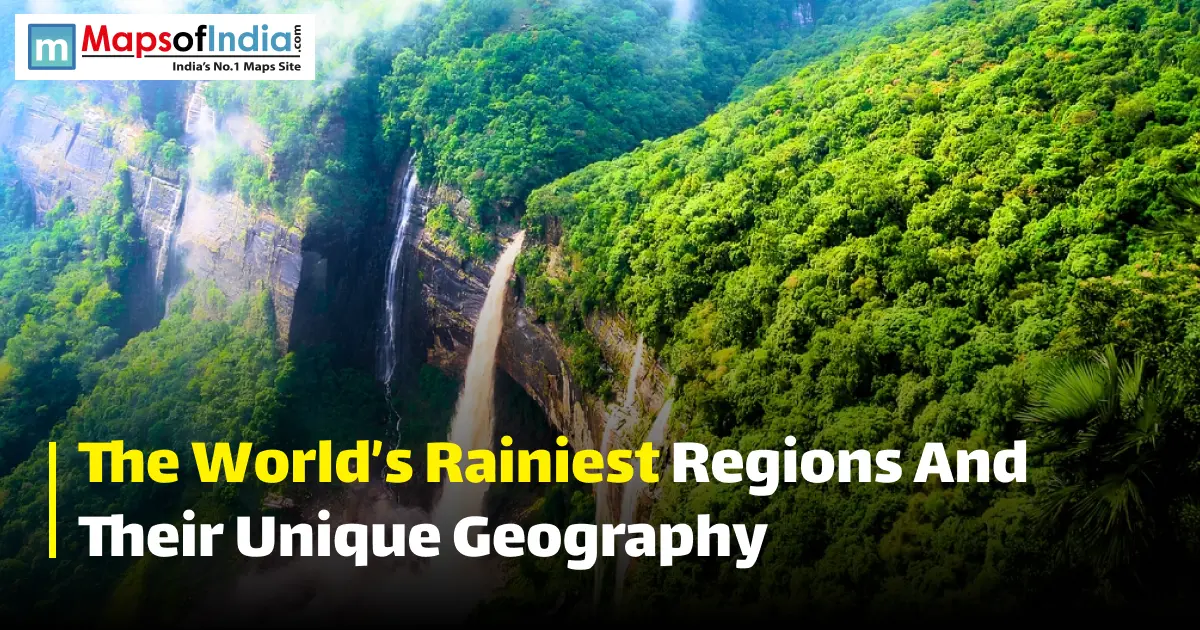
Rainfall can transform a landscape into a place full of waterfalls, thick forests, and strong rivers. Some of the rainiest regions in the world receive more than 10,000 millimetres of rain each year, which is many times the worldwide average.
From Mawsynram and Cherrapunji in northeast India to the rain‑soaked Pacific coast of Colombia, these places get extremely wet because of mountains, monsoon winds, warm oceans and air that come together.
This guide looks at the science behind rainfall, the wettest places on Earth, the climate zones where they exist, and how heavy rain changes forests, farming, and daily living.
What Makes a Region "Rainy"? Understanding Rainfall Science
A region becomes very rainy when large amounts of air are lifted again and again and cool down, making water vapor turn into clouds and then rain. Mountains, monsoon winds, warm oceans and tropical air that meet can all raise rainfall, sometimes giving thousands of millimetres of rain each year.
Orographic Rainfall (mountains forcing moist air upward)
Orographic rainfall happens when moist air meets a mountain range and is pushed upward. When the air rises, it cools, water vapour condenses and rain forms. The side of the mountain that faces the wind can get a lot more rain than the flat land or the side away from the wind.
Monsoon systems and seasonal wind reversal
Monsoons mean that the main wind direction changes with the seasons because land and water warm and cool at different rates. In South Asia, summer monsoon winds bring air from the Indian Ocean to the land, creating long periods of heavy rain.
Conventional rainfall near the equator
Near the equator, strong sun heat makes warm, moist air go up. The Intertropical Convergence Zone (ITCZ), where trade winds meet, has rising air, clouds, showers, and storms. That is why many places near the equator get rain often.
The Rainiest Places on Earth (Ranked)
The order of places with the rain depends on how long the data is collected, where the station is, and whether the list uses yearly averages or single rainfall records.
The places below are often mentioned as some of the wettest on Earth.
| Rank | Place | Country/Region | Approx. Annual Rainfall |
| 1 | Mawsynram | India | 11,872 mm |
| 2 | Cherrapunji (Sohra) | India | 11,000+ mm |
| 3 | Lloró | Colombia | 13,000+ mm in some datasets |
| 4 | Tutunendo | Colombia | 10,900–11,400 mm |
| 5 | Mount Waialeale | Hawaii, USA | 11,500–11,700 mm |
| 6 | Debundscha | Cameroon | 10,287 mm |
Mawsynram, India. The current record holder
Mawsynram in Meghalaya is known as one of the wettest spots on Earth and is noted by WMO as having the highest yearly average rainfall in Asia: 11.872 metres during 1941–1979. The huge rain comes from monsoon winds that are pushed upward by the Khasi Hills.
Cherrapunji (Sohra), India. Historic rainfall records
Close by, Cherrapunji, now called Sohra, has set rain records. WMO records 26.47 metres of rain in a year from August 1860 to July 1861, the biggest 12‑month record in its archive.
Lloró and Tutunendo, Colombia
The lowlands on the Pacific coast of Colombia's Chocó region are one of the wettest places on Earth. Studies from stations show an average of 13,159 mm a year at López de Micay and 10,946 mm at Tutunendo, while Lloró is around 13 300 mm in published data.
Mount Waialeale, Hawaii, US
Mount Waialeale on Kauai is well known for rain. Long‑term numbers often given for the top are 11 684 mm each year, though averages differ with time and source. Its steep volcanic shape and contact with Pacific air help create heavy orographic rain.
Debundscha, Cameroon
Debundscha, located on the coast of Cameroon near Mount Cameroon, is one of Africa's wettest places. Rainfall there reaches about 10,287 millimetres each year thanks to air from the Gulf of Guinea that mixes with the volcanic mountains nearby.
Rainiest Countries and Regions by Climate Zone
Tropical rainforest regions (Amazon Basin, Congo Basin)
Tropical rainforest climates stay warm and humid all year long, which helps convection and heavy rain. In the Amazon Basin, vegetation releases water vapour into the air. That vapour can turn back into rain, creating a cycle of moisture recycling within the forest.
Monsoon Asia (Northeast India, Southeast Asia)
Northeast India and parts of Southeast Asia get some of the planet's most intense seasonal rainfall. Moisture‑rich monsoon winds meet mountain ranges. Drop extreme amounts of rain, especially in places like Meghalaya. The reversing winds are a key trait of monsoon climates.
Temperate rainforest zones (Pacific Northwest, Chilean Patagonia)
Temperate rainforests grow in areas where ocean moisture mixes with good air circulation and mountains. In the Pacific Northwest, for instance, moist Pacific air climbs the Cascades. Brings heavy rain to the western slopes while the eastern side stays much drier.
The Geography Behind the Rain
Mountain ranges and windward slopes
Mountains act as amplifiers of rain. When moist winds meet a mountain, the air rises. Drops its moisture. Thus, the windward side becomes much wetter than the leeward side, producing rain differences over short distances.
Proximity to warm oceans and moisture sources
Warm oceans give off large amounts of water vapour by evaporation. Coastal and island areas that catch moist ocean winds can get lots of rain, especially when mountains lift that air upward.
Wind patterns and atmospheric convergence zones
Global wind patterns decide where moisture moves at the ITCZ trade winds. Rise, forming wide cloud bands and frequent showers and thunderstorms. Seasonal circulation like monsoons can push rain further into specific regions and months.
How Rainiest Regions Shape Local Life and Ecosystems
Biodiversity in high-rainfall zones
Lots of water supports dense plants and complex ecosystems. Tropical rainforests in places like the Amazon and Chocó give homes to a variety of plants and animals. High rainfall also keeps rivers, wetlands and forest soils alive.
Agriculture and livelihoods
Rain is essential for crops, fresh water, and animals. In monsoon areas, seasonal rains matter most for farming. The when and how hard it rains can greatly affect harvests. In India, for example, the summer monsoon ties tightly to how farming goes.
Challenges: flooding, erosion, infrastructure
Extreme rain also brings danger. Heavy or long rains can cause floods, landslides and soil erosion. Roads, bridges, houses, and drainage may need protection. In mountain zones, heavy rain on the ground makes these hazards even worse.
Conclusion
The world’s places show how mountains, monsoon winds, warm oceans, and air movement come together to create very heavy rainfall. Places like Mawsynram and Cherrapunji get large amounts of rain. So do the rainforests in Colombia, the Amazon, and Southeast Asia. These areas are full of life. Support many different types of plants and animals. They also struggle with floods, soil erosion, and landslides. Looking at their geography helps explain why some parts of the Earth get much rain while others stay dry. Rainfall is not spread evenly across the planet.
FAQs
1. What is the rainiest place in the world?
Mawsynram in Meghalaya, India, is known worldwide as the wettest place. The WMO lists 11,872 millimetres of rain each year for its 1941–1979 average. Some Colombian stations show higher averages when looked at different time periods, so the comparison depends on the data used.
2. Why does Mawsynram receive much rain?
Moisture‑rich monsoon winds from the waters get lifted by the Khasi Hills. As the air rises, it cools. Drops a lot of rain through orographic rainfall.
3. Is Cherrapunji wetter than Mawsynram?
Mawsynram has the higher long‑term average in the comparison, while Cherrapunji holds an amazing 12‑month record of 26.47 metres from 1860–1861.
4. What is rainfall?
Orographic rain happens when moist air is pushed up mountains. Cooling at higher elevations makes water vapour turn into clouds and rain, so the windward slopes get much wetter than nearby spots.
5. Which country has the rainfall?
There is no answer for every type of measurement. India hosts Mawsynram and Cherrapunji, while Colombia’s Chocó region has stations with high yearly averages, some over 13,000 millimetres, in certain data sets.
6. Why are tropical regions very rainy?
Tropical regions often have rain. The sun heats the land strongly, which makes water evaporate fast. Warm, moist air rises when tropical winds meet. That rising air cools, forms clouds, and leads to thunderstorms that bring rainfall, especially near the equator.
7. How does heavy rainfall affect ecosystems?
Heavy rainfall can help build forests, feed rivers, and support great biodiversity. I also see that too much rain can cause flooding, erosion, landslides, and put pressure on local infrastructure.