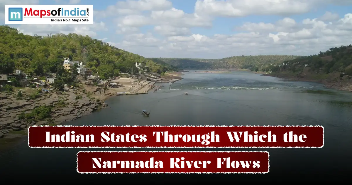
The Narmada River flows through three states. Madhya Pradesh, Maharashtra and Gujarat. Rising at Amarkantak in the Maikal Range. Emptying into the Arabian Sea via the Gulf of Khambhat. Unlike every major river on the peninsula, it runs from east to west, cutting a nearly 1,312-kilometre path through a rift valley wedged between the Vindhya and Satpura ranges.
| State | Approx. Length within state | Defining feature |
| Madhya Pradesh | 1,077 km | Source at Amarkantak; carries the bulk of the rivers |
| Maharashtra | 74 km (plus short border stretches) | Skirts the edge of the Satpura hills |
| Gujarat | 159-161 km | Widens into an estuary before meeting the sea |
Where the Narmada Begins?
The river's story starts at Narmada Kund, a small spring on the Amarkantak plateau in Madhya Pradesh's Anuppur district at an elevation of roughly 1,057 metres. From there it winds through the Mandla hills before reaching Jabalpur, where it carves through the Marble Rocks gorge. A stretch so striking that boat rides through it have become something of an institution at sunset, when the pale limestone cliffs pick up a soft golden glow. Before the gorge, the river also drops sharply at Dhuandhar Falls, whose name literally translates to "smoke cascade," a nod to the mist that rises off the water as it crashes down.
Because it flows along a trough rather than a conventional river valley, geographers classify the Narmada as a rift valley river, one of only a handful in the country. It runs in the depression between the Vindhya Range to its north and the Satpura Range to its south, an arrangement that gives the river its straight west-bound trajectory instead of the winding branching patterns typical of most Indian rivers. It is also, by count, the largest of the peninsula's west-flowing rivers, sharing that distinction with the Tapi and the Mahi. A small notable club, given that the vast majority of India's rivers drain eastward into the Bay of Bengal.
The river carries names in historical texts. The 2nd-century Greek geographer Ptolemy referred to it as Namados, while British-era records called it the Nerbudda. In Sanskrit literature, it appears as the Rewa, a name still used in parts of Madhya Pradesh today.
The Three States, One by One
1. Madhya Pradesh- Where it all begins
Then four-fifths of the Narmada's length lies within Madhya Pradesh alone. It passes towns like Narmadapuram ( Hoshangabad), Narsinghpur, Mandla, Omkareshwar and Maheshwar, threading through some of the state's fertile and historically significant districts. This is also where its two largest dam projects sit.
2. Maharashtra- A meaningful stretch
The river only grazes Maharashtra briefly, first forming a boundary between Madhya Pradesh and Maharashtra for a run, then between Maharashtra and Gujarat further downstream. In this stretch, it skirts the Satpura hill system before handing off to Gujarat.
3. Gujarat- Where it meets the sea
In this stage, the Narmada widens considerably as it nears Bharuch, eventually forming a tidal estuary roughly 20 kilometres across before draining into the Gulf of Khambhat. Seagoing vessels have historically used this stretch during the tide. The estuary itself has long served as a working waterway rather than just a scenic one. This final Gujarat stretch is also home to the Sardar Sarovar Dam, one of India's consequential infrastructure projects, along with the Statue of Unity that now overlooks it from a nearby river island.
It's worth noting that the boundary-sharing pattern between these states isn't incidental. It reflects the fact that the Narmada Valley has historically served as one of India's dividing lines between the north and the south, a role it has played in maps and travel accounts for centuries.
Narmada River Route Map (State-Wise)
Imagine the Narmada as a line that stretches west across central India. It begins high near the Madhya Pradesh–Chhattisgarh border. Ends at the Gujarat coast. If you map it state by state, the path looks like this:
Narmada flows from Anuppur (source at Amarkantak) → Dindori → Mandla → Jabalpur (Marble Rocks, Dhuandhar Falls) → Narsinghpur → Narmadapuram ( Hoshangabad) → Harda → Khandwa (Omkareshwar) → Khargone (Maheshwar, Barwaha) → Barwani, before Narmada reaches the tri‑junction with Maharashtra and Gujarat.
In Maharashtra, Narmada touches the edge of Nandurbar district. It mainly serves as a line. Does not cut deeply into the state.
When Narmada reaches Gujarat, it travels through Narmada district (Rajpipla) → Vadodara district (Dabhoi, Karjan, Sinor) → Bharuch district. Here Narmada widens into an estuary. Finally empties into the Gulf of Khambhat.
A helpful way to picture Narmada is to think that if you trace the river on a map of India, about nine‑tenths of Narmada lies entirely within Madhya Pradesh. The remaining tenth splits between a stretch in Maharashtra and a wide estuarine section in Gujarat.
Major Dams Along the Way
Sardar Sarovar Dam (Gujarat).
Completed in 2017 near Kevadia, it has a capacity of 1,450 MW and supplies power and irrigation water across Madhya Pradesh, Gujarat and Maharashtra. It's also home to the Statue of Unity built on an island facing the dam.
Indira Sagar Dam (Madhya Pradesh).
One of India's reservoirs by water-spread area, built for irrigation and power generation.
Omkareshwar Dam (Madhya Pradesh).
Located near the pilgrimage town of Omkareshwar, combining hydropower generation with religious significance.
Key Tributaries
The Narmada is fed by 41 tributaries in total.
Left-bank tributaries:
Burhner, Banjar, Sher, Shakkar, Dudhi, Tawa, Ganjal, Kundi, Goi, Karjan
Right-bank tributaries:
Hiran, Tendoni, Barna, Kolar, Man, Uri, Hatni, Orsang
Among these, the Tawa is the longest, joining the river in Madhya Pradesh's Narmadapuram district. Altogether, the river is fed by around 41 tributaries, a mix of seasonal hill streams and larger perennial rivers, which is part of why the Narmada basin stays productive for agriculture in drier stretches of the year.
Why the River Matters?
Cultural weight. The Narmada is considered one of India's seven rivers, and pilgrims undertake the Narmada Parikrama. A circumambulation of the river from source to the mouth and back along the opposite bank. A journey that can take months on foot and is considered one of the most demanding pilgrimages in Hindu tradition.
Economic backbone. Its basin supports agriculture across India. 57% of the basin area is under cultivation. Its dams underpin irrigation and electricity supply for millions of people across three states. The river has also historically doubled as a trade route linking the Arabian Sea coast to inland markets before roads and railways took over that role.
A river of debate. The Narmada dam projects of Sardar Sarovar have also made it one of India's closely watched rivers from a policy standpoint. Questions of resettlement, water-sharing between states and environmental impact have shaped decades of tribunal hearings and public debate, making the Narmada much a subject of governance and law as much as geography.
Narmada River: Quick Facts
● Length: 1,312 km
● Source: Narmada Kund, Amarkantak, Madhya Pradesh
● Mouth: Gulf of Khambhat, Bharuch district, Gujarat
● States: Madhya Pradesh, Maharashtra, Gujarat
● Number of tributaries: around 41
● Also known as: the Rewa
Conclusion
The Narmada flows through Madhya Pradesh, Maharashtra and Gujarat, and it is really a story of one river taking on roles in each state. It is a source and lifeline in Madhya Pradesh, a boundary marker in Maharashtra and a working estuary and engineering hub in Gujarat. Few Indian rivers have that religious and economic significance in a single westward journey to the sea, which is part of why the Narmada continues to appear in everything from pilgrimage circuits to policy debates centuries after it was first mapped and named.
Frequently Asked Questions
Which states does the Narmada River flow through?
Madhya Pradesh, Maharashtra and Gujarat.
In how many states does the Narmada flow?
Three. The river forms inter-state boundaries before crossing into each new state.
Where does the Narmada River originate?
At Narmada Kund on the Amarkantak Plateau, Anuppur district, Madhya Pradesh.
Where does the Narmada River end?
It empties into the Arabian Sea through the Gulf of Khambhat near Bharuch in Gujarat.
Is the Narmada a west-flowing river?
Yes. It's the largest of the peninsula's west-flowing rivers, alongside the Tapi and Mahi.
What is the length of the Narmada River?
1,312 kilometres, making it one of India's longest rivers.