Zanskar is one of India’s remote regions because it sits behind tall mountain ranges connected by difficult high-altitude paths. For periods, heavy snowfall kept the area cut off from the outside world. Located in the Union Territory of Ladakh, Zanskar lies behind the Zanskar Range, making it hard to reach from parts of the region. Now that new roads are being built, Zanskar remains geographically isolated due to its rugged terrain, freezing winters, and areas where phone signals are weak or missing.
The remoteness of Zanskar is changing, though. In March 2024, the Nimmu–Padum–Darcha (NPD) road was completed, offering a route through the region. Road construction and improvements were still ongoing in 2026. Cold weather continues to impact travel. This means that, with better infrastructure, getting to Zanskar can still be tough depending on the season.
Where Is Zanskar Located?
Geography Within Ladakh
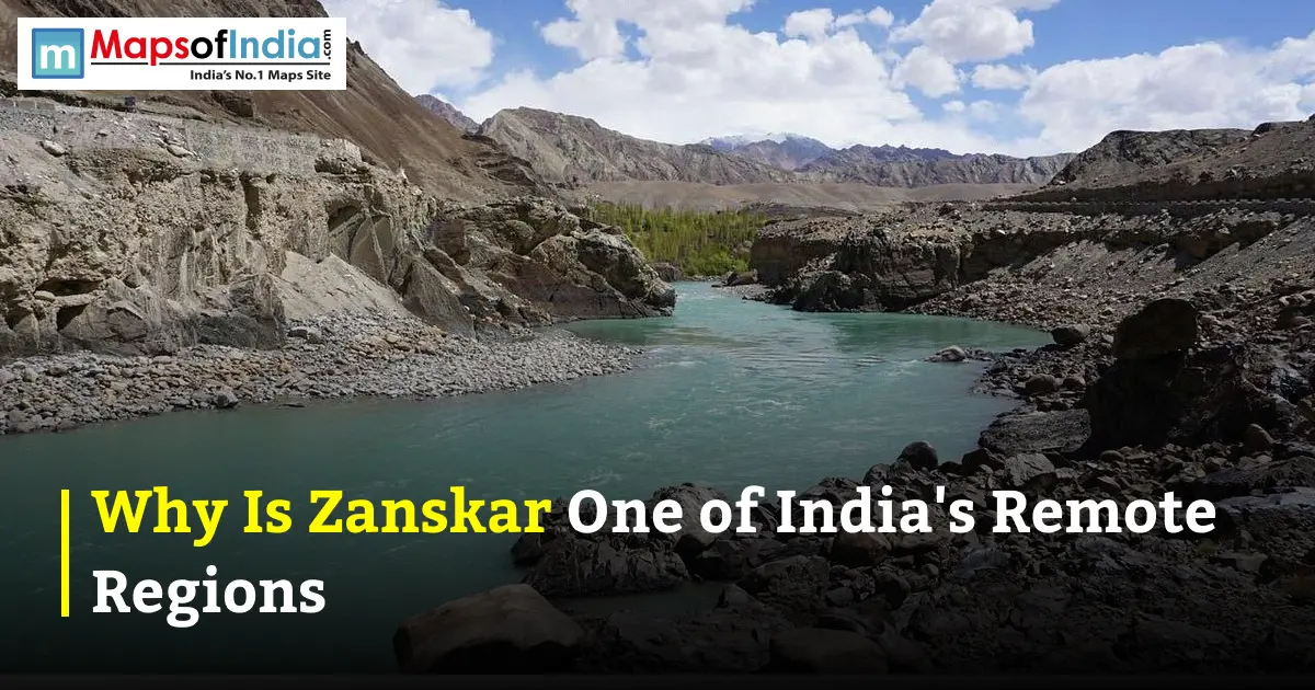
Zanskar is a high-altitude area within Ladakh. In April 2026, Zanskar officially became one of Ladakh's seven districts with Padum as its district center. The landscape features valleys, steep mountains, and winding high-altitude trails. Most of the population lives between 3,500 and 4,000 meters above sea level.
One of the geographical features is the Zanskar River. The land around the river makes it hard to move between Zanskar and nearby areas, which has helped keep the region isolated for centuries.
The Zanskar Range as a Natural Barrier
The Zanskar Range acts as a wall separating the region from Ladakh to the north. It is part of the Himalayan system that makes access difficult. Zanskar is entirely surrounded by big Himalayan peaks, with only a few high mountain passes providing entry points.
This isolation is more about barriers than distance. Although Zanskar may not be far from parts of Ladakh in straight-line terms, the height, the rough roads, and the mountainous terrain make travel much harder than the distance suggests.
What Makes Zanskar So Hard to Reach?
The Kargil–Padum Road via Pensi La
The route from Kargil to Zanskar goes over Pensi La, a pass at around 4,400 to 4,450 meters in height. The Ladakh administration calls this the point along the Kargil–Zanskar road. Official records say the road is 250 km long, though some people measure it differently.
Pensi La has been a reason for Zanskar’s isolation. Heavy snow can block the pass, stopping all road traffic for months. The Ladakh administration says Zanskar was cut off for more than eight months each year because of snow blocking Pensi La.
The New Nimmu–Padum–Darcha (NPD) Road. Status in 2026
The Nimmu–Padum–Darcha road has changed transportation in Zanskar significantly. The 298-km strategic road was opened by the Border Roads Organisation on March 25, 2024. It connects Nimmu near Leh with Padum and Darcha in Himachal Pradesh, creating a link between Ladakh and the rest of India.
It would be wrong to call the route a complete all-weather highway in 2026. As of February 2026, the Zanskar administration was still reviewing road work. By June 2026, officials had asked agencies to speed up blacktopping and finish the remaining tasks.
The planned Shinkun La Tunnel is expected to improve all-weather access through this route, reducing dependence on roads.
Manali–Darcha–Shinkula Route. Seasonal Alternative
People coming from Himachal Pradesh can use the Darcha–Shinkula–Padum route. This path crosses Shinkun La, which stands at 16,558 feet (5,048 meters). Offers a vital way into Zanskar.
Now, this route is still affected by mountain weather and poor road conditions. The completion of the Shinkun La Tunnel could reduce reliance on this path in the future.
Why Does Zanskar Stay Cut Off for Half the Year?
Snowfall and Pass Closures
Winter is one of the reasons why Zanskar becomes cut off. Heavy snow can close high-altitude passes. Make road maintenance difficult. With new routes, winter closures have not disappeared. For example, the Padum–Darcha road was officially reopened in April 2025 after being blocked by snow during the winter.
This shows that the old belief that Zanskar is completely unreachable in winter is no longer true. Seasonal problems remain real and affect travel plans.
Winter Isolation and the Chadar Trek Phenomenon
During winter, the Zanskar River freezes solid. Parts of its surface form what is known as the Chadar—an ice path leading to the Chadar Trek.
This trek usually happens between January and February, although exact dates depend on the weather and how frozen the river is. The Ladakh administration has had to manage the trek alongside road construction and safety concerns.
Chadar is more than a tourist activity. It shows how people used to deal with Zanskar’s winter isolation and survive in these conditions.
Life Without Connectivity — Zanskar’s Communication Gap
The Sankoo "Dead Zone"
Mobile service is not strong on roads leading into Zanskar. Long stretches between towns often have no signal, especially on remote mountain tracks.
Calling the area a "Sankoo dead zone" might be too strong for a 2026 article. Service varies by operator and location. In recent years, network improvements have taken place, so coverage is better in some places.
BSNL, Jio Coverage limits around Padum
Mobile service around Padum is much better than before. Travel reports from 2026 show that BSNL, Jio and Airtel all provide some coverage in Zanskar. Coverage is still uneven outside the main areas. Jio and Airtel work in parts of Padum and nearby villages, while BSNL remains useful in remote spots.
The best way to describe the situation in 2026 is scattered mobile network coverage—not "no service everywhere.”
Phugtal Monastery — A Symbol of Zanskar’s Isolation
The Cave’s Ancient History
Phugtal Monastery, also called Phugtal Gompa, is one of Zanskar’s impressive cultural sites. It’s built around a cave in the Lungnak Valley.
There is a difference between the cave traditions and the current monastery. Legends say the cave is linked to sages going back about 2,500 years. However, the Ladakh administration says the monastery was started by Phagspa Sherab Zangpo in the middle of the century.
The Trek to Reach It
Phugtal’s location shows just how difficult the geography of Zanskar is. The monastery lies far from any road system. Getting there means traveling through the Lungnak Valley before finishing the trip on foot.
Its position on a cliff, its history as a site, and its isolation have made Phugtal one of the most well-known symbols of remote Zanskar.
A Kingdom Cut Off by Choice and Geography
Zanskar’s Buddhist Kingdom Origins
Zanskar developed its unique Himalayan Buddhist culture, influenced by the wider Tibetan Buddhist world. Monasteries, villages, and local traditions became closely tied to the valleys and the land.
The region’s terrain helped protect these traditions for many years, keeping movement limited.
Trade Routes and Tibetan Influence
Before roads, connections between Zanskar, Ladakh, Kashmir, and Tibet were mostly through mountain paths and high passes. Moving goods or people between these areas was slow and risky compared to today.
This mix of barriers and old trade links created a culture deeply rooted in Tibetan Buddhism but separate from India’s larger cities.
Is Zanskar Still Worth Visiting Despite Its Remoteness?
What Travelers Gain From the Isolation
Zanskar’s isolation is part of what makes it different from other mountain destinations. Visitors see mountain views, high-altitude villages, Buddhist monasteries, and a place with very few people.
At the time, the area was changing fast. New roads are making it easier to reach. The creation of Zanskar district in 2026 shows that administrative and infrastructure development is happening.
Best Time to Visit
For road travel, summer and early autumn are usually the best times. High passes are more likely to be open during these months. June to September is generally the recommended travel window. Actual road conditions depend on snow, rain, construction progress, and advice from locals.
Winter offers a kind of experience, including the Chadar Trek, but conditions are much tougher. Travelers need to pay attention to weather and safety when planning trips in winter.
Conclusion
Zanskar is one of India’s regions because its geography creates multiple layers of isolation—tall mountain ranges pass above 4,000 to 5,000 meters, freezing winters, rough roads, and limited communication. Pensi La used to block access from Kargil, while the Zanskar Range formed a barrier around the area.
Zanskar’s isolation is slowly changing. The Nimmu–Padum–Darcha road has brought a new connection, and ongoing road and tunnel projects aim to make travel more reliable.
FAQs
1. Is Zanskar the most remote place in India?
There is no list ranking Zanskar as the most remote place in India. It is, however, one of the country’s most isolated areas where people live. Factors like altitude, difficult paths, seasonal road closures, and past limited access contribute to this status.
2. How many hours does it take to reach Zanskar from Leh?
Journey time from Leh to Padum changes depending on the route, road conditions, weather, and stops. The Nimmu–Padum–Darcha route provides a road from the Leh side. There is no single travel time that works all year.
3. Is there any mobile network in Zanskar?
Yes. Mobile service exists in parts of Zanskar around Padum and populated areas. BSNL, Jio and Airtel offer varying levels of service. However, travelers should expect no signal away from main settlements.
4. Can you visit Zanskar in winter?
Yes. But winter travel is much harder due to cold, snow, and blocked roads. The Chadar Trek is the winter activity using frozen sections of the Zanskar River when conditions allow.
5. What is the safest route to Zanskar Valley?
There is no single safest route in every season. The Kargil–Padum road and the newer Nimmu–Padum–Darcha route are both options. Travelers should always check road updates and weather conditions before starting their journey, as mountain conditions can change quickly.