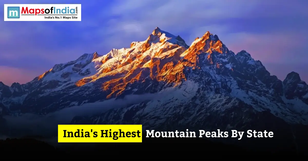
India's overall highest peak is Kangchenjunga (8,586 m) in Sikkim — the world's third-highest mountain. Among Himalayan states, Uttarakhand's Nanda Devi (7,817 m) and Himachal Pradesh's Reo Purgyil (6,816 m) rank among the tallest, while southern states like Kerala (Anamudi, 2,695 m) top out much lower via the Western Ghats.
Highest Peak in Every Indian State
| State | Peak Name | Elevation (m) | Mountain Range |
| Sikkim | Kangchenjunga | 8586 | Himalaya (India–Nepal border) |
| Uttarakhand | Nanda Devi | 7816 | Garhwal Himalaya |
| Arunachal Pradesh | Kangto | 7090 | Eastern Himalaya |
| Himachal Pradesh | Reo Purgyil | 6816 | Western Himalaya |
| West Bengal | Sandakphu | 3636 | Singalila Ridge, Eastern Himalaya |
| Nagaland | Mount Saramati | 3826 | Purvanchal Range |
| Manipur | Mount Iso (Tempu) | 2994 | Naga Hills, Purvanchal Range |
| Kerala | Anamudi | 2695 | Western Ghats |
| Tamil Nadu | Doddabetta | 2637 | Nilgiri Hills, Western Ghats |
| Mizoram | Phawngpui (Blue Mountain) | 2157 | Lushai Hills |
| Meghalaya | Shillong Peak | 1965 | Khasi Hills |
| Assam | Unnamed peak (Laike) | 1960 | Barail Range, Dima Hasao |
| Karnataka | Mullayanagiri | 1930 | Western Ghats |
| Rajasthan | Guru Shikhar | 1722 | Aravalli Range |
| Andhra Pradesh | Arma Konda | 1680 | Eastern Ghats |
| Odisha | Deomali | 1672 | Eastern Ghats |
| Maharashtra | Kalsubai | 1646 | Western Ghats (Sahyadri) |
| Haryana | Karoh Peak | 1467 | Sivalik Hills |
| Jharkhand | Parasnath | 1365 | Chota Nagpur Plateau |
| Madhya Pradesh | Dhupgarh | 1352 | Satpura Range |
| Chhattisgarh | Gaurlata (Bailadila) | 1276 | Bailadila Range |
| Gujarat | Girnar | 1069 | Girnar Hills |
| Goa | Sonsogor | 1022 | Western Ghats |
| Punjab | Unnamed peak (Rupnagar) | 1000 | Sivalik Hills |
| Uttar Pradesh | Amsot Peak | 945 | Sivalik Hills (Rajaji Range) |
| Telangana | Doli Gutta | 965 | Deccan Plateau |
| Tripura | Betlingchhip (Thaidawr) | 930 | Jampui Hills |
| Bihar | Someshwar point | 880 | Someshwar Range, Kaimur Hills |
Highest Peaks in Himalayan States
Sikkim– Kangchenjunga
At 8,586 meters, Kangchenjunga lies on the border between Sikkim and Nepal. It is the third-highest mountain in the world. Local traditions hold it as sacred, so climbers do not reach the summit. This agreement has long been respected by mountaineers.
Uttarakhand– Nanda Devi
Rising to 7,816 meters in the Garhwal Himalaya, Nanda Devi is the peak entirely within Indian territory. Before Sikkim joined India in 1975, Nanda Devi was considered the highest mountain in the country.
Arunachal Pradesh– Kangto
Standing at about 7,090 meters, Kangto is near the China border in the Eastern Himalaya. Its remote and restricted location makes it one of the least climbed peaks in India.
Himachal Pradesh– Reo Purgyil
At 6,816 meters, Reo Purgyil lies in the Kinnaur district along the Himachal-Tibet border. It belongs to the Zanskar Range in the Western Himalaya.
Jammu & Kashmir / Ladakh
K2, at 8,611 meters, is the second-highest mountain in the world. It lies in the Karakoram Range. It is currently administered by Pakistan. However, India includes it in lists based on historical boundaries. Within areas under control, the tallest point is in the Siachen Glacier region of Ladakh. Peaks like Saltoro Kangri exceed 7,700 meters.
Highest Peaks in North-Eastern States
Nagaland– Mount Saramati
At 3,826 meters, Saramati is the highest point in the Purvanchal Range. It sits directly on the border between Nagaland and Myanmar.
Manipur, Mizoram, Meghalaya, Tripura, Assam
Manipur’s highest point is Mount Iso, also known as Tempu, at 2,994 meters in the Naga Hills. Mizoram’s Phawngpui, or Blue Mountain, reaches 2,157 meters. It is central to a national park. Meghalaya’s Shillong Peak stands at 1,965 meters overlooking the capital city. Tripura’s Betlingchhip, in the Jampui Hills, rises to 930 meters. Assam’s highest point is 1,960 meters in the Barail Range of Dima Hasao district, sometimes locally called Laike Peak.
Highest Peaks in Southern & Western Ghats States
Kerala– Anamudi ( peak in South India)
At 2,695 meters, Anamudi in the Anamalai Hills is the tallest peak south of the Himalayas. It is also the highest point in the entire Western Ghats range.
Tamil Nadu– Doddabetta
Standing at 2,637 meters in the Nilgiri Hills near Ooty, Doddabetta is a popular tourist spot with an observatory at its top.
Karnataka– Mullayanagiri
At 1,930 meters near Chikkamagaluru, this peak in the Western Ghats is a known trekking destination.
Maharashtra– Kalsubai
At 1,646 meters in the Sahyadri range, Kalsubai is the highest point in Maharashtra. It is a favourite weekend trek for people from Mumbai and Pune.
Highest Peaks in Central, Eastern & Plains States
Madhya Pradesh– Dhupgarh
At 1,352 meters in the Satpura Range near Pachmarhi, Dhupgarh is known for its sunset views over the Mahadeo Hills.
West Bengal– Sandakphu
Reaching 3,636 meters on the Nepal border, Sandakphu is the highest point in West Bengal. On clear days, it offers views of four of the world’s five highest mountains.
Odisha– Deomali
At 1,672 meters in the Eastern Ghats, Deomali is the highest point in Odisha. It is located near Koraput.
Haryana, Rajasthan, Gujarat and other lower-relief states
Haryana’s Karoh Peak stands at 1,467 meters in the Sivalik foothills. Rajasthan’s Guru Shikhar reaches 1,722 meters and tops the Aravalli Range, which is India’s oldest mountain system. Gujarat’s Girnar rises to 1,069 meters. It is both a geological landmark and a pilgrimage site. Elsewhere, Jharkhand’s Parasnath reaches 1,365 meters, Chhattisgarh’s Gaurlata stands at 1,276 meters; Punjab’s unnamed Sivalik peak is 1,000 meters, Uttar Pradesh’s Amsot Peak is 945 meters; Telangana’s Doli Gutta is 965 meters, and Bihar’s Someshwar point is 880 meters. All these points are relatively low compared to those in the regions.
How These Peaks Compare– Highest vs. Lowest State Peaks
The difference is huge. Sikkim’s Kangchenjunga, at 8,586 meters, towers ten times higher than Bihar’s highest point at 880 meters. Within the Himalayan belt, elevation drops sharply as you move east to west and north to south. Arunachal Pradesh and Uttarakhand have peaks over 7,000 meters. Northeastern states like Tripura and Assam, despite being hilly, barely reach 2,000 meters. South of the Vindhyas, no state peak exceeds 2,700 meters because the Western and Eastern Ghats do not reach the scale of the Himalayas.
Mountain Ranges Behind India's State Peaks
Every state high point traces back to one of seven major mountain systems:
- Himalayas- (Sikkim, Uttarakhand, Himachal Pradesh, Arunachal Pradesh, West Bengal)
- Karakoram- (Jammu & Kashmir Ladakh)
- Western Ghats- (Kerala, Tamil Nadu, Karnataka, Maharashtra, Goa)
- Eastern Ghats- (Andhra Pradesh, Odisha)
- Vindhya-Satpura ranges- (Madhya Pradesh)
- Aravalli Range (Rajasthan) and
- Purvanchal Range- (Nagaland, Manipur, Mizoram, Tripura).
Conclusion
India's state high points show a rise in elevation. From Kangchenjunga’s 8,586 meters in the Himalayas down to modest plateau and plains peaks under 1,000 meters in states like Bihar and Tripura. This pattern matches the country’s geology closely. States that touch the Himalayas or Karakoram dominate the top of the list. The Western Ghats, Eastern Ghats, Aravallis and Chota Nagpur Plateau support the remaining peaks.
FAQs
1. What is the highest mountain peak in India?
Kangchenjunga, at 8,586 meters on the border between Sikkim and Nepal. The world’s third-highest mountain.
2. Which state has the lowest highest point in India?
Bihar, whose highest point near the Someshwar Range in the Kaimur Hills reaches about 880 meters.
3. What is the highest peak in South India?
Anamudi, at 2,695 meters in Kerala’s Anamalai Hills. Also the highest point in the Western Ghats.
4. Which Indian state has the most peaks above 6,000 m?
Himachal Pradesh. Its Kinnaur and Lahaul-Spiti districts alone contain more than a dozen peaks above 6,000 meters, including Reo Purgyil, Gya and Leo Pargial.
5. Is Kangchenjunga fully in India?
No. Kangchenjunga lies directly on the India-Nepal border. Its summit and main massif are shared between Sikkim and Nepal’s Taplejung district.