Imagine sitting in a café, shopping in a local store or standing outside a house, only to discover that an international border passes directly through the building. In most places, national borders are marked by fences, rivers, mountains or checkpoints. But in Baarle, a small town in Europe, the boundary between Belgium and the Netherlands runs through streets, homes, shops and other buildings, creating one of the world's most unusual geographical arrangements.
Baarle is famous for its complicated patchwork of national territories, where Belgian enclaves are surrounded by Dutch land and, in some cases, Dutch territory is found within those enclaves. The result is a fascinating border landscape in which two countries coexist within a single urban settlement. This unusual arrangement is not a modern experiment but the outcome of centuries of land agreements, inheritance and historical territorial claims.
Where Is Baarle Located?
Baarle is situated in the Belgian-Dutch border region in northern Europe. It is commonly associated with two municipalities: Baarle-Hertog in Belgium and Baarle-Nassau in the Netherlands.
Baarle-Hertog is the Belgian municipality, while Baarle-Nassau is its Dutch neighbour. Although they belong to separate countries, their territories are interwoven so closely that the boundary can pass between adjoining buildings or through a single property.
The area is located in the province of Antwerp in Belgium and the Dutch province of North Brabant. Its position near the international border makes it an interesting destination for visitors curious about geography, political boundaries and European history.
Unlike a conventional border town with a clear dividing line at its edge, Baarle has an irregular network of territorial boundaries running through its built-up areas. Visitors can walk through the settlement and cross between Belgium and the Netherlands several times without travelling any significant distance.
Why Does the International Border Pass Through Buildings?
The unusual border pattern in Baarle developed over many centuries, when European territories were divided according to complex feudal arrangements, land grants and agreements between rulers.
During the medieval period, different lords and noble families controlled separate pieces of land in the region. These holdings were not always arranged as large, continuous territories. Instead, ownership could consist of scattered parcels surrounded by land controlled by other authorities.
Over time, the historical claims of the rulers who controlled these parcels developed into the territorial boundaries that distinguish Baarle-Hertog from Baarle-Nassau today.
Belgian territory in the area consists of several separate enclaves surrounded by Dutch territory. Some of these Belgian enclaves also contain smaller Dutch enclaves, creating an especially complicated geographical pattern.
When modern Belgium became independent from the Netherlands in 1830, the two countries inherited a border arrangement that was difficult to simplify. Later agreements and boundary surveys helped establish the international frontier, but the historical pattern of enclaves largely remained.
Rather than redraw the entire region into two simple blocks, the countries retained the unusual arrangement. This is why the border continues to pass through ordinary residential and commercial areas.
How Many Enclaves Are There in Baarle?
Baarle is widely recognised for its remarkable collection of enclaves. Baarle-Hertog comprises 22 Belgian enclaves in and around the Dutch municipality of Baarle-Nassau. Some of these Belgian territories contain smaller Dutch enclaves.
The Netherlands also has territory that lies within Belgian enclaves, producing a nested arrangement of international boundaries. This makes the area's territorial map look more like a puzzle than a conventional national border.
An enclave is a territory that is completely surrounded by the territory of another country. When a country's territory is separated from its main national territory and surrounded by another country, it can also be described as an exclave from the perspective of the country to which it belongs.
In Baarle, these geographical concepts become visible in everyday life. A small plot of land, a house or even part of a building may belong to a different country from the surrounding streets.
The complicated arrangement is particularly interesting to geographers because it demonstrates that international borders do not always follow natural features or straight lines.
Houses and Shops Divided by an International Border
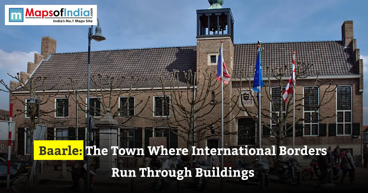
One of Baarle's most famous features is the way the international boundary crosses buildings. In some locations, a property can extend across Belgian and Dutch territory, meaning that different parts of the same building may fall under different national jurisdictions.
The boundary is often marked on the ground with small crosses, special pavement markers or other visible signs. These markings allow residents and visitors to see exactly where one country's territory ends and the other's begins.
Some buildings display national flags or house-number plates that help identify which country they belong to. The arrangement can be especially confusing for first-time visitors, who may find themselves standing in Belgium while the next section of the same building is in the Netherlands.
Historically, the precise location of the border could influence practical matters such as taxation, property registration and administrative responsibilities. Modern rules and cooperation between the two countries have made daily life more manageable, but the border remains a defining characteristic of the town.
Baarle demonstrates how political geography can intersect directly with architecture and urban planning.
Does the Border Affect Daily Life in Baarle?
Despite its complicated territorial map, Baarle functions as a connected community. Residents from both sides share streets, services, businesses and many aspects of everyday life.
However, the international boundary still matters. Belgian and Dutch authorities retain responsibility for their respective territories, and national laws and administrative systems apply according to the location of a property or activity.
In situations where a building crosses the border, the relevant rules may depend on the specific legal arrangements and the location of the activity. Historically, some practical matters were handled through local conventions designed to reduce inconvenience for residents and businesses.
The town's close relationship between its two municipalities also makes cooperation essential. Infrastructure, public services, tourism and local planning require coordination across an international boundary that is unusually intricate.
For visitors, the border is often more of a curiosity than an obstacle. There are no conventional international checkpoints at every crossing, and people can move around the town freely under the normal rules that apply within the Schengen Area.
Why Is Baarle a Popular Tourist Attraction?
Baarle attracts visitors because it offers an experience that is difficult to find elsewhere. Instead of viewing an international border from a distant observation point, visitors can see it marked across ordinary pavements, residential streets and building entrances.
Walking tours allow people to explore the boundary and understand how the enclaves fit together. The border markings also provide opportunities for photographs, particularly where a single building appears to belong to two countries at once.
Beyond its geographical novelty, Baarle has cafés, shops, restaurants and a local atmosphere shaped by Belgian and Dutch influences. Visitors can experience aspects of both countries without travelling between distant cities.
The settlement is especially appealing to geography enthusiasts, history lovers and travellers interested in unusual places. Its compact layout makes it possible to explore several border crossings during a single visit.
What Makes Baarle Important for Geography?
Baarle provides a real-world example of how political boundaries are shaped by history rather than geography alone. Many international borders follow rivers, mountain ranges or surveyed lines, but Baarle's boundary reflects centuries of territorial agreements and inherited land ownership.
Its enclaves demonstrate that a country's territory does not always form one continuous area. They also illustrate the difference between political borders on a map and the way those boundaries operate in people's everyday lives.
The town is a reminder that borders are human-made arrangements that can persist long after the political circumstances that created them have changed.
Conclusion
Baarle is one of Europe's most fascinating border settlements because the international boundary between Belgium and the Netherlands runs through the heart of its built environment. Its unusual pattern of enclaves, divided buildings and marked pavements reflects centuries of territorial history.
Although the border creates a complicated map, residents have developed ways to live and work within this arrangement. Today, Baarle stands as a distinctive example of how history, politics and geography can combine to produce a town unlike almost any other in the world.
FAQs
1. Where is Baarle, the town divided between Belgium and the Netherlands?
Baarle is located in Western Europe along the border between Belgium and the Netherlands. It consists of two municipalities, Baarle-Hertog in Belgium and Baarle-Nassau in the Netherlands, whose territories are interwoven in an unusual pattern of international enclaves.
2. Why does the international border run through buildings in Baarle?
The international border runs through buildings in Baarle because of medieval land agreements, historical property ownership and territorial divisions. These boundaries were preserved when modern national borders were established, leaving Belgian and Dutch territories mixed within the same settlement.
3. How many enclaves are there in Baarle?
Baarle is known for its complex arrangement of 30 enclaves: 22 Belgian enclaves belonging to Baarle-Hertog and eight Dutch enclaves belonging to Baarle-Nassau. Some Dutch enclaves are located within Belgian enclaves, creating an unusual geographical puzzle.
4. How do people live in houses divided by the Belgium-Netherlands border?
People in Baarle live relatively normal lives despite the unusual border arrangement. Special markings identify the international boundary, and the location of a building's main entrance generally helps determine which country it belongs to for administrative purposes. Cooperation between local authorities helps residents manage everyday activities.
5. Do residents of Baarle need passports to cross the border?
Residents and visitors generally do not need passports to move between the Belgian and Dutch parts of Baarle because both countries belong to the Schengen Area. However, travellers must comply with applicable identification requirements and any temporary border controls.
6. Which country does a house belong to if the border passes through it?
When a house in Baarle crosses the international border, the country in which its main entrance is located generally determines its official national classification. This principle, commonly known as the front-door rule, helps establish the property's administrative jurisdiction.
7. Why is Baarle famous among tourists and geography enthusiasts?
Baarle is famous for its unusual international borders, numerous enclaves and buildings that span Belgium and the Netherlands. Visitors can follow border markings across streets and pavements, explore local attractions and experience elements of both countries in one connected settlement.