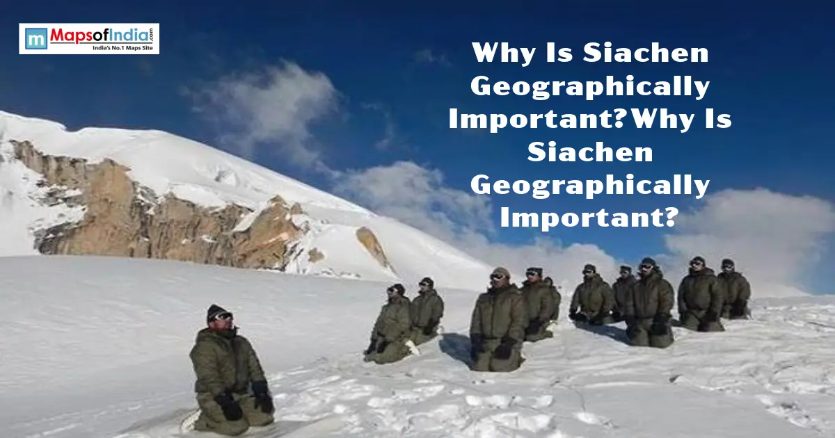
Soldiers here fight the cold more than each other. Siachen Glacier sits at the top of the world, quite literally, widely regarded as the world’s highest active military zone. But Siachen's geographical importance goes well beyond soldiers and altitude records. It's a water source, a strategic chokepoint, and a genuinely fragile piece of the planet's climate system, all rolled into one remote stretch of ice. Let's look at location, strategy, climate, and the geopolitics that keep this place in the headlines.
Quick Facts About Siachen Glacier
Fact | Detail |
| Location | Eastern Karakoram Range, Ladakh |
| Length | Approximately 76 km (70 km measured from Indira Col) |
| Altitude | 5,753 m at its head, down to 3,620 m at its terminus |
| Mountain Range | Karakoram, bordered by the Saltoro Ridge |
| Nearest Countries | India, Pakistan, China (all in proximity) |
| Status | Administered by India since 1984, claimed by Pakistan |
Where Is Siachen Glacier Located?
Position in the Karakoram Range
Siachen sits in the eastern Karakoram, sandwiched between the Saltoro Ridge to the west and the main Karakoram Range to the east. It's the longest glacier in the entire Karakoram system, and the second-longest non-polar glacier anywhere on Earth, behind only Tajikistan's Fedchenko Glacier.
Proximity to India, Pakistan, and China
This is exactly what makes the location so sensitive. Siachen sits close to Pakistan-administered Gilgit-Baltistan on one side, and China's Xinjiang region on the other. The glacier lies in a strategically sensitive region near India, Pakistan-administered areas, and China.
Geographical Significance of Siachen
Source of the Nubra River
Meltwater from Siachen feeds the Siachen River, which flows into the Nubra River, then the Shyok, eventually joining the wider Indus River system. That makes the glacier a genuine, if distant, contributor to water security across the region.
Gateway Between Ladakh and Central Asia
Historically, this stretch of terrain formed part of a corridor linking Ladakh toward Central Asia, relevant to old trade and travel routes crossing some of the world's most difficult mountain passes.
Karakoram Pass and Trade Route History
The nearby Karakoram Pass once carried real trade traffic between South and Central Asia. The wider region has long had strategic and historical importance because of its location near major mountain passes and routes.
Strategic and Military Importance
Control Over the Saltoro Ridge
India's control of the Saltoro Ridge, secured through Operation Meghdoot in 1984, means holding the high ground over the entire glacier system, including the key passes of Sia La, Bilafond La, and Gyong La.
Overlooking Access to Ladakh and Aksai Chin
Control of these heights provides an important strategic position overlooking surrounding approaches in the Ladakh region, an area of real, ongoing significance given the region's broader border sensitivities involving both Pakistan and China.
Why Is It Called the World's Highest Battlefield?
Soldiers here operate above 18,000 feet in some sectors, facing temperatures that can plunge to minus 40°C or lower. Many fatalities have resulted from avalanches, extreme cold, altitude-related illness, and other harsh environmental conditions rather than direct combat.
Climatic and Environmental Importance
Glacier as a Freshwater Reserve
Siachen sits within what scientists sometimes call the "Third Pole," a broader high-mountain region of Asia containing extensive freshwater stored in glaciers and snow outside the polar regions.
Impact of Climate Change on Siachen
Changes in snowfall, snowmelt, and glacier conditions associated with broader climate change can affect the stability and hazards of high-altitude environments, even as temperatures there remain brutally cold by any ordinary standard.
Ecological Sensitivity of the Region
Decades of military activity have raised concerns about waste and its potential impact on the fragile high-altitude environment and downstream ecosystems, a genuine environmental cost layered on top of the human one.
Geopolitical Importance
The Line of Control and AGPL
India and Pakistan's Line of Control officially ends at a point known as NJ9842. Beyond that point, the boundary was never clearly demarcated, contributing to differing interpretations of the boundary and the territorial status of the region. India and Pakistan instead maintain what's called the Actual Ground Position Line, or AGPL, marking where each side's forces currently sit.
Operation Meghdoot Overview
India launched Operation Meghdoot in April 1984, establishing military positions in the Siachen region and securing key passes. The operation is widely regarded as a significant logistical and military achievement, given the extreme altitude and conditions involved, and India maintains military control over the area, while Pakistan continues to claim the territory.
Why the Region Remains Contested?
The dispute traces back to ambiguity in the 1972 Simla Agreement, which defined the Line of Control only up to NJ9842 and did not clearly demarcate the boundary beyond that point, contributing to differing interpretations. India and Pakistan have held opposing positions on the boundary ever since, and the area remains one of the most militarily sensitive, high-altitude standoffs anywhere in the world.
Why Siachen Matters Beyond Military Strategy?
Scientists view Siachen as a genuinely valuable site for glaciology and climate research, given its scale and its role in the broader Himalayan freshwater system. Some limited tourism and trekking interest has also grown around the wider Nubra Valley region in recent years, drawn by the area's sheer, dramatic scale. And as climate monitoring becomes more urgent globally, glaciers like Siachen offer real, measurable data on how quickly high-altitude ice systems are actually changing.
Conclusion
Siachen isn't important for just one reason. It's a water source fringing straight into the Indus system, a genuine strategic chokepoint near three major powers, and one of the most extreme, closely-watched environments on the planet, all layered into a single, remote stretch of ice. Whatever happens politically in the years ahead, its geography alone guarantees it stays significant.
FAQs
Where is Siachen Glacier located?
In the eastern Karakoram Range, within the Ladakh region, close to where India, Pakistan, and China's borders all converge.
Why do India and Pakistan fight over Siachen?
The dispute stems from an undefined boundary beyond a point called NJ9842, which was not clearly demarcated in the 1972 Simla Agreement. India moved to secure the glacier through Operation Meghdoot in 1984, and both countries have maintained a military presence in the area since.
What is the altitude of Siachen Glacier?
It ranges from about 5,753 metres at its head near Indira Col down to roughly 3,620 metres at its lower end, with military posts stationed well above 18,000 feet in several sectors.
Is Siachen the highest battlefield in the world?
Yes, it's widely recognized as the world's highest active military zone, with troops stationed at altitudes few permanent military postings anywhere else reach.
How cold does it get in Siachen?
Winter temperatures typically range from minus 20 to minus 40 degrees Celsius, with extreme conditions reported as low as minus 60 degrees Celsius in the harshest stretches.
How long is the Siachen Glacier?
Approximately 76 kilometres measured along its longest route, or about 70 kilometres measured directly from Indira Col, making it one of the longest glaciers in the Karakoram Range.
What river system does Siachen feed into?
Meltwater flows into the Siachen River, then the Nubra River, followed by the Shyok River, eventually joining the wider Indus River system.
Has climate change affected Siachen Glacier?
Yes. Changes in snowfall, snowmelt, and glacier conditions associated with broader climate change can affect the glacier and the hazards faced in its high-altitude environment, adding to the existing risks from avalanches and extreme weather.