A two-dimensional image of a planet is a world map. It depicts lands, seas and countries simply. For example, it employs such approaches as Mercator or Robinson to appear correct. We get to know more about the Earth through these maps. And there are years of people going around exploring the world. OK, what makes a world map cool, its types, features, and why is our map fantastic to kids, travellers and curious people?
What Is A Map of the World?
The world map places the Earth on a flat surface. It presents lands, seas, and country lines. For example, it is accurate due to special techniques like Mercator. Earlier, maps were primitive since people did not know too much about the Earth. However, by the 1700s, the majority of coastlines were mapped. Later on, remote locations were even charted by the 1900s. Nowadays, it is easy to learn about places with the help of world maps.
The Reason World Maps are Cool
We learn about our planet with the help of world maps. They depict such things as mountains, rivers and cities. They also assist you in locating where people speak various languages or where earthquakes occur. For example, one may work out travel programs with the help of a world map or learn some interesting facts. Therefore, they are excellent in school, on the road, or even the world.
Types of World Maps
World maps are of various types. Every one of them has a particular task. The principal ones are the following:
-
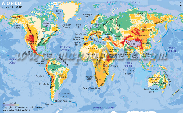
Physical Map
Natural features of the Earth are depicted on physical maps. As an example, they depict mountains, rivers and flat land. Colors indicate areas of high or low elevations. As an illustration, green represents the lowlands, and brown represents the mountains. Therefore, these maps enable you to visualize the cool forms of the Earth. -
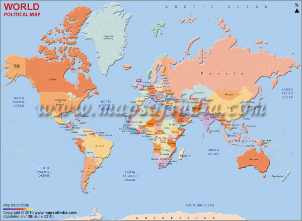
Political Map
The political map of the world indicates the boundaries of states. It points out cities and capital places. An example is that it depicts the origins and ends of countries. Consequently, individuals access it to get to know about other destinations. -
Latitude and Longitude Map
This map locates places through the use of lines. In particular, any global location can be identified with latitude and longitude lines. For example, you may find a city or an island. Thus, it is perfect for navigation. -
River Map
The world river map is used to illustrate big rivers. Rivers cause lands to appear differently, and they benefit plants and animals. They also aid in the farming or trading of people. Thus, this map indicates the locations of river flow. -
Weather Map
Weather maps depict such things as rain, heat, or wind. For example, they inform you about the locations where storms may occur. Besides, they aid in making people speculate the weather. Consequently, through these maps, we are prepared and safe. -
Historical Map
Ancient maps depict the Earth in the past. For example, they depict ancient country lines or metropolises. Thus, people and history enthusiasts apply them to observe how the world transformed.
Characteristics of the World Map
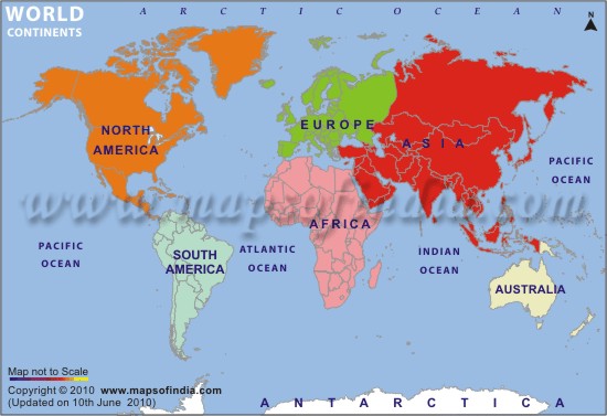
The Earth has essential parts, as seen on the world maps. By way of example, they name the seven continents, in descending order of size:
- Asia
- Africa
- North America
- South America
- Antarctica
- Europe
- Oceania (Australia)
- Pacific Ocean
- Atlantic Ocean
- Indian Ocean
- Arctic Ocean
- Southern Ocean
Why Choose Our World Map?
We also have an accurate, uncluttered and usable world map. This is why it is so great:
- Real Clear Images - Our maps have clear, light images. For example, you can quickly notice all country lines, names of rivers or cities. They may also be saved as PDFs. The sharp pictures make everything, school, work or play. Our maps thus suit everybody.
- Cool Click-and-Zoom Features - Ours are photograph-free maps. In particular, you can click and zoom to view more. This can be seen by looking at how many people are in a location or where the roads are. You don't feel alone, like you have a tour partner. Besides, these characteristics make learning very entertaining.
- Being a student is dope - The school has a marvellous geographical map. For example, children can get acquainted with different cultures, lands or seas. Teachers have utilized it to describe big ideas. It also displays such things as mountains or ancient places. Consequently, it is ideal among children, adults and educators.
- Nevertheless, on the Edge - We make our maps up to date. For example, when country lines are changed or new roads are constructed, we add them quickly. Thus, you always have the current information about trips, school work, or exploration. So our maps are super trustworthy.
- Cool World Map Topics -
There are loads of fun things in our world map collection.
- Physical World Map: Gives mountains, rivers, and plains.
- World Continent Map: In this, there is a map depicting the seven continents.
- World Climate Map: The weather is denoted as rain or warmth.
- World Population Density Map: reveals places of wastefulness, such as cities.
- World Time Zone Map: Will assist you in knowing the time in the world.
- World Map Kids: Both easy and fun to learn for young children.
- World Elevation Map: This maps the high and lowlands.
- World Tectonic Plates Map: It is a map showing where earthquakes are likely to occur.
- World Desert Map: Areas that are deserts, like the Sahara, are tagged.
- World Religion Map: It represents the place of persons holding different beliefs.
- World Language Map: A map that displays the distribution of languages.
- World Oceans Map: Five big oceans are depicted on this map.
- Poorest Countries on Earth: The map shows where there is little money.
- World satellite Map: It lets you see the Earth from space.
- World Map of Countries and Capitals: It shows you a list of Countries Capitals of the entire World.
FAQs
Q1: How frequently do you update the world maps?
To display new country lines or roads, we update them very frequently.
Q2: Is the world map helpful in the classroom?
Totally! It is fantastic with kids, educators and learners.
Q3: Is a world map applicable to travel?
It assists in route planning, city search and familiarity with places.
Q4: Does it show maps of specific locations?
We have maps of the continents, countries or smaller places.
More than a picture, our world map is. Learning, exploring, and planning are fun in this way. You can use our maps whether you are a school kid, a traveler or even curious. They are ideal for all as they have sharp pictures, fun click and zoom capabilities and fresh updates. For example, you may learn about seas, mountains, or the habitation of people. So our world map is here and we are prepared to view the world!
Last Updated on : January 20, 2026


