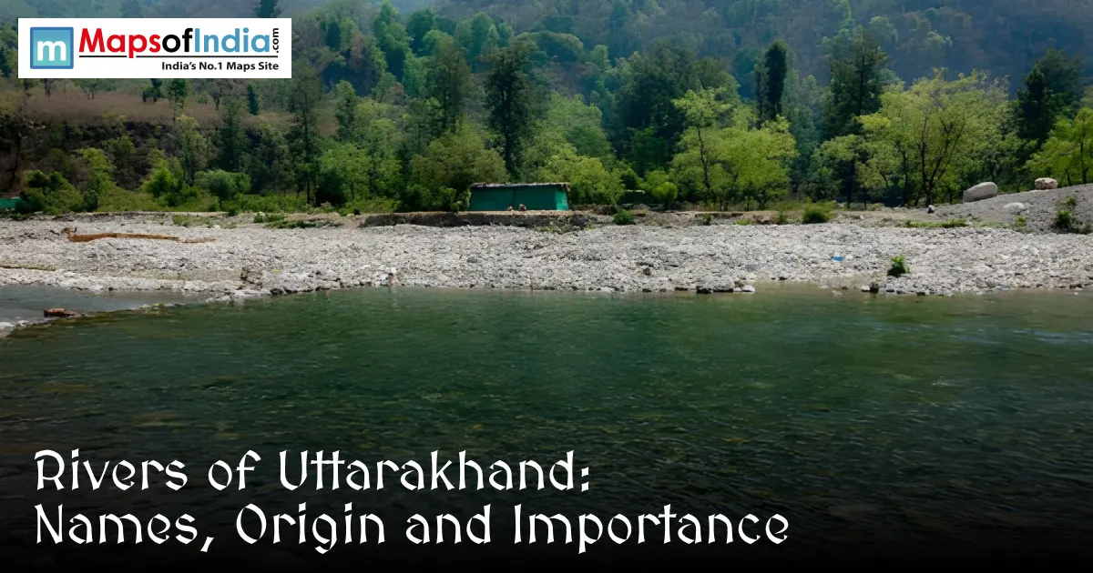
Uttarakhand, nestled amongst the folds of the Himalayas, is the source of rivers that are an integral part of the lives of Indians. The source of the flows is the pristine ice and mountain air of Devbhoomi. These waters are nourished by snowy peaks; out of their rocky paths, they flow with nutrition to far-off places. They are not only currents, but they are a way to feed in faith, landscape, and community. It is silent at the start of the Ganga; it becomes robust, and the Yamuna gracefully takes a meander through wild valleys. They affect a lifestyle, a mode of agriculture, a style of transportation, and even breathing habits. The following are the rivers of Uttarakhand:
Ganga
The origin of the Ganga is in the Himalayas, where the ice melts and gives birth to a new stream, which is worshipped throughout India. It flows from Uttarkashi through the hard rock of the Himalaya from the glacial melt at Gangotri. The Bhagirathi joins the Alaknanda at Devprayag through ancient cliffs. Pilgrims come from faraway places owing to their faith and visit the town of Haridwar every year. In the morning, the sun rises, and the prayers ascend from the sand of Rishikesh. On the sand of Rishikesh, prayers rise with the sun. From the mountains down to the sea, the river waters the farms, moves through homes and draws in visitors. It moves as a quiet faith, slow and strong, and makes all it touches upon the earth's surface.
Yamuna
The birthplace of the Yamuna is the Yamunotri Glacier, located in the high reaches of the Garhwal Himalayas. Apart from one other large river, it is the largest among the tributaries that branch out from the Ganga River. It goes through rocky terrain, cutting through Uttarakhand on its way down to the flatlands. Hindus make four pilgrimages, including the shrine of Yamunotri, which is close to the place where the ice melts into water. Mythology has it that she was born of sunlight itself and is the sister of Yama, the king of the dead. It springs clear from the high mountains; it waters the farms and forests of the land.
Alaknanda
The Alaknanda rises at a high altitude in Chamoli and has a good flow from the ice at Mana Pass. This wild stream runs through narrow valleys, through rock and pine. It grows from the glacier melt and is nourished by the cold streams that flow in the open sky. The Bhagirathi is named Ganga at the bend of Devprayag. The Alaknanda river flows through the mountain valleys, drives electricity power stations and attracts the rafters to its rapids. It is born high in the Himalayas, and joins another river to form the sacred Ganga, wild waters forming landscapes and livelihoods.
Bhagirathi
Bhagirathi is the beginning of the Ganga from the Gangotri Glaciers at Gaumukh; the beginning of the Ganga is believed to be here. It passes through the Garhwal region, where it carries its name after King Bhagirath, who, according to old legends, is credited with bringing the river from the heavens to earth. It is revered with reverence and visited at holy places such as Gangotri. A mythical form of flow; it is clear and loaded with meaning.
Mandakini
The Mandakini river flows from the Chorabari glacier, near Kedarnath, Rudraprayag district. Its crystal clear water and sharp drops of land made by time. It is very much related to Lord Shiva and is situated near the Kedarnath temple. The confluence of the rivers is at a place called Rudraprayag. There was a sudden rush of water in 2013, which resulted in deep marks in the land near Mandakini. It travels through one of the most hallowed areas of Hinduism and recounts stories as ancient as memory.
Pindar River
The source of the Pindar River lies at the fringes of the Pindari Glacier at high altitude in the Bageshwar district. It takes one of many routes that lead to Alaknanda. Beauty attracts, leading to icy slopes in the sky above her valley. Its waters irrigate farms, and its currents thrum through turbulent turbines. Pindar is important to the surrounding villages as much as the water from a pristine mountain that feeds people far away.
Tons River
The source of the Tons River is in the Himalayas in Garhwal at a glacier. This is a major arm of the Yamuna, which opens into the Yamuna far downstream. It snakes through wild areas, attracting those who want a wild experience on fast-flowing water. It is characterized by crystal-clear flow along the way. It is a dynamic element in the river system, with abundant life from its banks.
Kali (Sharda) River
The Kali River starts in Kalapani and flows through the hills of Pithoragarh. It is locally known as the Sharda and is the border between India and Nepal. Its currents are tapped by power stations, and farmers take water to water their fields. It has a significant tradition for those who live around it, particularly for the Kumaonis. It is not just a line on maps; it links common stories across lands.
Dhauliganga River
The Dhauliganga River flows from high within the Nanda Devi Biosphere Reserve, from near Chamoli, with the melting water of the Dhauliganga Glacier. It runs through rough land with clear blue water, through unspoiled hills and through hills. Although it is in a secluded place, away from the bustling surrounding towns, its electricity drives turbines at the Tapovan Vishnuprayag plant. It meanders through thinly veined ecosystems, entering valleys teeming with life. It is part of the extended Ganga and flows silently and coolly, forming the landscape and the faith on the sacred mountains.
Ramganga River
The Ramganga originates from the slopes of the Dudhatoli Hills of Pauri Garhwal. It is quite small initially, but grows strong as it passes through the territory of the Corbett National Park. It is a calm river, and plants and animals grow along its banks. It doesn't disappear in dry periods; it still eats crops and forests. This river keeps its flow going in winter, while many rivers cease to flow at that time. Like the roots that grow under the ground, it subtly connects mountain snowmelt to valley life.
How Rivers Shape Life in Uttarakhand
The rivers of Uttarakhand, in the valleys of which the farms and the power stations exist, influenced the beliefs as well. Not only that, they are home to a whole host of plants and animals on the mountain slopes. However, as temperatures increase, they gradually become weaker and weaker. Forests are disappearing in the vicinity, and building is occurring in an unplanned way, each with its own strain on these waters. Here, waterways carry life through mountains, memory. Protecting them is the next chapter in the lives of all who inhabit Devbhoomi.
FAQs
1. Which are the major rivers of Uttarakhand?
The major rivers of Uttarakhand include the Ganga, Yamuna, Alaknanda, Bhagirathi, Mandakini, Pindar, Tons, Kali (Sharda), Dhauliganga, and Ramganga.
2. Where does the Ganga River originate in Uttarakhand?
The Ganga originates from the Gangotri Glacier near Gaumukh in Uttarakhand. The Bhagirathi and Alaknanda rivers meet at Devprayag, where the river officially takes the name Ganga.
3. What is the origin of the Yamuna River?
The Yamuna River originates from the Yamunotri Glacier in the Garhwal Himalayas of Uttarakhand and is one of the most important tributaries of the Ganga.
4. Why are the rivers of Uttarakhand important?
The rivers of Uttarakhand provide drinking water, irrigation, hydroelectric power, support biodiversity, promote tourism, and hold immense religious and cultural significance.
5. Which river forms the India–Nepal border?
The Kali River, also known as the Sharda River, forms a major part of the international border between India and Nepal.
6. Where do the Alaknanda and Bhagirathi rivers meet?
The Alaknanda and Bhagirathi rivers meet at Devprayag in Uttarakhand, where they merge to form the Ganga.
7. Which river flows near the Kedarnath Temple?
The Mandakini River flows near the Kedarnath Temple and is considered sacred due to its association with Lord Shiva.