The Political Map of India represents the country's administrative boundaries, showing all states, union territories, and their capitals. Whether you're a student preparing for exams, a teacher creating study material, a traveller planning a trip, or simply looking for an updated India political map, understanding the country's political divisions is essential.
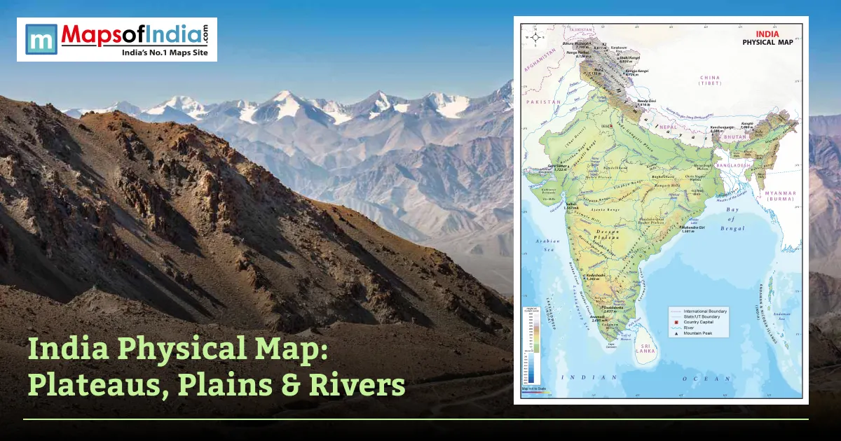
A political map emphasizes state and national boundaries, capitals, and landforms, whereas a physical map emphasizes mountains, rivers, and landforms. In July 2026, there are 28 states and 8 union territories in India. It is a guide to the political map of India, with lists of states and capitals, regional division of India, neighbouring countries, changes in the political map of India and answers to some of the most common questions.
What Is a Political Map of India?
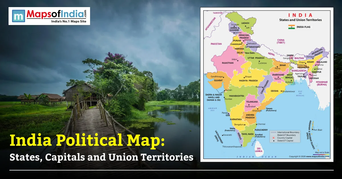
A political map of India is a map that shows the administrative divisions of India, such as the states, union territories, national capital, state capitals and international boundaries. One of the most popular reference maps in schools, Government offices, competitive examinations, and research.
A political map is a map that shows man-made features like boundaries and administrative areas, while a physical map shows natural features like mountains, rivers, plateaus and deserts. It will enable users to know the location of all States and Union territories, regional divisions, and the capitals.
Currently, India has 28 states and 8 Union Territories of India as of July 2026. This article contains an updated political map overview, states/capitals table, regional classifications, neighbouring countries table, an administrative history and frequently asked questions for quick reference.
India Political Map
The political map displays:
- Boundaries of all 28 states and 8 union territories
- State and UT capitals
- National capital (New Delhi)
- International boundaries
- Major neighbouring countries
- Arabian Sea, Bay of Bengal, and Indian Ocean
List of Indian States and Their Capitals
State | Capital | Region |
| Andhra Pradesh | Amaravati | South |
| Arunachal Pradesh | Itanagar | Northeast |
| Assam | Dispur | Northeast |
| Bihar | Patna | East |
| Chhattisgarh | Raipur | Central |
| Goa | Panaji | West |
| Gujarat | Gandhinagar | West |
| Haryana | Chandigarh | North |
| Himachal Pradesh | Shimla | North |
| Jharkhand | Ranchi | East |
| Karnataka | Bengaluru | South |
| Kerala | Thiruvananthapuram | South |
| Madhya Pradesh | Bhopal | Central |
| Maharashtra | Mumbai | West |
| Manipur | Imphal | Northeast |
| Meghalaya | Shillong | Northeast |
| Mizoram | Aizawl | Northeast |
| Nagaland | Kohima | Northeast |
| Odisha | Bhubaneswar | East |
| Punjab | Chandigarh | North |
| Rajasthan | Jaipur | North |
| Sikkim | Gangtok | Northeast |
| Tamil Nadu | Chennai | South |
| Telangana | Hyderabad | South |
| Tripura | Agartala | Northeast |
| Uttar Pradesh | Lucknow | North |
| Uttarakhand | Dehradun (Winter), Gairsain (Summer) | North |
| West Bengal | Kolkata | East |
List of Union Territories and Their Capitals
Union Territory | Capital |
| Andaman and Nicobar Islands | Port Blair |
| Chandigarh | Chandigarh |
| Dadra and Nagar Haveli and Daman and Diu | Daman |
| Delhi (NCT) | New Delhi |
| Jammu and Kashmir | Srinagar (Summer), Jammu (Winter) |
| Ladakh | Leh |
| Lakshadweep | Kavaratti |
| Puducherry | Puducherry |
Note: Delhi (National Capital Territory) and Puducherry have elected legislatures with special constitutional provisions, while the remaining union territories are administered by the Central Government through appointed administrators or lieutenant governors.
India's States by Region
North India
The regions of North India are Uttar Pradesh, Uttarakhand, Delhi (UT), Rajasthan, Haryana, Punjab, Himachal Pradesh and Jammu and Kashmir (UT). It also contains the Himalayas, the fertile Indo-Gangetic Plain, and some historic cities like Lucknow, Jaipur and Delhi. It is significant in the fields of agriculture, tourism, and government.
South India
South India includes Andhra Pradesh, Telangana, Karnataka, Kerala, Tamil Nadu, Puducherry, Lakshadweep and Andaman and Nicobar Islands. The area is characterized by a long coastline, information technology hubs, classical languages, temples and flourishing manufacturing and service sectors.
East India
Bihar, Jharkhand, Odisha and West Bengal are the main states of Eastern India. The area has abundant mineral resources and is of high agricultural and cultural value. Kolkata is an educational and commercial hub, whereas Odisha is well known for its temples and coastline.
West India
Dadra and Nagar Haveli and Daman and Diu, Gujarat, Maharashtra and Goa are part of West India. It is the country's most influential financial and industrial centre, with Mumbai being the financial capital of India and vital ports for international trade.
Northeast India
The northeastern region includes Arunachal Pradesh, Assam, Manipur, Meghalaya, Mizoram, Nagaland, Sikkim and Tripura. It is a region with high biodiversity, mountains, tea gardens and rich tribal culture, and it is connected to mainland India through the Siliguri Corridor.
Central India
Madhya Pradesh and Chhattisgarh are the main parts of Central India. This area is in the middle of the country with forests, wildlife reserves, minerals and major agricultural production.
India's International Borders and Neighbouring Countries
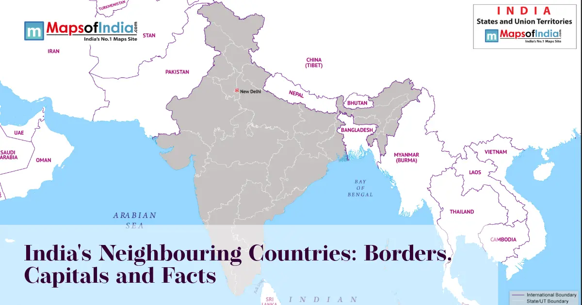
India shares land borders with seven countries:
Neighbouring Country | Indian States/UTs Sharing Border |
| Pakistan | Jammu & Kashmir (UT), Punjab, Rajasthan, Gujarat |
| China | Ladakh (UT), Himachal Pradesh, Uttarakhand, Sikkim, Arunachal Pradesh |
| Nepal | Uttarakhand, Uttar Pradesh, Bihar, West Bengal, Sikkim |
| Bhutan | Sikkim, West Bengal, Assam, Arunachal Pradesh |
| Bangladesh | West Bengal, Assam, Meghalaya, Tripura, Mizoram |
| Myanmar | Arunachal Pradesh, Nagaland, Manipur, Mizoram |
| Afghanistan | Ladakh (UT) (as shown on the official map of India) |
India also shares maritime boundaries with Sri Lanka, Maldives, Indonesia, Thailand, and Myanmar across surrounding seas.
How India's States Have Changed Over Time
The landscape of the Indian political map has changed greatly since gaining Independence.
States Reorganization Act, 1956
The States Reorganization Act was a reorganization of states, which was basically based on the language factor and had been organized on a more systematic basis throughout the country.
New States in 2000
Three new states were formed:
- Chhattisgarh (from Madhya Pradesh)
- Jharkhand (from Bihar)
- Uttarakhand (then Uttaranchal, from Uttar Pradesh)
Formation of Telangana (2014)
Telangana was created as the 29th state of India on 2nd June 2014 from the erstwhile state of Andhra Pradesh. Hyderabad was the interim capital of the state till the capital city Amaravati was established as the capital of Andhra Pradesh.
Reorganization of Jammu and Kashmir (2019)
On 31 October 2019, the former State of Jammu and Kashmir was reorganized into two union territories:
- Jammu and Kashmir
- Ladakh
Following this reorganization, India currently has 28 states and 8 union territories.
Conclusion
India's political map accurately displays all the Indian states, capitals, union territories, international borders and the administrative divisions of India. It acts as a crucial learning resource and reference for students, teachers, scholars and geographers. The administrative boundaries may be altered by law; therefore, for educational and reference purposes, the most up-to-date official political map should always be used.
FAQs
How many states and union territories does India have?
As of July 2026, India has 28 states and 8 union territories.
Which is the largest state in India by area?
Rajasthan is the largest state in India by area, covering approximately 342,239 square kilometres.
Which is the smallest state in India by area?
Goa is the smallest Indian state by area, covering about 3,702 square kilometres.
What is the difference between a state and a union territory?
States have elected governments with greater constitutional powers, while union territories are generally administered by the Central Government. However, Delhi and Puducherry have elected legislatures with special constitutional status.
Which states share a border with the maximum number of countries?
Arunachal Pradesh shares international borders with China, Bhutan, and Myanmar, making it one of the Indian states that borders the highest number of neighbouring countries.
Why is a political map important?
A political map helps identify administrative boundaries, state capitals, union territories, and international borders. It is widely used for education, governance, planning, examinations, and general reference.