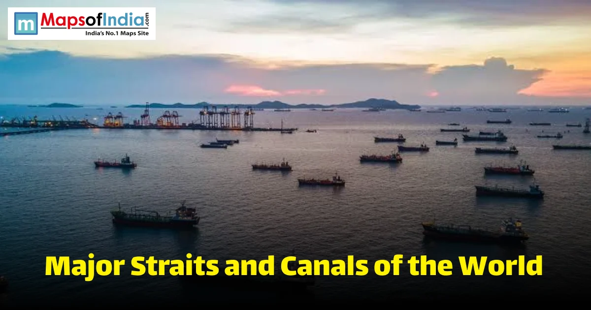
Global trade runs through water. Ships carry over 80% of the world's goods, and most of that traffic squeezes through a small number of narrow passages. These are the major straits and canals of the world, the arteries of global shipping and, often, the flashpoints of global politics. This guide covers what makes a strait different from a canal, the most important waterways on Earth, and why a single blockage or closure in one of them can shake markets everywhere. You will also find a comparison table and clear answers to the questions people search for most.
What Is a Strait and What Is a Canal?
A strait is a narrow strip of sea that forms naturally and joins two larger seas. It does not occur because of humans. On the contrary, canals are man-made artificial structures, in particular made for connecting bodies of water that would otherwise remain in isolation from each other.
Strait vs. Canal
Straits occur naturally over geological time. Canals are constructed by design, sometimes over a period of years or decades. Straits can vary hugely in width. From the beginning, canals are constructed with a given width and depth, according to the ships for which they are intended.
Why Straits and Canals Matter Globally?
A strait or canal can turn a months-long voyage into a matter of days. That single fact gives these waterways enormous economic power. It also makes them targets. Close one down, even briefly, and global trade feels it fast.
Straits and Canals as Global Trade Chokepoints
Analysts call these passages "chokepoints" for good reason. A small number of them carry a hugely disproportionate share of the world's trade and energy shipments. When one gets blocked or restricted, ships cannot simply reroute for free. They often face weeks of extra travel time and real added cost.
Major Straits of the World
Strait of Malacca
This strait runs between Malaysia and the Indonesian island of Sumatra. It connects the Indian Ocean to the Pacific Ocean. It is the busiest oil chokepoint on Earth by volume, carrying roughly 23 to 24 million barrels of oil per day, close to 29% of global seaborne oil trade. Over 50,000 vessels pass through it every year. It is also quite shallow in places, under 22 metres in some spots, which adds real navigational risk.
Strait of Hormuz
It's the part of the ocean that separates the countries of Iran and Oman, and connects the Persian Gulf and the Arabian Sea. It transports about 20 million barrels of oil every day, nearly 1/5 of the world's total oil consumption. The fact is that this strait has been effectively closed to the majority of commercial vessels since late February 2026, due to regional conflict, and a major update is needed here. Transits have been reduced from a normal level of approximately 88 vessels to a current level of barely the low teens per day. Since then, there have been several closures and re-openings. Don't think of a single day's status as a final decision.
Strait of Gibraltar
This strait connects the Atlantic Ocean to the Mediterranean Sea. It separates Spain from Morocco, marking the border between Europe and Africa at its narrowest point, only about 14 kilometres wide.
Bosphorus and Dardanelles Straits
Together with the Sea of Marmara between them, these two straits form the Turkish Straits. They link the Black Sea to the Aegean Sea. The Bosphorus runs directly through Istanbul, physically splitting the city between its European and Asian sides. A 1936 international treaty, the Montreux Convention, still governs how ships pass through today.
Bab-el-Mandeb Strait
This strait is located between Yemen and the Horn of Africa, and it links the Red Sea to the Gulf of Aden. It can transport about 4.2 million barrels of oil a day. The "Gate of Tears" is its nickname due to its historically dangerous currents and narrow passage.
Strait of Dover / English Channel
This is the narrowest point of the English Channel, separating England from France by roughly 33 kilometres. It is widely considered the busiest shipping lane in the world by sheer volume of vessel traffic, given how much traffic funnels through such a tight gap.
Palk Strait
This strait lies between India and Sri Lanka, between the Palk Bay and the Bay of Bengal. It is also relevant to Indian geography students and exam takers, taking into consideration its importance in the relationship between India and Sri Lanka in the field of maritime trade and also its nearness to Adam's Bridge, a chain of shoals that connects the two countries.
Bering Strait
The strait is the boundary between the coast of Alaska, U.S. and the coast of Russia in Siberia. It is about 82 kilometres wide at its narrowest and stretches from the Pacific Ocean to the Arctic Ocean. It is located near the International Date Line, which is almost 24 hours apart between the two coastlines.
Davis Strait
Baffin Bay is separated from the Labrador Sea by this strait, the strait between Greenland and Baffin Island. It is becoming an increasingly important subject in the conversation on future transport through the Arctic, given the changing sea ice conditions.
Strait of Magellan
It is located in the south of South America, between the continent of Chile and Argentina, and the Tierra del Fuego island. It is a waterway that leads ships around South America and bypasses the even rougher seas around the Cape Horn peninsula, connecting the Atlantic and Pacific Oceans. It was found in 1520 by Ferdinand Magellan's expedition.
Major Canals of the World
Suez Canal
The canal, which links the Mediterranean Sea to the Red Sea as it passes through Egypt, is 193 kilometres long and requires no locks. It was constructed in 1859-1869, and it shortened the distance between Europe and Asia by over 7,000 kilometres from going around the Cape of Good Hope in Africa. It transports about 12% of the world's trade, including approximately 22% of the world's container transport. The Ever Given, a container ship, rammed into a dock and jammed in the canal for six days in 2021, which halted nearly $10 billion in trade.
Panama Canal
This canal connects the Atlantic and Pacific Oceans across Panama, spanning 82 kilometres. Construction began in 1881, and the United States completed and opened it in 1914; Panama took over full control in 1999. It uses a system of locks to lift ships between sea levels on either side. It saves ships roughly 15,000 kilometres compared to sailing around South America, and it carries around 40% of all US containerized shipping traffic.
Kiel Canal
This canal links the North Sea to the Baltic Sea, running 98 kilometres through northern Germany. Built between 1887 and 1895, it lets ships skip the long, often rough journey around Denmark's Jutland Peninsula entirely.
Corinth Canal
This canal connects the Gulf of Corinth to the Saronic Gulf in Greece, cutting through the narrow Isthmus of Corinth. Built between 1881 and 1893, it stretches just 6.4 kilometres, making it one of the shortest major canals on this list. Its extreme narrowness, only about 21 to 25 metres wide, means most modern cargo ships simply cannot fit through it anymore.
Grand Canal (China)
This is the world's oldest and longest artificial waterway, stretching approximately 1,776 kilometres between Beijing and Hangzhou. Construction began under the Sui Dynasty and continued in phases for centuries. It connects five major Chinese rivers, including the Yellow River and the Yangtze, and UNESCO recognized it as a World Heritage Site in 2014.
Sault Ste. Marie Canal
This canal system connects Lake Superior to Lake Huron along the US-Canada border, bypassing the fast-moving rapids of the St. Mary's River. It has supported Great Lakes shipping since the 1800s, and it remains essential for moving iron ore and other bulk cargo through North America's inland waterway system.
Straits vs. Canals
Name | Type | Connects | Length | Bordering Areas | Strategic Importance |
| Strait of Malacca | Strait | Indian Ocean – Pacific Ocean | ~805 km | Malaysia, Indonesia, Singapore | World's busiest oil chokepoint |
| Strait of Hormuz | Strait | Persian Gulf – Arabian Sea | ~167 km | Iran, Oman | Critical oil route, currently disrupted |
| Suez Canal | Canal | Mediterranean Sea – Red Sea | 193 km | Egypt | Carries ~12% of global trade |
| Panama Canal | Canal | Atlantic Ocean – Pacific Ocean | 82 km | Panama | ~40% of US container shipping |
| Strait of Gibraltar | Strait | Atlantic Ocean – Mediterranean Sea | ~60 km | Spain, Morocco | Divides Europe and Africa |
| Bosphorus/Dardanelles | Strait | Black Sea – Aegean Sea | Combined ~330 km | Turkey | Governed by the 1936 Montreux Convention |
| Grand Canal (China) | Canal | Multiple Chinese rivers | ~1,776 km | China | World's longest artificial waterway |
Strategic and Economic Importance of These Waterways
These passages are not just shipping shortcuts. They are economic lifelines and, at times, genuine geopolitical flashpoints, especially the ones tied closely to global oil supply.
How Blockages Affect Global Trade?
The 2021 Ever Given grounding showed exactly how fragile this system can be. Six days of blockage disrupted nearly $10 billion in trade and delayed hundreds of ships worldwide. The current Strait of Hormuz situation shows the same pattern on a larger, ongoing scale. Since a normal baseline of roughly 88 daily vessel transits collapsed to just a handful following the outbreak of conflict in early 2026, oil markets and shipping routes worldwide have had to adjust in real time. Both cases prove the same point. A single narrow passage can hold enormous leverage over the entire global economy.
Conclusion
A remarkably small number of straits and canals carry an outsized share of the world's trade and energy supply. Malacca and Hormuz dominate oil shipping. Suez and Panama dominate the container and cargo trade. When any one of them faces disruption, whether from a grounded ship or an active regional conflict, the ripple effects reach markets and supply chains almost immediately. Understanding these waterways is not just useful geography. It is a genuinely practical way to understand how fragile and how connected global trade really is.
FAQs
What is the difference between a strait and a canal?
A strait is a body of water between two bodies of water, created by nature over time. A canal is a human-made structure created to link two bodies of water that are not normally joined together.
Which strait is the busiest in the world?
The Strait of Malacca earns that distinction for oil transport, accounting for nearly 29% of the world's seaborne oil transport. The busiest in terms of the number of vessel transits is often claimed to be the Strait of Dover.
Which canal saves the most shipping distance?
The Panama Canal reduces about 15,000 kilometres compared to circling around South America for voyages. The Suez Canal is more than 7000km short of the round-the-African route.
Which strait connects the Mediterranean and Atlantic?
They are directly joined by the Strait of Gibraltar, which is about 14 kilometres wide at its narrowest spot, with Spain on one side and Morocco on the other.
Which canal connects the Atlantic and Pacific Oceans?
They are connected directly by the Panama Canal, which spans across the Isthmus of Panama, using a system of locks, for a total length of 82 kilometres.
Is the Strait of Hormuz currently open to shipping?
It is effectively closed to the majority of commercial traffic as a result of a regional conflict which commenced in February 2026, as of the latest report. Since then, however, it has been partially opened and closed many times.
Why do straits and canals matter for competitive exams?
They are often found in the geography and current affairs sections, particularly in straits that are connected to India's own sea borders, such as the Palk Strait, and canals linked to key topics, such as the blockage of the Suez Canal in 2021.
What percentage of global trade passes through the Suez Canal?
The Suez Canal handles approximately 12% of all global trade, with almost 22% of the world's container traffic.