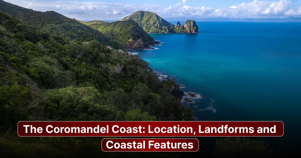
The Coromandel Coast is the coastline of peninsular India running along the Bay of Bengal from roughly the Krishna River delta in Andhra Pradesh down to Point Calimere in Tamil Nadu. It matters beyond geography. Its reversed northeast monsoon rainfall pattern, its river deltas, its historic trading ports and its string of temple towns and colonial-era settlements have shaped the region for over a thousand years. This piece covers where the Coromandel Coast sits, the landforms that define it, its major cities and natural landmarks, its distinctive climate, and how it compares to India's major coastline, the Malabar Coast.
What Is the Coromandel Coast?
The Coromandel Coast is the name given to the coastal plain of peninsular India fronting the Bay of Bengal and conventionally running from around the Krishna River delta southward to Point Calimere near the Palk Strait.
The name is generally believed to come from the Tamil “Cholamandalam”, meaning "realm of the Cholas " after the dynasty whose heartland lay in the Kaveri delta. A term Portuguese and other European traders picked up and anglicised into "Coromandel" from the 16th century onward. A competing, widely cited theory traces it instead to “Karai Mandalam” or "coastal region ", pointing to the area's distinctive black coastal soil. Whichever origin is correct, the coast's name reflects centuries of overlapping trade: it was an artery for Chola-era maritime commerce and later for Dutch, French, and British trading companies, whose rival settlements still dot the coastline today.
Where Is the Coromandel Coast Located?
Boundaries and extent
The Coromandel Coast runs along the Bay of Bengal, bounded to the west by the Eastern Ghats and the plateau behind them. Its northern and southern limits aren't fixed by a universal convention. Sources variously place the northern boundary at the Krishna River delta at Pulicat Lake just north of Chennai or at the Andhra Pradesh-Tamil Nadu border, while the southern end is generally agreed to sit at Point Calimere (Kodikkarai) near the Palk Strait opposite Sri Lanka. Depending on which convention is used, the coast's total length is cited anywhere from 650 km to over 900 km.
States and union territories covered
Today the Coromandel Coast spans Tamil Nadu, Andhra Pradesh and the union territory of Puducherry, whose enclaves of Puducherry and Karaikal are former French colonial settlements embedded within the Tamil Nadu coastline.
Coromandel Coast vs. Northern Circars
It's worth distinguishing the Coromandel Coast from the Northern Circars, a historical coastal strip running from roughly Pulicat Lake north to the Mahanadi delta in Odisha. Where definitions place the Coromandel Coast's limit at Pulicat Lake, the Northern Circars pick up immediately to its north. The two are adjoining, but distinct sections of India's eastern coastal plain, and conflating them is a common point of confusion.
Landforms of the Coromandel Coast
The plain
The Coromandel Coast is defined by a wide, gently sloping coastal plain running between the Eastern Ghats and the sea. Generally wider and flatter than the Western Coastal Plains on India's other coast.
River deltas and alluvial plains
Several major rivers reach the Bay of Bengal across this plain, with the Kaveri delta as the anchor example. A densely populated delta that's been central to Tamil agriculture and settlement for millennia. To the north, the Penner, Palar and Ponnaiyar rivers form their own smaller deltas and alluvial stretches, while the Krishna River's delta at the coast's northern edge extends the same pattern into Andhra Pradesh.
Lagoons, backwaters and spits
Pulicat Lake, India's largest brackish water lagoon, sits at the Andhra Pradesh-Tamil Nadu border, separated from the Bay of Bengal by Sriharikota, a long barrier island. The lagoon supports a bird sanctuary and has a documented history stretching back to Dutch-colonial trading days.
Sand dunes, beaches and mudflats
Long sandy beaches and dune systems run along much of the coast, with Chennai's Marina Beach, one of the world's urban beaches, as its most recognisable example.
Mangroves and wetlands
Pichavaram near Chidambaram holds one of India's significant mangrove forests, while the Point Calimere wetland complex at the coast's southern end combines mangroves, mudflats and dry evergreen forest, supporting migratory birds and species like blackbuck within its wildlife sanctuary.
Emergent coastline characteristics
Unlike India's coast, the Coromandel Coast is classified as a coastline. Formed as land rose relative to the sea rather than being drowned by rising water. This is part of why it is relatively smooth and straight, with few natural harbours or deep inlets, a contrast to the more indented submergent Western Coastal Plains.
Key Coastal Features and Notable Places
Major Ports and Coastal Cities
Chennai, Puducherry, Nagapattinam, Cuddalore and Karaikal rank among the Coromandel Coast's most significant port cities and towns, with Chennai Port and the nearby Ennore (Kamarajar) Port among India's principal eastern gateways. Tuticorin (Thoothukudi), south near Kanyakumari, is sometimes grouped with the broader southeastern coastline, though it sits beyond Point Calimere, the conventional southern limit of the Coromandel Coast proper.
Heritage and natural landmarks
Mahabalipuram's UNESCO-listed shore temples, carved from rock by the Pallava dynasty, sit directly on the coast of Chennai. The Point Calimere Wildlife and Bird Sanctuary and the wetlands around Pulicat Lake round out the coast's significant natural landmarks, both drawing migratory birds in large numbers each winter.
Climate and Rainfall of the Coromandel Coast
Why does the Coromandel Coast get rain in winter?
The Coromandel Coast receives most of its rainfall from the northeast or "retreating" monsoon between October and December. The reverse of the pattern across most of India, where the southwest monsoon from June to September dominates. This happens because the Eastern Ghats block much of the southwest monsoon's moisture before it reaches this coast, while winter winds crossing the Bay of Bengal pick up moisture and deliver it directly onto the Tamil Nadu and southern Andhra Pradesh coastline. Tamil Nadu and coastal Andhra Pradesh are in fact the parts of India that depend so heavily on this northeast monsoon for their primary rainy season.
Cyclones and coastal vulnerability
That same October-to-December window also coincides with peak Bay of Bengal cyclone season, making the Coromandel Coast one of India's cyclone-exposed stretches of coastline. Storm surge and coastal erosion are recurring concerns for lying settlements and the delta regions in particular, where dense populations and agriculture sit close to sea level.
Coromandel Coast vs. Malabar Coast: Key Differences
The two sides of peninsular India's coastline differ sharply. The Coromandel Coast faces the Bay of Bengal to the east while the Malabar Coast faces the Arabian Sea to the west. The rainfall season follows the east-west split in reverse: the Coromandel Coast gets its main rains from the northeast monsoon in October-December, while the Malabar Coast is drenched primarily by the southwest monsoon from June to September. The coastline shape differs too. The Coromandel is an emergent coastline with few natural harbours, while the Malabar Coast is a submergent coastline, narrower and more indented, with backwaters, lagoons, and natural harbours like Kochi far more prominent. In terms of features, the Coromandel Coast is defined by broad river deltas (Kaveri, Krishna) and long sandy beaches, while the Malabar Coast is known for its chain of interconnected backwaters and a generally narrower coastal plain.
Why the Coromandel Coast Matters
The Coromandel Coast's river deltas, the Kaveris above all, support some of South India's productive agricultural land, feeding both the region's food supply and its export economy. Its fisheries sustain coastal populations while its ports, led by Chennai, handle a significant share of India's eastern maritime trade and industry. Tourism, from Mahabalipuram's temples to Puducherry's quarter, adds another economic layer. Historically, this coast was one of the subcontinent's consequential trading frontiers, hosting Dutch, French, and British settlements that shaped South Indian history long before independence. A legacy still visible in Puducherry and Karaikal's French-colonial character today.
Conclusion
The Coromandel Coast is the coastal plain of Tamil Nadu and southeastern Andhra Pradesh defined by its river deltas, its reversed northeast-monsoon rainfall pattern and a history of trade stretching from the Chola dynasty through the European colonial era. Its signature landforms include the Kaveri delta, Pulicat Lake, Marina Beach, and the Point Calimere wetlands. The Kaveri delta, Pulicat Lake, Marina Beach and the Point Calimere wetlands. Continuing to shape both the region's ecology and its economy, as rising cyclone risk and coastal erosion present growing challenges for the communities that depend on it.
FAQs
Where is the Coromandel Coast located?
The Coromandel Coast runs along India's coastline on the Bay of Bengal, conventionally extending from around the Krishna River delta in Andhra Pradesh south to Point Calimere in Tamil Nadu.
Which states does the Coromandel Coast cover?
It spans Tamil Nadu, Andhra Pradesh and the Union Territory of Puducherry, including its Karaikal enclave.
Why is it called the Coromandel Coast?
The name likely derives from the Tamil “Cholamandalam”, meaning "realm of the Cholas ", after the medieval Chola dynasty centred in the Kaveri delta, though a secondary theory traces it to “Karai Mandalam” or " region."
What is the Coromandel Coast known for?
It is known for its river deltas and fertile agricultural land, ports like Chennai, its reversed northeast-monsoon rainfall pattern, cyclone vulnerability, and heritage sites such as the Mahabalipuram shore temples.
Which rivers form deltas on the Coromandel Coast?
The Kaveri River, Krishna River, Pennar River, Palar River, and Ponnaiyar River all form deltas. These form important alluvial plains along the Coromandel Coast.
Why does the Coromandel Coast receive rainfall from October to December?
Because the Eastern Ghats stop a lot of the southwest monsoon before it gets to this coast, which means the northeast monsoon becomes the source of rain. The northeast monsoon gets moisture as it moves across the Bay of Bengal from October to December.
How is the Coromandel Coast different from the Malabar Coast?
The Coromandel Coast looks toward the Bay of Bengal. It gets its rain from the northeast monsoon. The Malabar Coast looks toward the Arabian Sea. It gets its rain from the southwest monsoon. The Coromandel Coast is a coastline that has not sunk underwater, and it has fewer natural harbours. The Malabar Coast is a coastline that has sunk underwater. It has many bays and waterways.