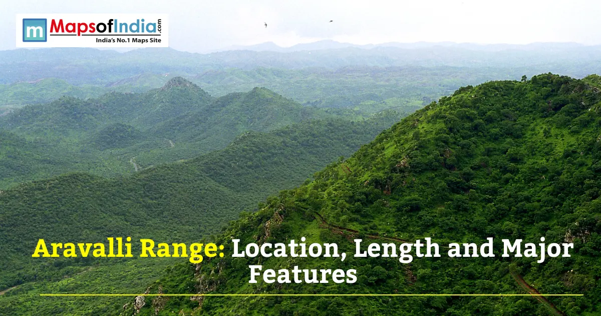
The Aravalli Range is one of India's most iconic landforms. It cuts across four states. It shapes the climate of an entire region. This guide covers everything worth knowing, from its location to its length to the features that make it special.
What Is the Aravalli Range?
The Aravalli Range is a mountain range in north-western India. It ranks among the oldest fold mountain ranges on the planet. The rocks found on this range date back to the Precambrian era. Proving that this range is older than the Himalayas. Over a billion years, erosion has been happening here. What we see now is a series of low, rugged hills rather than towering peaks. Even so, its age alone makes it geologically significant, and its position makes it ecologically vital for the whole region. The name itself comes from Sanskrit, roughly meaning "line of peaks," a fitting description for a range that looks more like a broken chain of ridges than one solid mountain wall.
Location of the Aravalli Range
The Aravalli Range location spans north-western India, running in a south-west direction.
States It Passes Through
The Aravalli Range states include Delhi, Haryana, Rajasthan, and Gujarat. The range begins near Delhi. It then passes through southern Haryana. From there, it cuts through Rajasthan, splitting the state into two distinct zones. It finally ends near Ahmedabad in Gujarat. Rajasthan holds the largest share of the range, including its tallest peaks.
Length of the Aravalli Range
Total Length in KM and Miles
The Aravalli Range length runs approximately 670 km, or about 420 miles. Some sources cite figures closer to 700 or even 800 km, depending on how the measurement is taken and where the range is considered to officially end. Regardless of the exact number, it remains one of the longest continuous hill systems in India.
Width and Elevation Range
Width varies quite a bit along the range. Some stretches run just 10 km wide. Others widen out to nearly 100 km. Elevation stays modest overall, generally between 300 and 900 meters. That modesty is part of the story. These hills once stood far taller, before millions of years of weathering wore them down.
Major Features of the Aravalli Range
Highest Peak - Guru Shikhar (Mount Abu, 1,722 m)
Guru Shikhar is the highest peak of the range. It is 1,722 mts high, situated in the Mount Abu area of the Sirohi district in Rajasthan state. The peak is also of religious importance as it houses a temple dedicated to the sage Dattatreya. It attracts tourists and pilgrims all year round.
Geological Age and Formation
The Aravalli hills are believed to be some of the oldest fold mountains in the world. They are formed as a result of the Aravalli-Delhi Orogen, a geological event associated with ancient tectonic plate collisions in the PreCambrian. Their age is estimated to be over a billion years; some researchers have suggested two or three billion years. That makes them much older than the Himalayas, which continue to rise to this day.
Rivers Originating from the Aravallis
The hills are the source of several rivers. The Banas River flows from here, which merges into the Chambal. The Luni River flows towards the Rann of Kutch. The rivers Sakhi and Sabarmati are also tributaries of this system, which supplies water for the state of Gujarat. These rivers provide water for millions of people downstream.
Role as a Barrier Against the Thar Desert
This range is a natural barrier. It prevents the Thar Desert from extending its range towards the fertile land of Rajasthan further east. If it's not there, the drought situation can spread more extensively into the state, and more of the agricultural community could be at risk. This barrier role is one of its most essential ecological roles.
Biodiversity and Wildlife Sanctuaries
Although this is a dry range, it is home to a surprising diversity of wildlife. It is home to the Sariska Tiger Reserve, where tigers, leopards, and a variety of bird species can be found. Mount Abu Wildlife Sanctuary is another protected pocket with sloth bears and langurs being sheltered amongst dense forest cover. These sanctuaries are remnants of undisturbed environments in a landscape that is heavily used.
Cultural and Historical Significance
This range is not only of geological significance but also of cultural importance. The Dilwara Temples near Mount Abu are examples of centuries-old high-quality marble carving in India. The Kumbhalgarh Fort, located at the edge of the range in Rajasthan, was a strategic fortress and was equipped with one of the world's longest uninterrupted fortification walls. Both sites are attractive to tourists seeking to see history come alive in these ancient hills.
Aravalli Range vs. Other Indian Mountain Ranges
Feature | Aravalli Range | Himalayas | Western Ghats |
| Age | Precambrian, over 1 billion years | Still forming, under 50 million years | Around 150 million years |
| Length | ~670 km | ~2,400 km | ~1,600 km |
| Highest Peak | Guru Shikhar, 1,722 m | Mount Everest, 8,849 m | Anamudi, 2,695 m |
| States Covered | 4 | Several across northern India | 6 |
Why the Aravalli Range Matters Today?
This ancient range is being put to the test by modern pressures. Much of the hill cover has been lost due to mining, illegal construction and urbanization around cities such as Gurugram. This has caused a reduction in groundwater levels, and desert conditions have begun to spread to places that were previously protected by these hills. In late 2025, the Supreme Court of India reduced the definition of the Aravalli hills to a height of at least 100 meters above the surrounding land and the range of the hills is defined as two or more hills within 500 meters of each other. The move was controversial with environmental groups, who said the move could clear more land for development, as the smaller, lower ridges would be removed from legal protection. Conservation efforts, such as the Aravalli Green Wall project, are working to reverse this trend and to help restore forest cover around the range. The fate of this range in the next few years will determine what water security and air quality will be for millions of people who live nearby.
FAQs
1. How long is the Aravalli Range?
Some estimates place it at 800 km using the method of measuring it, but it is estimated to be around 670 km.
2. The Aravalli Range runs through which states?
It goes through Delhi, Haryana, Rajasthan and Gujarat.
3. Which is the highest peak of the Aravallis?
The highest peak is the Guru Shikhar at Mount Abu, Rajasthan, with a height of 1,722 meters.
4. Which range is older, the Aravalli or the Himalayas?
Yes. The Aravalli Range is much older than the still-growing Himalayas, as it is believed to be of Precambrian age.
5. What are the starting and ending points of the Aravalli Range?
It runs diagonally across North-West India from near Delhi to near Ahmedabad in Gujarat.
6. The Aravalli Range is significant for the Thar Desert for which reason?
It serves as a natural barrier that stops the invasion of the desert into the fertile areas of eastern Rajasthan.
7. Which are the rivers start from the Aravalli hills?
This range is the source of the Banas, Luni, Sakhi and Sabarmati rivers.
8. What are the current threats to the Aravallis?
Forest area has been diminished through various activities, such as urban development, mining and illegal construction, and more recently, legal and conservation measures are being taken to safeguard remaining forests.