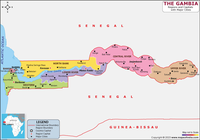
A nation in West Africa, The Gambia is officially known as the Republic of The Gambia. It is the smallest nation on African soil and, except for its western coast on the Atlantic Ocean, is encircled by Senegal. The Gambia's long shape results from its location on either side of the lower reaches of the Gambia River, which bears the country's name and flows through the country's center before emptying into the Atlantic Ocean. It has a land area of 11,300 km2 and a population of 1,857,181. The largest cities in the country are Serekunda and Brikama, while the capital and largest metropolitan area is Banjul.
History:
The Gambia became a constitutional monarchy within the Commonwealth on February 18, 1965, with Elizabeth II serving as the Queen of the Gambia and being represented by the Governor-General. The national government quickly held a referendum proposing that the nation turns into a republic. The results of this referendum garnered considerable attention abroad as evidence of the Gambia's observance of secret balloting, fair elections, civil rights, and liberties despite falling short of the two-thirds majority needed to amend the constitution.
Following a second referendum, the Gambia became a republic on April 24, 1970, and joined the Commonwealth.
Culture:
The Gambia has a diverse ethnic population that has lived there for a long time and preserved its unique cultural traditions, giving the nation a rich history. Blacksmiths, goldsmiths, leatherworkers, weavers, textile dyers, and other artisans were once present in every society in the area. Particularly for its indigo-dyed textiles, The Gambia is well known. There are still some active kora and drum makers, and traditional music from these makers has been recorded.
Language:
Although English is the official language, languages from the Niger-Congo family's Atlantic branch are typically the most widely spoken. The official languages of the nation are Mandinka and Wolof, though Pulaar, Serer, Diola, and Soninke are also used.
Geography:
The Gambia has an overall area of 11,295 km2 and is less than 50 km (31 mi) wide at its widest point. The water covers a total area of the Gambia of about 1,300 square kilometers. The continent of Africa is the smallest of nations. In terms of size, the Gambia is slightly smaller overall than the island of Jamaica. If it weren't for the boundaries imposed by Europeans, the Gambia River, one of the easiest rivers in Africa to travel, would probably have become the main trade route for Senegal, The Gambia, and landlocked Mali.
| Official name | Republic of The Gambia |
| Capital | Banjul |
| Population | 26.4 lakhs |
| Area | 11,300 km² |
| Currency | Gambian Dalasi |
| Religion | Islam |
| Language | English |
| Major Cities | Abuko, Bakau, banjul |
FAQs
Q1.What is the official language of Gambia?
English is the official language of Gambia.
Q2.What is the capital of Gambia?
Banjul is the capital of Gambia.
Q3.What is the currency of Gambia?
Gambian Dalasi is the currency of Gambia
Q4.What is the climate in Gambia?
A long, dry season and a brief, wet season are characteristics of The Gambia's Sahelian climate. Throughout the dry and wet seasons, respectively, the average temperature in Gambia ranges from 18 to 30 degrees Celsius.
Last Updated on: April 19, 2023
