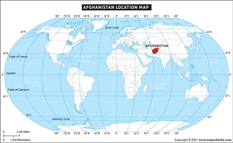
Do you know where Afghanistan is located? Check the location of Afghanistan on World Map with MapsofIndia.com
Afghanistan shares borders with Iran, Pakistan, Turkmenistan, Tajikistan, Uzbekistan, China and India. The latitude and longitude for Afghanistan are 34.5333° N, 69.1333° E.
Afghanistan is situated in Central Asia. The country is a landlocked country. It shares its borders with Turkmenistan, Uzbekistan, and Tajikistan to the north, Iran to west, Pakistan to the southeast, India and China to the northeast.
The major cities in Afghanistan are Kabul (capital), Kunduz, Bamiyan and Balkh.
| About Afghanistan | |
|---|---|
| Country Name | Afghanistan |
| Capital and largest city | Kabul |
| Population | 31,390,200 (2020 estimate) |
| Area | 652,864 km2 (252,072 sq mi) Water (%) Negligible |
| Currency | Afghani (AFN) |
| Time Zone | D† (UTC+4:30) |
| Neighbour Countries | India, Pakistan, Iran, China, Turkmenistan, Tajikistan, Uzbekistan |
| Official Language | Pashto Dari |
| Lat Long | 34.5333° N, 69.1333° E |
Last Updated on: January 13, 2026

