
 |
 |
 |
 |
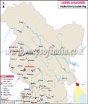
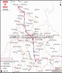
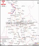
| Vaishno Devi Location Map | Leh Tourist Map | Jammu Tourist Map | Jammu Srinagar Route Map |
 |
 |
 |
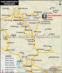 |
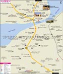
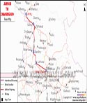
| Jammu Delhi Route Map | Jammu Chandigarh Route Map | Jammu Amritsar Route Map | Amarnath Yatra Map |
Jammu and Kashmir Travel
The state of Jammu and Kashmir has been a symbol of eternal natural beauty since time immemorial. The once mountain retreat of Mughals, abode of Buddhist Lamas and Alps of India for the British rulers, was rightly termed as Jahangir's valley of paradise. It has been one of the most beautiful, attractive, serene, and most talked about yet most controversial tourist destination in India.
Thankfully, the things are getting better in the valley of lakes and houseboats after a disturbing era of insurgency of 20 years.
Kashmir is home to some of the highest and most beautiful parts of the Himalayas. It is necessary to dispel a doubt here that the entire Kashmir is not violent or affected by the insurgency. The state of Jammu and Kashmir is comprised of three major parts; the largely Hindu Jammu, a Buddhist dominated Laddakh and the Muslim majority Kashmir valley.
Laddakh is almost unaffected by the violent disturbances of Kashmir valley. Jammu is comparatively safer and Kashmir valley is getting better day by day; so you can travel to any part of the state including the Kashmir valley without any worries, if the security situation is normal over there.
The most beautiful city in the entire Kashmir valley is Srinagar. The scenic views of the valley vary according to the location you are at. The mountain peaks look heavenly from a distance, the sunlight and the clouds appear to be out of this world and deep blue sky makes us feel at peace and rejuvenated. Srinagar is also called the city of lakes. It is famous for enchanting Dal Lake, HazratBal shrine (Dargah) and the Mughal Gardens referred to as Shalimar Bagh and Nishat Bagh. Pahelgam is another beautiful valley with a wildlife sanctuary, ropeways and wonderful tracking routes. Gulmarg is known for its exemplary scenic beauty, ski resorts and the highest golf course in the world.
| Location | Northern tip of India Pakistan to the west Afghanistan to the North China to the East Himachal Pradesh to the South |
| Latitude | 32°17' to 36°58' North |
| Longitude | 37°26' to 80°30' East |
| Area | 2101437 sq kms |
| Climate | Tropical in Jammu plains Semi-arctic cold in Ladakh Temperate in Kashmir and Jammu mountainous tracts |
| Max Temperature | 440 |
| Min Temperature | 40 |
| Average Annual Rainfall | Jammu - 1115.9 mm Leh - 92.6 mm Srinagar - 650.5 mm |
| Capital | Summer (May-October) - Srinagar Winters (November-April) - Jammu |
| Population | 76.77 Lakhs |
| Languages | Kashmiri, Urdu, Hindi, English |
| Religion | Islam, Hindu, Buddhist |
| Best Time to Visit | Jammu: October - April Kashmir: March - October Ladakh: March - October |
| Clothing | Summer - Light cottons Winter - Heavy/medium woolens |
About Jammu and Kashmir
The tourists can embark in Jammu and Kashmir travel for a heavenly vacation in the lap of mountains. The travel enthusiasts have always referred Kashmir as the 'Paradise on Earth'. The stand out beauty of the Himalayan Mountain range attracts tourists from all over the world. Himalaya, the world's largest mountain range, which also features the highest mountain peak of the world can be distinctly viewed from the state of Jammu and Kashmir.
Leh, Gulmarg, Patnitop, Ladakh and Pahalgam are some of the important places here.
Jammu and Kashmir can be classified into three different regions. The foothill plains of Jammu, the magnificent mountains of Ladakh and the lakes and valleys of Kashmir that soar high up to the alpine passes. The mesmerizing beauty of the scintillating snow capped Himalayan Mountain range evokes romanticism.
How to reach Jammu and Kashmir
The state of Jammu and Kashmir is located in the extreme north of India. It makes for one of the most visited states in the country and about four million Indian tourists visit the state every year. Presence of the sacred Vaishno Devi Temple in the state is the factor driving most of the people to the state. The political turmoil in the state doesn't prevent the tourists from making their way to one of the most beautiful states in the country.
By Air
The state has four airports, namely:
- Jammu Airport (Domestic)
- Kargil Airport (Defense)
- Kushok Bakula Rimpochee Airport, Leh (Domestic)
- Srinagar Airport (International).
By Train
The most important railway station in the state of Jammu and Kashmir is the Jammu Tawi Station which receives trains from all the major Indian cities. Following are some of the trains that one can take to Jammu and Kashmir from major cities in India.
By Road
The state has a good road network connecting important neighbourhood states and cities like Delhi, Amritsar, Ambala, Chandigarh, Ludhiana, Jalandhar, Pathankot, Shimla and Manali. National Highway 1A is the national highway connecting various cities of Jammu to each other and to the rest of India. One can also take JKSRTC (Jammu Kashmir State Road Transport Corporation) buses to travel within the state and the nearby states.
Travel within Jammu and Kashmir The buses operated by JKSRTC connects most points around the state. Some terrains of the state are not that easily accessible, for such areas 4wd jeeps are quicker, but a little more expensive option. Private jeeps are also available to travel within the state.
Jammu and Kashmir Tourism
Jammu and Kashmir offers scope for various adventure activities.
Trans Himalayan Jeep Safari, trekking and mountaineering are some of the adventure activities that can be enjoyed here. The ideal trekking month is from April to November. Other pulsating adventure sports that can be indulged in at various places in Kashmir include:
- Motorbike Safari in Ladakh
- Kayaking & Canoeing
- Mountain Cycling in Ladakh
- Snow Skiing in Gulmarg
- River Rafting in Ladakh
- Trekking in Kashmir Valley
- Trekking in Zanskar
- Ladakh Trekking
The travel to Jammu and Kashmir is made convenient by the air services to Leh and Srinagar from a number of Indian cities.
The bus services from Manali to Leh provide the other way to reach Jammu and Kashmir. The buses also ply at frequent intervals from Jammu to Srinagar. The railway station in Jammu is served by a number of trains from a few Indian cities.
There are a number of resorts, hotels and houseboats in Jammu and Kashmir. Few of the renowned hotels in Jammu and Kashmir include:
Hotel Akbar, Hotel Zamrud, Grand Hotel, Hotel Zahgeer Continental
The stay in houseboats is a unique experience. Few of the recognized houseboats on Dal Lake, Srinagar include Prince of Vale, Meena Houseboat, Newzealand Houseboat, Young Morning Star, Safina Houseboat.
Jammu & Kashmir Tourist Attractions
For the sightseeing in Jammu and Kashmir, the tourists can avail either the state operated buses or 4WD jeeps.
The Jammu and Kashmir travel is never complete if the following locations are not sighted:
Gulmarg, Kargil, Pahalgam, Vaishno Devi, Zanskar, Jammu, Leh, Ladakh, Patnitop, Srinagar, Sonamarg, Zangla.
Last Updated on : June 10, 2026
Travel to Jammu and Kashmir