Inland Waterways Authority of India (IWAI) is the legal authority in-charge of the waterways in India and was created by the Govt. of India on 27 October 1986 .Its headquarters is located in Noida, Uttar Pradesh and regional offices are at Patna, Kolkata, Guwahati and Kochi and sub-offices at Allahabad, Varanasi, Bhagalpur, Farrakka and Kollam. The function of IWAI is to build necessary infrastructure in the waterways, survey the economic possibilities of new projects, administrate, develop and regulate the waterways for navigation and shipping.
National Waterway 1
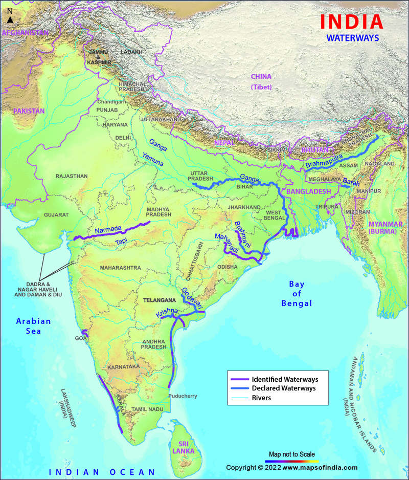
The National Waterway 1 lies on the Allahabad-Haldia stretch of the Ganges, Bhagirath and Hooghly river system. It was established in October 1986 and has a length of 1620 km.
National Waterway 2
The National Waterway 2 lies on the Sadiya-Dhubri stretch of the Brahmaputra River. It was established in September 1982 and has a total length of 891 km.
National Waterway 3
The National Waterway 3 lies on the Kottapuram-Kollam stretch of the West Coast Canal, Champakara Canal and Udyogmandal Canal. It was established in February 1993 and a length of 205 km.
National Waterway 4
The National Waterway 4 lies on the Kakinada-Pondicherry stretch of Canals and the Kaluvelly Tank, Bhadrachalam-Rajahmundry stretch of River Godavari and Wazirabad-Vijayawada stretch of River Krishna. It was established in November 2008 and has a length of 1095 km,
National Waterway 5
The National Waterway 5 lies on the Talcher-Dhamra stretch of the Brahmani River, the Geonkhali-Charbatia stretch of the East Coast Canal, the Charbatia-Dhamra stretch of Matai River and the Mangalgadi-Paradip stretch of the Mahanadi River Delta. It was established in November 2008 and has a length of 623 km.
National Waterway 6 (Proposed)
The National Waterway 6 will be from Lakhipur to Bhanga on the River Barak with a total length of 121 km.
Last Updated on April 17, 2026