Traditionally spatial data has been stored and presented in the form of map. A map represents geographic feature or other spatial phenomena by graphically conveying information about location and attributes. Each feature on the earth surface has a specific position and to specify the position a coordinate system is used.
Spatial features may be discrete or continuous. Discrete are those that not exist between observations, form separate entities, and are individually distinguishable. Wells, roads and land use types are examples of discrete features. Continuous features exist spatially between observations. Precipitation and elevation are examples of continuous features.
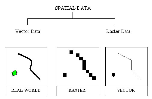
GIS uses two basic models to represent spatial features: Vector data model and Raster data model.
|
|
|
|
Last Updated on 28 September 2012