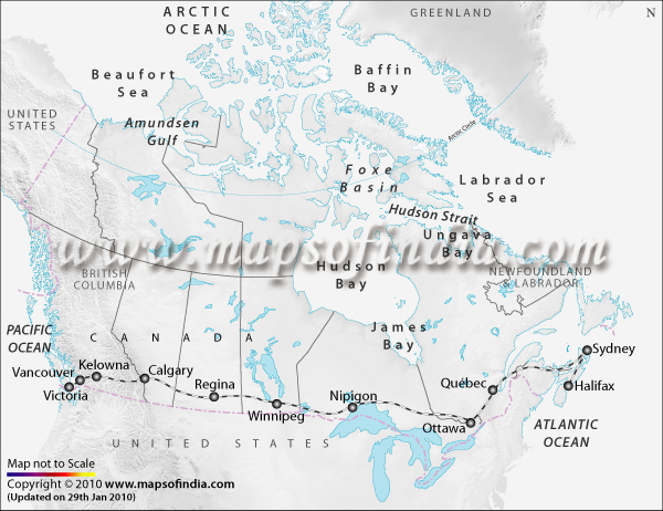
- Name the transcontinental railway line shown in the below map
CBSE Geogrpahy Map List Class 12 - 2010 |
Map Question:1
 | |||||
|
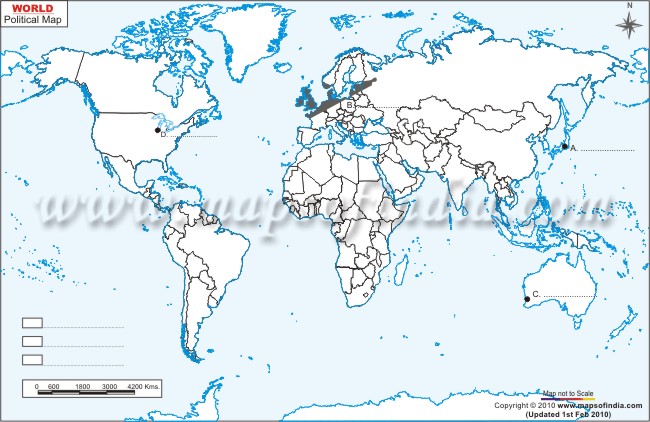
Map Question:2
In the given outline political map of the World, four features are shown by A, B, C, D. Identify the features with the help of the information given below and write their correct names on the lines marked in the map:
In the given outline political map of the World, four features are shown by A, B, C, D. Identify the features with the help of the information given below and write their correct names on the lines marked in the map:
- A. Mega City
B. Largest region of dairy farming
C. Western terminal city of Australian Trans Continental Railway
D. An important industrial centre
 | |||||
|
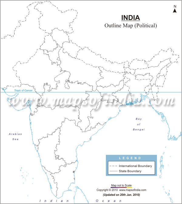
Map Question:3
Locate and label the following on the given outline politicial map of India:
Locate and label the following on the given outline politicial map of India:
- The state having the highest percentage of population below the poverty line
- The state leading in coffee production
- The software technology park in Uttaranchal
 | |||||
|