





About
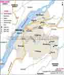
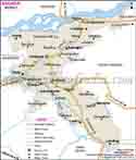
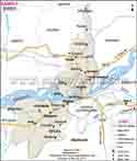
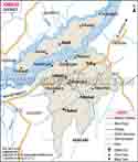
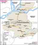
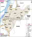
Barpeta is an area in the west of Assam. Barpeta city is the district headquarter. It also includes the Lower Assam Division. To the north Barpeta is bordered by Baksa, in the east by Bajali, to the south by Kamrup and Goalpara, and to the west by Bongaigaon and Chirang. This district which is in the Brahmaputra Valley has many rivers, agricultural fields, villages and low land.
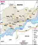
The Brahmaputra runs through the south of Barpeta. In the district also many rivers and smaller water ways which pass through. They include Beki, Manah, Pohumara, Kaldia, Palla, Nakhanda, Marachaulkhowa and Bhelengi. These rivers support agriculture, fishing and village ways of life although monsoons see some low land areas affected by floods.
History & Culture
Barpeta’s past is tied to that of Assam. What you today recognize as the modern district developed out of the former Kamrup region. The British in 1841 established Barpeta Civil Sub Division. John Batlor was the first to serve as administrative officer of what was then the old civil sub division. Later in July 1983 Barpeta broke away from the old Kamrup district to become a separate district.
Barpeta came to be a very important religious center with the coming of Srimanta Sankardeva and his disciple Madhavdeva. The Neo-Vaishnavite movement which followed brought in great changes to the religious and cultural life in the area. Satras became places of worship, study, music, drama and community activity.
Barpeta Satra is a very important part of history. In 1583 Madhavdeva established the Barpeta Satra. He first named the place Rongialgriha. Later Mathuradas Burha Ata became the first Satradhikar. The Satra grew to be a great center of Neo-Vaishnavite culture.
In Barpeta Satra’s Kirtan Ghar you will find that this is the most prominent structure in the district. The complex which is a part of it has prayer halls, study rooms, guest houses, a Doulgriha and other structures. Also the Satra’s traditional method of worship which is in accordance with the preaches of Madhavdeva and Sankardeva is followed.
In Barpeta the Doul festival is a very popular cultural event. During the festival great crowds of devotees visit Barpeta Satra. Music, prayer, traditional rituals and community gatherings are the main elements of the event.
Barpeta is home to a variety of religious communities. In the past Ahom rulers granted land to Satras, Muslim Dargahs and Hindu temples which is a part of that history.
Sarthebari’s brass and bell-metal industries are what the region is known for. Out of a skilled workforce comes out plates, bowls, lamps, religious items and a large variety of other products. Also these products have cultural value and they are very much a part of the local craft economy.
Economy
Barpeta’s economy is based in large part on agriculture, trade, handicrafts, small scale businesses, transport, tourism, government services and also what the local area has to offer.
In Barpeta’s plains and by its rivers which also support agriculture in many areas. At the same time during heavy monsoon you can see roads and crops affected by floods. Farmers there for the most part base their income on seasonal conditions.
Barpeta is a district which has had a large village industry base for a very long time. In Sarthebari you can see brass and bell metal work, handloom, handicrafts and small scale trade. Also tourism brings in additional income through its contribution to the hotel, restaurant, transport and local shopping sectors.
Government Sector
In Barpeta the government plays a key role. District administration runs revenue affairs, public services, law and order, disaster response and development programs. Also within the government different departments run affairs related to agriculture, education, health, roads, water resources, social welfare and rural development.
Barpeta has present day six revenue circles and nine development blocks. In present terms the six revenue circles are Barpeta, Chenga, Baghbar, Kalgachia, Sarthebari and Barnagar. The district has 98 Gaon Panchayats and 105 revenue villages.
Government health care covers from town to village. In the district report you find one medical college and hospital, one civil hospital, community health centers, model hospitals, block primary health centers, primary health centers and many sub centers.
Government schools and in turn report that they enroll students from local families. Also you can see that public works in roads and large scale rural development as well as the welfare programs put out by the government which in turn create opportunities for local labour and supply based companies.
Public Sector
In Barpeta public resources are put into health, education, roads, transport, rural development and other public services. Also public institutions provide direct and indirect jobs.
Agriculture is supported by government departments, farming schemes and local field offices. Farmers get information on crops, farm inputs and government support programs.
Barpeta is home to connections which include Manas National Park. The park is a source of tourism which in turn benefits local areas. There are hotels, guides, drivers, restaurants, shops and local service providers which put food on the table thanks to visitors who head to Manas.
Public infrastructure also plays a key role in Barpeta. You can see roads which link villages to towns and market centers. Also they have railway services at Barpeta Road which support passenger traffic and movement of goods.
In Barpeta you can see a network of river based health centers and boat clinics. These services are for people which at rainy season time may have issues getting around by road.
Services Sector
In Barpeta the service sector is made up of shops, markets, banking, transport, education, health care, hotels, restaurants, and tourism which also includes small private businesses.
Barpeta is a major market point. People from nearby villages come to the town for shopping, banking, education, health care and government related matters. Also other towns and market areas serve the nearby villages.
Transport is a very large component of Barpeta’s economy. In Barpeta you can see a wide range of transport options from buses to taxis, auto rickshaws, goods vehicles which link the rural and urban areas. Also Barpeta’s connectivity to Guwahati and other districts in Assam through roads which in turn support trade.
Tourism is a growth area for service sector jobs in hotels, restaurants, travel companies and local shops. In Barpeta Satra, Manas National Park and at other sites visitors spend on food, transport, accommodation and local products.
Traditional crafts also play a role for small businesses. In Sarthebari brass and bell-metal products do well in Assam. Local artisans, traders and shop keepers are a part of this economic activity.
Tourism
Barpeta is a district that is very much a part of its religious, cultural, wild, and natural heritage. It has old Satras, temples, village sites and access to Manas National Park.
Barpeta Satra which is very well known for its culture and religion in that area. In 1583 Madhavdeva established the Satra. In the complex you will find Kirtan Ghar, prayer areas, Doulgriha and other structures.
Manas National Park is a well known natural feature which includes Barpeta. The park is at the foot of the Himalayas and home to forests, grasslands and riverine areas.
Barpeta Road is a major access point by road and rail for travelers going to Manas. The park is reached via Barpeta Road which is at a distance of 20 km from the park entrance as reported by the district administration.
Gorokhia Gosai is a religious and cultural site in Barpeta. Also it is included in the list of main points of interest put forth by the district administration. Religious sites which include this are very much a part of Barpeta tourism.
Sarthebari is known for its brass and bell-metal work. In terms of traditional crafts visitors may see that these local artisans produce out of metal also.
Sarthebari is a craftsman’s paradise which is very well known in Barpeta for it. Also this presents the connection between culture and local economy.
Demographics
Barpeta had a population of 1,439,806 at the time of the 2011 Census which also reports the present district profile. That year the district found 738,684 males and 701,122 females in the district. Also the district reported a literacy rate of 50.22% in the said profile.
Assam language is dominant in Barpeta. Also in different areas of the district you’ll find Bengali and other local languages. The district is home to many diverse religious and social communities.
Barpeta’s cultural tapestry is a reflection of that social diversity. You can see religious festivals, village fairs, local markets, traditional crafts and community events which play a large role in daily life.
The district is also home to populations which struggle with issues of flood and river erosion. In the monsoon the low lying areas by the Brahmaputra and other rivers see wide spread water logging. When large scale flooding happens government agencies step in with relief and disaster support.
Administration
Barpeta is included in the Lower Assam Division. Barpeta town is the district headquarter. At present the district has one sub division, six revenue circles, nine development blocks, 98 Gaon Panchayats and 677 revenue villages.
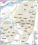
In the six revenue circles the district has Barpeta, Chenga, Baghbar, Kalgachia, Sarthebari and Barnagar. In the nine development blocks we see Barpeta, Sarukhetri, Chenga, Gomafulbari, Pakabetbari, Chakchaka, Rupshi, Mandia and Gobardhana.
The district reports 10 police stations as per the district profile. Also it has a large public health network which includes hospitals, health centers and river based medical services.
District level administration is in charge of revenue issues, law and order, disaster management, public welfare and development works. In respect to administration of different branches of the Deputy Commissioner’s office the former is responsible for administration, accounts, magistracy, public buildings and other government tasks.
| Official Name | Barpeta District |
| Location | Assam |
| Capital | Dispur |
| Area | 2243.96 sq. km |
| Population | 1,439,806 (2011 Census) |
| Religion | Hinduism, Islam, Christianity and other faiths |
| Language | Assamese, Bengali and other local languages |
FAQs
Q.1: Where is Barpeta located?
Barpeta is in the west of Assam. It is part of the Lower Assam Division.
Q.2: Which river flows through Barpeta?
In the south of Barpeta large portions of the district which the Brahmaputra graces. Also in the district you will find the Beki, Manah, Pohumara, Kaldia, Palla and Nakhanda rivers.
Q.3: Who founded Barpeta Satra?
Madhavdeva established Barpeta Satra in 1583. Mathuradas Burha Ata was to become the first Satradhikar.
Q.4: What festival is famous in Barpeta?
In Barpeta they have The Doul festival which is very popular. Many devotees visit Barpeta Satra at this time.
Q.5: What is Sarthebari famous for?
Sarthebari is known for its brass and bell-metal work. Hand made traditional household and religious products are the specialty of local artisans.
Q.6: Which tourist spots should you visit in Barpeta?
Barpeta has also to visit places like Manas National Park, Hadira Chaki, Gorokhia Gosair Than and Sarthebari.
Last Updated on : October 15, 2026
