





About
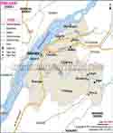
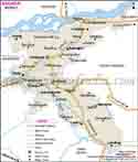
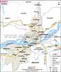
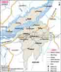
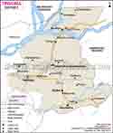
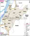
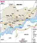
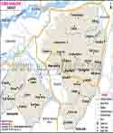
Kamrup is a district in Assam located in the lower Assam division of the region. Its name is derived from Kamarupa, the ancient name of Assam which in turn gives the district a very special place in the history of the state. District headquarter is Amingaon which lies on the Northern side of Guwahati, and Kamrup lies beside the river Brahmaputra. The current Kamrup was carved out from a much larger territorial unit on 31 March 2003 when the original Kamrup was broken up into smaller sub-units - Kamrup-metropolitan Nalbari Barpeta and so on. What is left after the reorganisation is about 3150 sq km in extent. Even after being a restructured administrative unit, Kamrup maintains many of the native practices and a dialect collectively known as kamrupi, shared by the neighbouring districts which were part of the same pre-reorganisation landmass. Kamrup is the land of temples, satras (Vaishnavite monasteries), and villages where silk is made with its proximity to Guwahati, i.e. the main gateway of the north-east. The district is largely a rural landscape with a few towns and semi-urban centres from which goods, farm produce and workers are supplied to the surrounding big city.
History & Culture
Kamrup gets its name from the ancient kingdom of Kamarupa. It finds a place in ancient Indian texts and inscriptions. As time passed, Kamarupa area of the wider territory was divided into several smaller kingdoms and administrative divisions and the area of the present-day district is only a small part of the old Kamarupa in the west even though it still carries the name as a legacy from its past During the colonial era, British controlled the area as part of the Assam province and when India gained independence the district stayed one of the larger ones in the state until it was divided again in 2003 to come up with smaller units of administration that would be more practical and manageable at the grass root level. Besides the peaceful changes, the area witnessed a number of violent changes particularly during conflicts and it has also been at the forefront as its position, close to the Saraighat region, made it an arena where in the 17th century, the Ahom kingdom resisted the Mughal army, a historical battle that the people of Assam still remember as one of their history's turning points. What gives Kamrup its identity is the Vaishnavite tradition which became the heart of Assamese culture following the visit of reformer-saint Srimanta Sankardeva and his disciples into the region where they established their religious, artistic and educational centres called satras. In fact, satras today still play an important role as it is there one can watch classical Assamese Sattriya dance as well as learn and sing devotional singing Borgeeit. On the cultural aspect side, the district has various ethnic tribes who speak the Kamrupi dialect, that is, one variation of the Assamese language characterised by different vocabulary, pronunciation and melody, and a folk music tradition called Kamrupi Lokgeet. Alongside the temple towns like Hajo, there are religious functions and festivals held throughout the year, and this attracts devotees from different communities because one can find temples, stupas , mosques and shrines in Hajo that are considered sacred by Hindus, Buddhists as well as Muslims. The presence of places of worship for various communities is probably one of the reasons that make this locale so unique to this district."
Economy
Government Sector
There is an ample number of people in Kamrup who derive their livelihood from government jobs which is a result of the city's proximity to Guwahati and Dispur, the location where Assam's state government is headquartered. The various departments dealing with district administration, education, health, and public works hire a significant percentage of the local population, besides government initiatives tied to agriculture, rural development, and welfare programmes being implemented via district-level offices in the area.
Public Sector
Various public sector operations like banking outlets, post offices, state transportation services, and electricity or water boards are part of Kamrup's public sector presence. All of these maintain offices and employ people across the district revenue circles. Public sectors related to railways and highways also depend on the district workforce as National Highways 31, 37, 127D, and 15 pass through the region; besides there are railway links going towards Guwahati.
Services Sector
The services in Kamrup have developed progressively, and that is largely because of the activities of trade, transport, and small business that are feeding into the greater Guwahati economy. Markets in local towns like Rangia, Boko, and Palasbari are trade hubs for farm goods, whereas the silk trade that is based on Sualkuchi supports weavers, traders, and associated workers like dyers and yarn suppliers. Also, services connected with tourism that comprise of, for example, small hotels, tea stalls, and transportation of pilgrims who are coming to Hajo and other temple towns, increase household earnings in the local population.
Agriculture and Industry
In Kamrup, farming still brings livelihood mainly for many of the residents in the rural areas where rice remains the primary crop. Other crops which are grown here are cotton, oilseeds, sugarcane, betel nut, and coconut. There are forest reserves like Garbhanga and Rani in the district that provide an opening to timber-related jobs besides forest produce collection in a few areas. Food processing, handloom, and handicraft industries are examples of the types of small industries that have been set up. Among all of these, the handloom industry has been the main economic activity in the area of Sualkuchi because of its silk manufacture. That is why it contributes so much to the economic identity of the district.
Tourism
Kamrup district's tourism potential is not limited to its historical monuments. It is also the result of the district's cultural heritage, picturesque countryside, and the daily life of its people. Visitors to the area will hardly miss the opportunity to enjoy the magnificent views of the Brahmaputra River during sunrise and sunset which can be very breathtaking. Hajo falls within the boundaries of Kamrup district. Hajo is among the most frequented towns; besides that, Hajo houses the remarkable Hayagriva Madhava Temple, one of the Vaishnavite holy places which is believed by a section of people to have some historical connection to Buddhism and the time when Buddha stayed in Hajo. Besides that, the Poa Mecca shrine located in Hajo town is considered by local Muslims to hold a quarter of the holiness of Mecca. On top of that, different Hindu temples including Kedar, Kameswar, and Ganesh, which represent different faiths in a very compact area can be found in Hajo.
Sualkuchi is nicknamed the "Manchester of Assam" because of this handloom fabric production. Anyone visiting the town has the opportunity to see artisans at work, weaving silk sarees and other fabrics using traditional looms while walking through the weaving lanes. And, most locals living nearby sell silk garments directly to the tourists as the main mode of their marketing. Madan Kamdev Temple: Madan Kamdev is an archaeological site situated near Baihata Chariali that has been left in ruins by time. It's a collection of various temples believed to be approximately a thousand years old. The site is also known to be in a somewhat rough state and located on an isolated hilltop surrounded by thick jungle forests. Currently, the site is protected and preserved. Dipor Bil. Dipor Bil is one great big lake and wetland that has been designated by the Ramsar Convention as a globally significant wetlands. It is actually a top location for birdwatchers owing to the diversity of both migrant and indigenous birds in the area. On top of all this, the wetland also contributes to flood control and provides a livelihood for fishing villages located nearby. Other attractions: Kamrup district also contains Saraighat War Memorial Park - one of the important monuments where the Ahoms vs. Mughals naval battle was fought. There are also Doul Govinda Temple, Siddheswar Devalaya, and Aswaklanta and Dirgheswari temples. These, in combination with the region's wetlands and patches of forest, offer Kamrup an interesting blend of religious, archaeological, and natural sites concentrated within a relatively small territory. Those passionate about nature can take advantage of in reality the district is abundantly endowed with greenery, wetlands, and river landscape, which are habitats for various plant and animal species. Besides art works and handloom products, Kamrup district is renowned for silk garments which are produced locally.
Demographics
Based on the data obtained during the 2011 Census of population for the last full Census, the Kamrup district showed that- Total population: 1,517,542 (male:778,461 and female:739,081).Rural population: 1,375,148 Urban population: 142,394.Population density: 489 per 1 sq km.Sex ratio: 949 per 1,000 males.
Administration
The headquarters of the revenue administration of Kamrup district is located at Amingaon, North Guwahati which is a Deputy Commissioner's office. Per administrative classification, revenue-wise, the district has about 11 to 12 revenue circles, such as Hajo Rangia Boko, Chhaygaon Chamaria, Goroimari Kamalpur Koya Nagarbera Palasbari, and the North Guwahati one.
| Official Name | Kamrup |
| Location | Assam |
| Area | 3105 sq. km |
| Population | 15,17,542 |
| Language | Kampuri |
FAQs
Q1. How many villages are there in Kamrup district?
Kamrup district has 1,037 villages.
Q2. What is the population of Kamrup district?
As per the 2011 Census, Kamrup district has a population of 15,17,542.
Q3. What is Kamrup district famous for?
Kamrup is known for its temples at Hajo, the silk-weaving town of Sualkuchi, and its deep connection to Assam's ancient Kamarupa heritage.
Q4. Where is the headquarters of Kamrup district located?
The district headquarters is located at Amingaon, in North Guwahati.
Q5. What is the total area of Kamrup district?
Kamrup district covers an area of approximately 3105 km²
Q6. Which river flows through Kamrup district?
The Brahmaputra River flows through the district, along with smaller rivers such as the Puthimari, Bornoi, and Kulsi.
Last Updated on : October 15, 2026
